-
Bayfield County [Wisconsin] Water-Table Map and Water Well Database
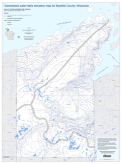
This report provides information about well construction, groundwater flow, and resulting implications for well susceptibility in Bayfield County, Wisconsin. The work follows an earlier groundwater study that focused on two agricultural areas within Bayfield County.-
Generalized Water-Table Elevation Map for Bayfield County, Wisconsin [GIS data]
2017
GIS Data: Shapefiles
-
Generalized Water-Table Elevation Map for Bayfield County, Wisconsin [plate 1]
2017
Plate: 30 in x 40 in, scale 1:100,000
-
Groundwater Data Compilation for the Geneva Lake, Wisconsin, Area
Open-file report; contains unpublished data that has not yet been peer-reviewed.-
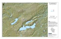
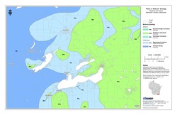
Regional Overview, Geneva Lake Area, Walworth County, Wisconsin [plate 1]
2006
Map: 11 in x 17 in, scale 1:100,000
-
Bedrock Geology, Geneva Lake Area, Walworth County, Wisconsin [plate 2]
2006
Map: 11 in x 17 in, scale 1:100,000
-
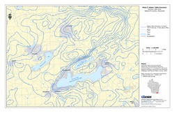
Elevation of Bedrock Surface, Geneva Lake Area, Walworth County, Wisconsin [plate 3]
2006
Map: 11 in x 17 in, scale 1:100,000
-
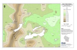
Depth to Bedrock (Thickness of Surficial Materials), Geneva Lake Area, Walworth County, Wisconsin [plate 4]
2006
Map: 11 in x 17 in, scale 1:100,000
-
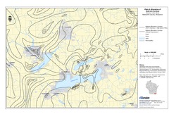
Water Table Elevation, Geneva Lake Area, Walworth County, Wisconsin [plate 5]
2006
Map: 11 in x 17 in, scale 1:100,000
-
Preliminary Hydrogeologic Maps of Iowa County, Wisconsin
Open-file report; contains unpublished data that has not yet been peer-reviewed.-
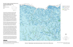
Preliminary Hydrogeologic Maps of Iowa County, Wisconsin: Preliminary Groundwater Recharge in Iowa County, Wisconsin [figure 1]
2010
Map: 28 in x 22 in, scale 1:225,000
-
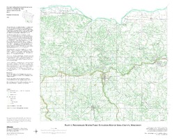
Preliminary Hydrogeologic Maps of Iowa County, Wisconsin: Preliminary Water-Table Elevation Map of Iowa County, Wisconsin [plate 1]
2010
Map: 26 in x 21 in, scale 1:100,000
-
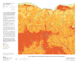
Preliminary Hydrogeologic Maps of Iowa County, Wisconsin: Preliminary Groundwater Susceptibility Map of Iowa County, Wisconsin [plate 2]
2010
Map: 26 in x 21 in, scale 1:100,000
-

Publications Catalog
Wisconsin Geological and Natural History Survey