-
Elevation contours of the Precambrian surface of south-central Wisconsin
Elevation contour data and an accompanying report provide an updated interpretation of the elevation of the top of Precambrian bedrock in south-central Wisconsin. The elevation surface was developed from geologic and geophysical data, and provides new detail on the entrenched bedrock valleys that were incised into the north and south ranges of the Baraboo...-
Elevation contours of the Precambrian surface of south-central Wisconsin [dataset 1]
2022
GIS Data: File geodatabase (.gdb file format)
-
-
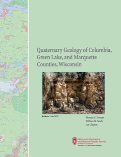
Quaternary Geology of Columbia, Green Lake, and Marquette Counties, Wisconsin
Columbia, Green Lake, and Marquette Counties were glaciated during the last ice age, and large areas were inundated with water from proglacial lakes and large meltwater rivers that occupied the valleys of the existing Wisconsin and Fox Rivers. These processes resulted in rolling upland hills, including drumlins punctuated by low-lying areas dominated by...-
GIS Data for the Quaternary Geology of Columbia, Green Lake, and Marquette Counties, Wisconsin [dataset 1]
2021
GIS Data: GeMS Level 3 file geodatabase (.gdb file format), shapefiles (.shp file format), GeoPackage (.gpkg file format)
-
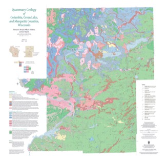
Quaternary Geology of Columbia, Green Lake, and Marquette Counties, Wisconsin [plate 1]
2021
Map: 35 in x 34 in, scale 1:100,000
-
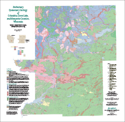
Preliminary Quaternary Geology of Columbia, Green Lake, and Marquette Counties, Wisconsin
This open-file report contains a map (PDF), GIS data (shapefiles), and metadata for Columbia, Green Lake, and Marquette Counties in central Wisconsin.-
Preliminary Quaternary Geology of Columbia, Green Lake, and Marquette Counties, Wisconsin [plate 1]
2015
Map: 35 in x 34 in, scale 1:100,000
-
Preliminary Quaternary Geology of Columbia, Green Lake, and Marquette Counties, Wisconsin [GIS data]
2015
GIS Data: Shapefiles (.shp file format)
-

Publications Catalog
Wisconsin Geological and Natural History Survey