-
Depth to Silurian Bedrock in Eastern Wisconsin
Silurian-aged bedrock in eastern Wisconsin is shallow, fractured, and contains groundwater that is susceptible to surface water contamination. Revisions to Wisconsin state rules ATCP50 and NR151 to regulate manure spreading over this Silurian-aged bedrock create the need for a depth-to-bedrock map of eastern WI. The Wisconsin Geological and Natural...-
Depth to Silurian Bedrock in Eastern Wisconsin [dataset 1]
2025
GIS Data: File geodatabase (.gdb file format)
-
-
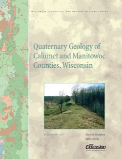
Quaternary Geology of Calumet and Manitowoc Counties, Wisconsin
All of what is now Calumet and Manitowoc Counties was covered by ice during the last great glaciation, between 30,000 and 11,000 years ago. This bulletin explains the glacial history, interprets the deposits left behind, and portrays the distribution of the deposits on a map and cross sections. This report should be useful to planners and development...-
Quaternary Geology of Calumet and Manitowoc Counties, Wisconsin [GIS data]
2017
GIS Data: Shapefiles (.shp file format)
-
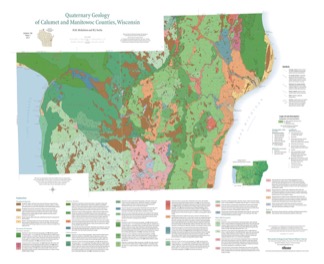
Quaternary Geology of Calumet and Manitowoc Counties, Wisconsin [plate 1]
2017
Plate: 35.5 in x 29 in, scale 1:100,000
-
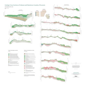
Geologic Cross Sections of Calumet and Manitowoc Counties, Wisconsin [plate 2]
2017
Plate: 36.67 in x 36.67 in, scale 1:100,000

Publications Catalog
Wisconsin Geological and Natural History Survey