-
Hydrogeology and Ground-Water Use and Quality, Brown County, Wisconsin
-
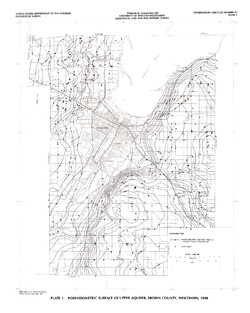
Potentiometric Surface of Upper Aquifer, Brown County, Wisconsin, 1980 [plate 1]
1986
Map: 20 in x 25 in, scale 1:100,000
-
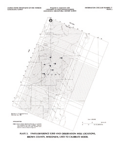
Finite-Difference Grid and Observation Well Locations, Brown County, Wisconsin, Used to Calibrate Model [plate 2]
1986
Map: 16 in x 19 in, scale 1:500,000
-
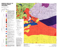
Pleistocene Geology of Portage County, Wisconsin
-
GIS Data for the Pleistocene Geology of Portage County, Wisconsin (version 2) [dataset 1]
1986
GIS Data: GeMS Level 3 file geodatabase (.gdb file format), shapefiles (.shp file format), GeoPackage (.gpkg file format)
-
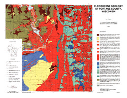
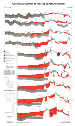
Pleistocene Geology of Portage County, Wisconsin [plate 1]
1986
Map: 28.5 in x 22 in, scale 1:100,000
-
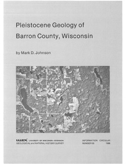
Pleistocene Geology of Barron County, Wisconsin
-
Pleistocene Geology of Barron County, Wisconsin (version 2) [GIS data]
1986
GIS Data: GeMS file geodatabase (.gdb file format)
-
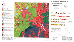
Pleistocene Geology of Barron County, Wisconsin [plate 1]
1986
Map: 40.5 in x 22.8 in, scale 1:100,000
-
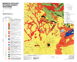
Bedrock Geology of Wood County, Wisconsin
-
Bedrock Geology of Wood County, Wisconsin [GIS data]
1986
GIS Data: Shapefiles (.shp file format), MrSID files (.sid file format)
-
-
Bedrock Geology of Portage County, Wisconsin
-
GIS Data for Bedrock Geology of Portage County, Wisconsin (version 2) [dataset 1]
1986
GIS Data: GeMS Level 3 file geodatabase (.gdb file format)
-
-
Glacial and Related Deposits of Langlade County, Wisconsin
-
Pleistocene Geology of Langlade County, Wisconsin (version 3) [GIS data]
1986
GIS Data: GeMS Level 3 file geodatabase (.gdb file format)
-
Pleistocene Geology of Langlade County, Wisconsin [plate 1]
1986
Map: 39.6 in x 27.4 in, scale 1:100,000
-
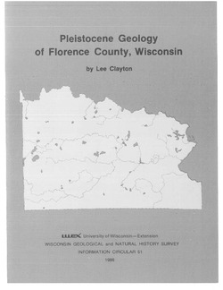
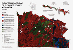
Pleistocene Geology of Florence County, Wisconsin
-
Pleistocene Geology of Florence County, Wisconsin (version 3) [GIS data]
1986
GIS Data: GeMS Level 3 file geodatabase (.gdb file format)
-
Pleistocene Geology of Florence County, Wisconsin [plate 1]
1986
Map: 26.8 in x 18.2 in, scale 1:100,000

Publications Catalog
Wisconsin Geological and Natural History Survey