-
Madison Lakes Ice Summary--1985-1986 Season
Open-file report; contains unpublished data that has not yet been peer-reviewed. -
Station History Data File Format for Personal Computer Applications Using Daily Climatological Data
Open-file report; contains unpublished data that has not yet been peer-reviewed. -
Wisconsin County Maps of Tornado Paths for 1950 to 1986 with a List of Tornados by County
Open-file report; contains unpublished data that has not yet been peer-reviewed. -
Hydrogeology and Ground-Water Use and Quality, Brown County, Wisconsin
-
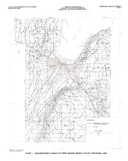
Potentiometric Surface of Upper Aquifer, Brown County, Wisconsin, 1980 [plate 1]
1986
Map: 20 in x 25 in, scale 1:100,000
-
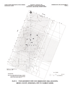
Finite-Difference Grid and Observation Well Locations, Brown County, Wisconsin, Used to Calibrate Model [plate 2]
1986
Map: 16 in x 19 in, scale 1:500,000
-
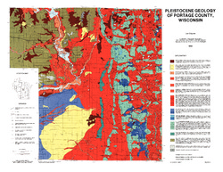
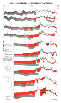
Pleistocene Geology of Portage County, Wisconsin
-
GIS Data for the Pleistocene Geology of Portage County, Wisconsin (version 2) [dataset 1]
1986
GIS Data: GeMS Level 3 file geodatabase (.gdb file format), shapefiles (.shp file format), GeoPackage (.gpkg file format)
-
Pleistocene Geology of Portage County, Wisconsin [plate 1]
1986
Map: 28.5 in x 22 in, scale 1:100,000
-
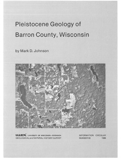
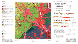
Pleistocene Geology of Barron County, Wisconsin
-
Pleistocene Geology of Barron County, Wisconsin (version 2) [GIS data]
1986
GIS Data: GeMS file geodatabase (.gdb file format)
-
Pleistocene Geology of Barron County, Wisconsin [plate 1]
1986
Map: 40.5 in x 22.8 in, scale 1:100,000
-
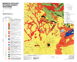
Bedrock Geology of Wood County, Wisconsin
-
Bedrock Geology of Wood County, Wisconsin [GIS data]
1986
GIS Data: Shapefiles (.shp file format), MrSID files (.sid file format)
-
-
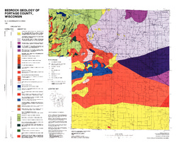
Bedrock Geology of Portage County, Wisconsin
-
GIS Data for Bedrock Geology of Portage County, Wisconsin (version 2) [dataset 1]
1986
GIS Data: GeMS Level 3 file geodatabase (.gdb file format)
-
-
Glacial and Related Deposits of Langlade County, Wisconsin
-
Pleistocene Geology of Langlade County, Wisconsin (version 3) [GIS data]
1986
GIS Data: GeMS Level 3 file geodatabase (.gdb file format)
-
Pleistocene Geology of Langlade County, Wisconsin [plate 1]
1986
Map: 39.6 in x 27.4 in, scale 1:100,000
-
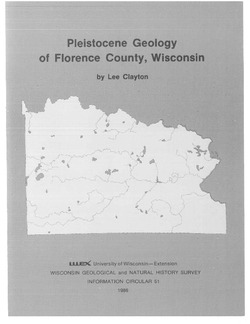
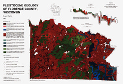
Pleistocene Geology of Florence County, Wisconsin
-
Pleistocene Geology of Florence County, Wisconsin (version 3) [GIS data]
1986
GIS Data: GeMS Level 3 file geodatabase (.gdb file format)
-
Pleistocene Geology of Florence County, Wisconsin [plate 1]
1986
Map: 26.8 in x 18.2 in, scale 1:100,000
-
Geoscience Wisconsin Volume 11
Precambrian petroleum potential in Wisconsin and Michigan-
Precambrian Petroleum: Worldwide Distribution of Precambrian Hydrocarbon Deposits
1986
Journal Article: p. 8-13
-
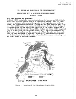
Setting and Evolution of the Midcontinent Rift: Midcontinent Rift as a Frontier Hydrocarbon Target
1986
Journal Article: p. 15-19
-
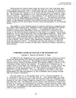
Setting and Evolution of the Midcontinent Rift: Lithospheric Flexure and Evolution of the Midcontinent Rift
1986
Journal Article: p. 19-21
-
Upper Keweenawan Stratigraphy: Reservoir Characteristics of the Keweenawan Supergroup, Lake Superior Region
1986
Journal Article: p. 25-31
-
Local Geologic Issues Impacting Exploration: Nature of the Northern Boundary of the St. Croix Horst
1986
Journal Article: p. 39-44
- 5 more...
-
Precambrian Petroleum Potential along the Midcontinent Trend
Companion volume to Geoscience Wisconsin, vol. 11. Prepared for 16th Annual Field Conference Great Lakes Section Society of Economic Paleontologists and Mineralogists. -
The Wolf River Batholith and Baraboo Interval in Central Wisconsin
Prepared for 32nd Annual Meeting Institute on Lake Superior Geology. -
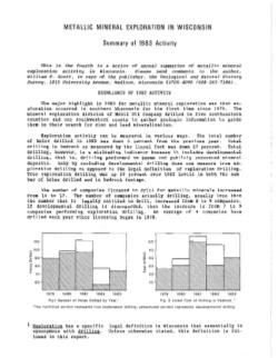
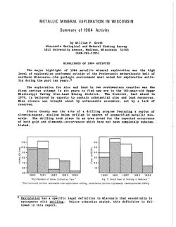
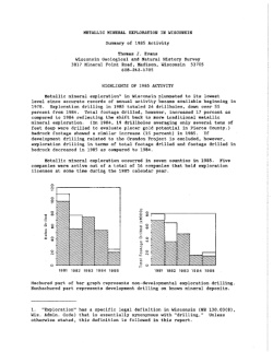
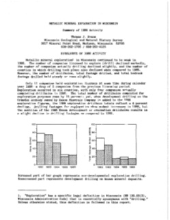
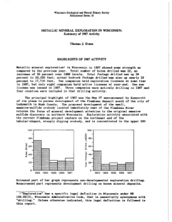
Metallic Mineral Exploration in Wisconsin [1980-1987]
Annual summaries of metallic mineral exploration in Wisconsin for 1980-1987. Each summary includes statistical reviews of exploration activity, highlights of the year's activity, and reviews of legislative actions affecting exploration.

Publications Catalog
Wisconsin Geological and Natural History Survey