-
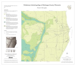
Preliminary Bedrock Geology of Sheboygan County, Wisconsin
Open-file report; contains unpublished data that has not yet been peer-reviewed.-
Preliminary Bedrock Geology of Sheboygan County, Wisconsin (version 2) [GIS data]
2013
GIS Data: GeMS file geodatabase (.gdb file format)
-
Hydrographic map of Elkhart Lake, Sheboygan County, Wisconsin
-
Hydrographic Map of Elkhart Lake, Sheboygan County, Wisconsin
1898
Map: 17.2 in x 14.1 in, scale 1 in = 1/7 mile
-
-
A Subsurface Study of the St. Peter Sandstone in Southern and Eastern Wisconsin
-
Structure Contour Map of the Pre-St. Peter Sandstone Erosion Surface in Southern and Eastern Wisconsin [plate 1]
1985
Map: 39.7 in x 23.5 in, scale 1:750,000
-
Paleogeologic Map of the Pre-St. Peter Sandstone Surface in Southern and Eastern Wisconsin & Thickness Map of the St. Peter Sandstone in Southern and Eastern Wisconsin [plate 2]
1985
Map: 39.4 in x 23.6 in, scale 1:750,000
-
Atlas of the Geological Survey of Wisconsin
Collection of most of the plates accompanying Chamberlin's four-volume Geology of Wisconsin: Survey of 1873-1879.-
Atlas of the Geological Survey of Wisconsin: General Geological Map of Wisconsin [plate 1]
1882
Map: 25.5 in x 30.3 in, scale 1 in = 15 miles
-
Atlas of the Geological Survey of Wisconsin: General Map of Quaternary Formations [plate 2]
1882
Map: 28.2 in x 32.4 in
-
Atlas of the Geological Survey of Wisconsin: General Map of Native Vegetation [plate 2A]
1882
Map: 28.2 in x 32.4 in
-
Atlas of the Geological Survey of Wisconsin: General Map of Soils [plate 2B]
1882
Map: 28.2 in x 32.5 in
-
Atlas of the Geological Survey of Wisconsin: Map of Rainfall and Temperature [plate 2C]
1882
Map: 27.7 in x 32.5 in
-
Atlas of the Geological Survey of Wisconsin: Maps of Subsoils and Native Vegetation of Eastern Wisconsin [plate 3]
1877
Map: 27.82 in x 32.17 in, scale 1 in = 12 miles
-
Atlas of the Geological Survey of Wisconsin: Maps of Topography and Quaternary Formations of Eastern Wisconsin [plate 4]
1877
Map: 27.83 in x 32.06 in, scale 1 in = 12 miles
-
Atlas of the Geological Survey of Wisconsin: Geology and Topography of the Lead Region [plate 5]
1877
Map: 27.68 in x 32.18 in
-
Atlas of the Geological Survey of Wisconsin: Geology and Topography of the Lead Region [plate 6]
1877
Map: 23.98 in x 28.94 in
-
Atlas of the Geological Survey of Wisconsin: Geology and Topography of the Lead Region [plate 8]
1877
Map: 24.03 in x 28.38 in
- 32 more...
-
-
Quaternary Geology of Sheboygan County, Wisconsin
This report traces the advances and retreats of glaciers through Sheboygan County in eastern Wisconsin. Available as a bulletin, map, cross sections, and GIS data.-
Quaternary Geology of Sheboygan County, Wisconsin [GIS data]
2011
GIS Data: Shapefiles (.shp file format), MrSID files (.sid file format)
-
Quaternary Geology of Sheboygan County, Wisconsin [plate 1]
2011
Map: 32 in x 22 in, scale 1:100,000
-
Geologic Cross Sections of Sheboygan County, Wisconsin [plate 2]
2011
Plate: 33 in x 24 in, scale 1:100,000
-
On the Lakes of Southeastern Wisconsin
-
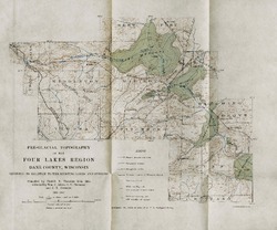
Pre-Glacial Topography of the Four Lakes Region, Dane County, Wisconsin: Showing Its Relation to the Existing Lakes and Streams [plate 37]
1910
Map: 11.6 in x 9.7 in, scale 1 in = 2 miles

Publications Catalog
Wisconsin Geological and Natural History Survey