-
Characterization of Groundwater Resources in the Chequamegon-Nicolet National Forest, Wisconsin
Results of a comprehensive review and analysis of groundwater resources in the Chequamegon-Nicolet National Forest. The study was divided by location into four reports corresponding to the four main land units: Medford, Nicolet, Park Falls, and Washburn/Great Divide. Each report describes the results of the inventory, modeling, and analysis.-
Characterization of Groundwater Resources in the Chequamegon-Nicolet National Forest, Wisconsin: Medford Unit [GIS data]
2018
GIS Data: File geodatabase (.gdb file format)
-
Characterization of Groundwater Resources in the Chequamegon-Nicolet National Forest, Wisconsin: Medford Unit [plates]
2018
Map: 10 maps, 11 in x 17 in
-
Characterization of Groundwater Resources in the Chequamegon-Nicolet National Forest, Wisconsin: Nicolet Unit [GIS data]
2018
GIS Data: File geodatabase (.gdb file format)
-
Characterization of Groundwater Resources in the Chequamegon-Nicolet National Forest, Wisconsin: Nicolet Unit [plates]
2018
Map: 20 maps (10 each, northern and southern Nicolet Unit), 11 in x 17 in
-
Characterization of Groundwater Resources in the Chequamegon-Nicolet National Forest, Wisconsin: Park Falls Unit [GIS data]
2018
GIS Data: File geodatabase (.gdb file format)
-
Characterization of Groundwater Resources in the Chequamegon-Nicolet National Forest, Wisconsin: Park Falls Unit [plates]
2018
Map: 10 maps, 11 in x 17 in
- 2 more...
-
Water Resources of Vilas County, Wisconsin
-
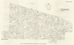
Altitude and Configuration of the Water Table, Vilas County, Wisconsin [plate 1]
1989
Map: 35.5 in x 21.8 in, scale 1:100,000
-
Bedrock Geology of Wisconsin, Northwest Sheet
Types of bedrock, formation names, major faults, and time period of formation.-
Bedrock Geology of Wisconsin, Northwest Sheet
1987
Map: 37.5 in x 22 in, scale 1:250,000; 35.5 in x 20 in
-
Bedrock Geology of Wisconsin, Northwest Sheet [GIS data]
1987
GIS Data: MrSID files (.sid file format)
-
-
Bedrock Geology of Wisconsin, Northeast Sheet
Types of bedrock, formation names, major faults, and time period of formation.-
Bedrock Geology of Wisconsin, Northeast Sheet [GIS data]
1984
GIS Data: GeMS file geodatabase (.gdb file format)
-
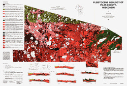
Pleistocene Geology of Vilas County, Wisconsin
-
Pleistocene Geology of Vilas County, Wisconsin (version 3) [GIS data]
1985
GIS Data: GeMS Level 3 file geodatabase (.gdb file format)
-
Pleistocene Geology of Vilas County, Wisconsin [plate 1]
1985
Map: 39.5 in x 26.7 in, scale 1:100,000
-
Reconnoissance [sic] Soil Survey of North Part of North Central Wisconsin
-
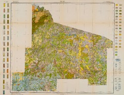
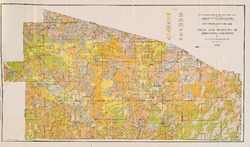
Soil Map: Wisconsin, Reconnoissance [sic] Survey - North Part of North Central Wisconsin Sheet
1916
Map: 26.0 in x 20.0 in, scale 1 in = 3 miles
-
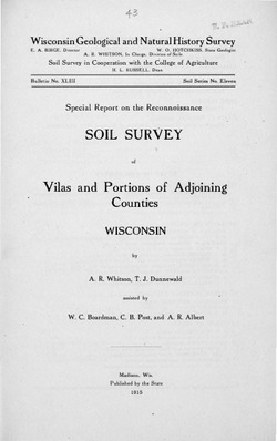
Special Report on the Reconnoissance [sic] Soil Survey of Vilas and Portions of Adjoining Counties, Wisconsin
-
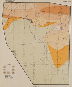
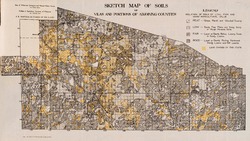
Reconnoissance [sic] Soil Map of Vilas and Portions of Adjoining Counties
1915
Map: 24.6 in x 14.5 in, scale 1/2 in = 1 mile

Publications Catalog
Wisconsin Geological and Natural History Survey