
Characterization of Groundwater Resources in the Chequamegon-Nicolet National Forest, Wisconsin
Data and Resources
-
Characterization of Groundwater Resources in the Chequamegon-Nicolet National Forest, Wisconsin: Medford Unit [GIS data]
2018
GIS Data: File geodatabase (.gdb file format)
-
Characterization of Groundwater Resources in the Chequamegon-Nicolet National Forest, Wisconsin: Medford Unit [plates]
2018
Map: 10 maps, 11 in x 17 in
-
Characterization of Groundwater Resources in the Chequamegon-Nicolet National Forest, Wisconsin: Nicolet Unit [GIS data]
2018
GIS Data: File geodatabase (.gdb file format)
-
Characterization of Groundwater Resources in the Chequamegon-Nicolet National Forest, Wisconsin: Nicolet Unit [plates]
2018
Map: 20 maps (10 each, northern and southern Nicolet Unit), 11 in x 17 in
-
Characterization of Groundwater Resources in the Chequamegon-Nicolet National Forest, Wisconsin: Park Falls Unit [GIS data]
2018
GIS Data: File geodatabase (.gdb file format)
-
Characterization of Groundwater Resources in the Chequamegon-Nicolet National Forest, Wisconsin: Park Falls Unit [plates]
2018
Map: 10 maps, 11 in x 17 in
-
Characterization of Groundwater Resources in the Chequamegon-Nicolet National Forest, Wisconsin: Washburn/Great Divide Unit [GIS data]
2018
GIS Data: File geodatabase (.gdb file format), documents (.pdf file format), spreadsheets (.xlsx file format)
-
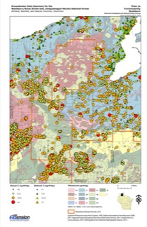
Characterization of Groundwater Resources in the Chequamegon-Nicolet National Forest, Wisconsin: Washburn/Great Divide Unit [plates]
2018
Map: 20 maps (10 each, Washburn and Great Divide Districts), 11 in x 17 in


Related Collections
-

Technical Report
View Technical Report