-
Chequamegon-Nicolet National Forest Water Quality Database
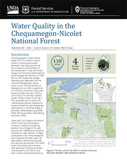
The Chequamegon-Nicolet National Forest (CNNF) in northern Wisconsin contains numerous groundwater-dependent water resources that may be vulnerable to potential effects of land development, mining, and climate change. In order to monitor water quality over time, 138 of the lakes, streams, wetlands, spring ponds, springs, and wells were sampled in...-
Chequamegon-Nicolet National Forest Water Quality Database
2024
Data: Spreadsheets (.csv file format)
-
-
Characterization of Groundwater Resources in the Chequamegon-Nicolet National Forest, Wisconsin
Results of a comprehensive review and analysis of groundwater resources in the Chequamegon-Nicolet National Forest. The study was divided by location into four reports corresponding to the four main land units: Medford, Nicolet, Park Falls, and Washburn/Great Divide. Each report describes the results of the inventory, modeling, and analysis.-
Characterization of Groundwater Resources in the Chequamegon-Nicolet National Forest, Wisconsin: Medford Unit [GIS data]
2018
GIS Data: File geodatabase (.gdb file format)
-
Characterization of Groundwater Resources in the Chequamegon-Nicolet National Forest, Wisconsin: Medford Unit [plates]
2018
Map: 10 maps, 11 in x 17 in
-
Characterization of Groundwater Resources in the Chequamegon-Nicolet National Forest, Wisconsin: Nicolet Unit [GIS data]
2018
GIS Data: File geodatabase (.gdb file format)
-
Characterization of Groundwater Resources in the Chequamegon-Nicolet National Forest, Wisconsin: Nicolet Unit [plates]
2018
Map: 20 maps (10 each, northern and southern Nicolet Unit), 11 in x 17 in
-
Characterization of Groundwater Resources in the Chequamegon-Nicolet National Forest, Wisconsin: Park Falls Unit [GIS data]
2018
GIS Data: File geodatabase (.gdb file format)
-
Characterization of Groundwater Resources in the Chequamegon-Nicolet National Forest, Wisconsin: Park Falls Unit [plates]
2018
Map: 10 maps, 11 in x 17 in
- 2 more...
-
Groundwater and Fractured Crystalline Bedrock in Wisconsin's National Forest
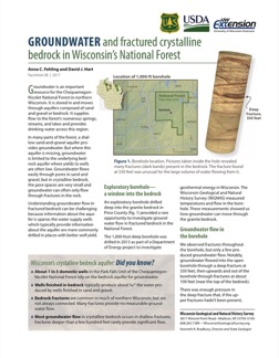
An exploratory borehole drilled into the fractured crystalline (granite) bedrock in Chequamegon-Nicolet National Forest provided a rare opportunity to investigate groundwater flow. This 2-page factsheet provides insights that can be applied to groundwater management in bedrock aquifers. -
Summary of Field Mapping in the Superior Map Sheet, Wisconsin
Open-file report; contains unpublished data that has not yet been peer-reviewed. -
Geology of Wisconsin - Outcrop Descriptions
These descriptions illustrate various geologic formations, features, and characteristics. Individual descriptions are one to ten pages long, and include a map with specific location, a description of geologic features, and a discussion of the geologic significance.-
Adams County: Upper Wisconsin Dells (T14N R6E Sec28)
Report: 3 p.
-
Adams County: Friendship Mound (T17N R6E Sec5)
Report: 2 p.
-
Adams County: Hamilton Mound (T20N R6E Sec36)
Report: 4 p.
-
Ashland County: Mt. Whittelsey (T44N R2W Sec9A)
Report: 3 p.
-
Ashland County: Mellen Gabbro (T45N R2W Sec30)
Report: 3 p.
-
Ashland County: Mellen Granite (T45N R2W Sec31)
Report: 3 p.
-
Ashland County: White River (T46N R4W Sec6)
Report: 2 p.
-
Bayfield County: South Fish Creek (T47N R5W Sec20)
Report: 2 p.
- 123 more...
-
-
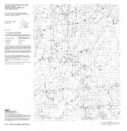
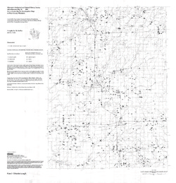
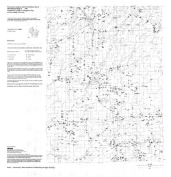
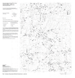
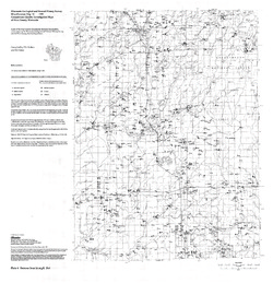
Groundwater Quality Investigation Maps of Price County, Wisconsin
Includes Plate 1: Nitrate as Nitrogen in mg/L. Plate 2: Chloride in mg/L. Plate 3: Laboratory Measurement of Alkalinity in mg/L. Plate 4: Total Hardness in mg/L. Plate 5: Laboratory Measurement of Electrical Conductivity in μmhos/cm. Plate 6: Ferrous Iron in mg/L.-
Groundwater Quality Investigation Maps of Price County, Wisconsin: Nitrate as Nitrogen in mg/L [plate 1]
1999
Map: 29 in x 30 in, scale 1:100,000
-
Groundwater Quality Investigation Maps of Price County, Wisconsin: Chloride in mg/L [plate 2]
1999
Map: 29 in x 30 in, scale 1:100,000
-
Groundwater Quality Investigation Maps of Price County, Wisconsin: Laboratory Measurement of Alkalinity in mg/L [plate 3]
1999
Map: 29 in x 30 in, scale 1:100,000
-
Groundwater Quality Investigation Maps of Price County, Wisconsin: Total Hardness in mg/L [plate 4]
1999
Map: 28.7 in x 30 in, scale 1:100,000
-
Groundwater Quality Investigation Maps of Price County, Wisconsin: Laboratory Measurement of Electrical Conductivity in μmhos/cm [plate 5]
1999
Map: 28.9 in x 30 in, scale 1:100,000
-
Groundwater Quality Investigation Maps of Price County, Wisconsin: Ferrous Iron in mg/L [plate 6]
1999
Map: 29 in x 30 in, scale 1:100,000
-
-
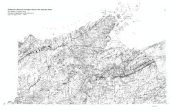
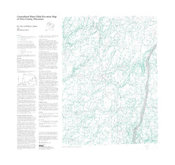
Generalized Water-Table Elevation Map of Price County, Wisconsin
-
Generalized Water-Table Elevation Map of Price County, Wisconsin
1999
Map: 31.5 in x 30 in, scale 1:100,000
-
-
Bedrock Geology of Wisconsin, Northwest Sheet
Types of bedrock, formation names, major faults, and time period of formation.-
Bedrock Geology of Wisconsin, Northwest Sheet
1987
Map: 37.5 in x 22 in, scale 1:250,000; 35.5 in x 20 in
-
Bedrock Geology of Wisconsin, Northwest Sheet [GIS data]
1987
GIS Data: MrSID files (.sid file format)
-
-
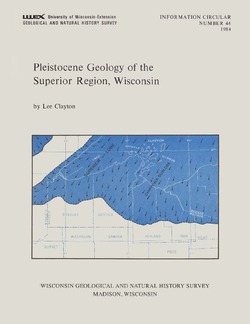
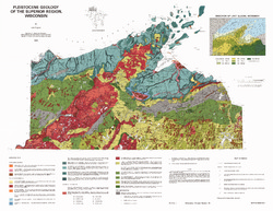
Pleistocene Geology of the Superior Region, Wisconsin
-
Pleistocene Geology of the Superior Region, Wisconsin (version 2) [GIS data]
1985
GIS Data: GeMS Level 3 file geodatabase (.gdb file format)
-
Pleistocene Geology of the Superior Region, Wisconsin [plate 1]
1985
Map: 35.9 in x 27.8 in, scale 1:250,000
-
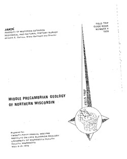
Middle Precambrian Geology of Northern Wisconsin
Prepared for 25th Annual Meeting, Institute on Lake Superior Geology. -
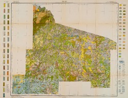
Reconnoissance [sic] Soil Survey of North Part of North Central Wisconsin
-
Soil Map: Wisconsin, Reconnoissance [sic] Survey - North Part of North Central Wisconsin Sheet
1916
Map: 26.0 in x 20.0 in, scale 1 in = 3 miles
-
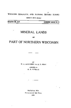
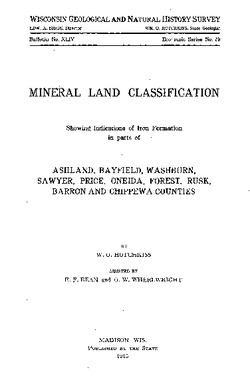
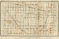
Mineral Land Classification, Showing Indications of Iron Formation in Parts of Ashland, Bayfield, Washburn, Sawyer, Price, Oneida, Forest, Rusk, Barron, and Chippewa Counties
-
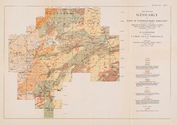
Map Showing Geology of Part of Northwestern Wisconsin Including Parts of Ashland, Bayfield, Washburn, Sawyer, Price, Oneida, Barron, Rusk, and Chippewa Counties [plate 1]
1915
Map: 20.7 in x 13.5 in, scale 1 in = 6 miles
-
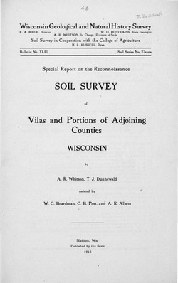
Special Report on the Reconnoissance [sic] Soil Survey of Vilas and Portions of Adjoining Counties, Wisconsin
-
Reconnoissance [sic] Soil Map of Vilas and Portions of Adjoining Counties
1915
Map: 24.6 in x 14.5 in, scale 1/2 in = 1 mile
-
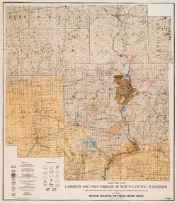
The Geology of North Central Wisconsin
-
Map of the Cambrian and Pre-Cambrian of North Central Wisconsin: Clark, Wood, Portage, Marathon, Lincoln, Taylor and Parts of Langlade, Rusk and Price Counties [plate 1]
1907
Map: 20.0 in x 22.9 in, scale 1 in = 3 miles
-
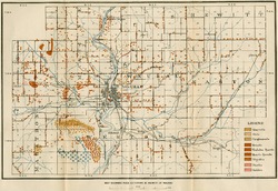
Map of the Pleistocene of North Central Wisconsin: Clark, Wood, Portage, Marathon, Lincoln, Taylor and Parts of Langlade, Rusk and Price Counties [plate 2]
1907
Map: 20.1 in x 23.1 in, scale 1 in = 3 miles
-
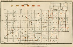
Map Showing Rock Outcrops in Vicinity of Athens and Upper Rib River [plate 8]
1907
Map: 13.6 in x 8.8 in
-
Map Showing Rock Outcrops in Vicinity of Arpin and Junction City [plate 12]
1907
Map: 15.1 in x 9.9 in
-
Map Showing Rock Outcrops in Vicinity of Hewitt and Rozellville [plate 15]
1907
Map: 10.9 in x 7.5 in

Publications Catalog
Wisconsin Geological and Natural History Survey