
Geology of Wisconsin - Outcrop Descriptions
Data and Resources
-
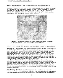
Adams County: Upper Wisconsin Dells (T14N R6E Sec28)
Report: 3 p.
-
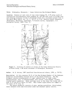
Adams County: Friendship Mound (T17N R6E Sec5)
Report: 2 p.
-
Adams County: Hamilton Mound (T20N R6E Sec36)
Report: 4 p.
-
Ashland County: Mt. Whittelsey (T44N R2W Sec9A)
Report: 3 p.
-
Ashland County: Mellen Gabbro (T45N R2W Sec30)
Report: 3 p.
-
Ashland County: Mellen Granite (T45N R2W Sec31)
Report: 3 p.
-
Ashland County: White River (T46N R4W Sec6)
Report: 2 p.
-
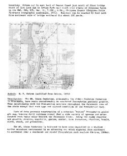
Bayfield County: South Fish Creek (T47N R5W Sec20)
Report: 2 p.
-
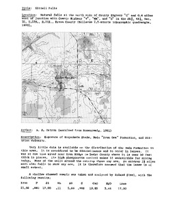
Brown County: Kittell Falls (T23N R21E Sec 32)
Report: 3 p.
-
Chippewa County: Irvine Park (T29N R8W Sec31)
Report: 3 p.
-
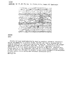
Chippewa County: Tilden (T29N R9W Sec7)
Report: 4 p.
-
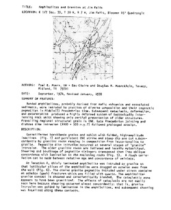
Chippewa County: Jim Falls (T30N R7W Sec30)
Report: 7 p.
-
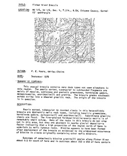
Chippewa County: Fisher River (T31N R6W Sec4)
Report: 2 p.
-
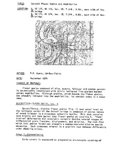
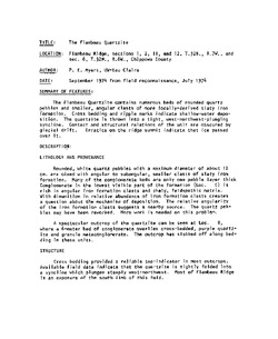
Chippewa County: Flambeau Ridge (T32N R7W Sec1)
Report: 2 p.
-
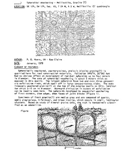
Clark County: Neillsville Mounds (T24N R2W Sec4)
Report: 2 p.
-
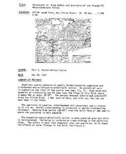
Clark County: Neillsville (T24N R2W Sec10)
Report: 1 p.
-
Clark County: Sidney (T24N R2W Sec20)
Report: 2 p.
-
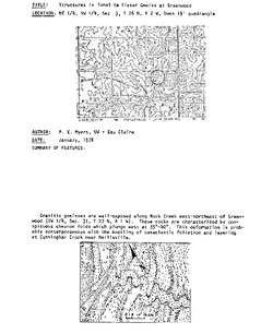
Clark County: Cunningham Creek (T24N R2W Sec26)
Report: 2 p.
-
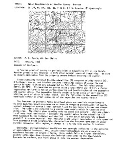
Clark County: Greenwood (T26N R3W Sec3)
Report: 1 p.
-
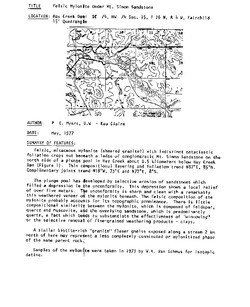
Clark County: Hay Creek Dam (T26N R4W Sec26)
Report: 2 p.
-
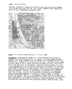
Crawford County: Prairie du Chien (T7N R6W Sec29)
Report: 4 p.
-
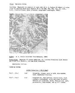
Crawford County: Marietta Valley (T8N R3W Sec10)
Report: 3 p.
-
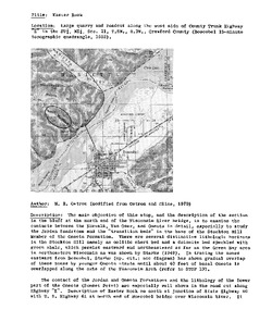
Crawford County: Easter Rock (T8N R3W Sec21)
Report: 7 p.
-
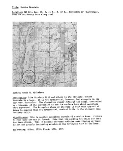
Dodge County: Neda (T11N R16E Sec1)
Report: 5 p.
-
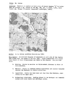
Dane County: Mt. Vernon (T5N R7E Sec3)
Report: 3 p.
-
Dane County: New Glarus North (T5N R8E Sec36)
Report: 4 p.
-
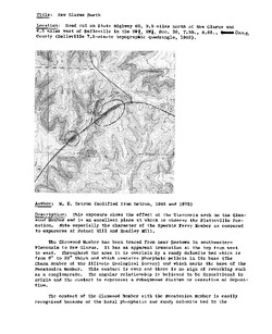
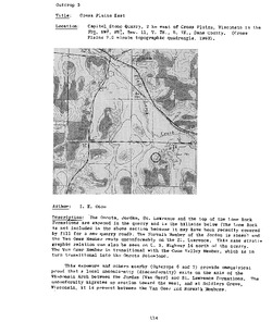
Dane County: Cross Plains West (T7N R7E Sec4)
Report: 3 p.
-
Dane County: Cross Plains East (T7N R7E Sec11)
Report: 3 p.
-
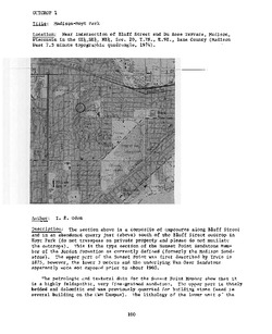
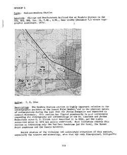
Dane County: Madison--Hoyt Park (T7N R9E Sec20)
Report: 4 p.
-
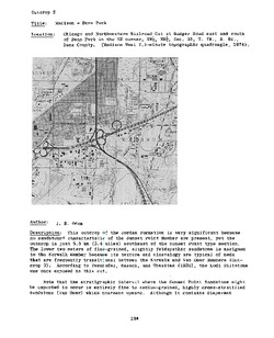
Dane County: Madison--Penn Park (T7N R9E Sec35)
Report: 3 p.
-
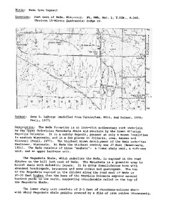
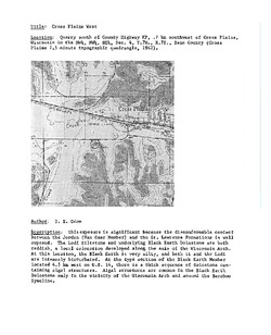
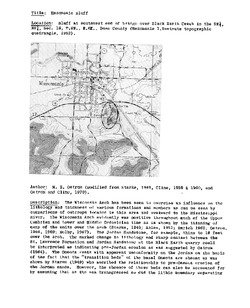
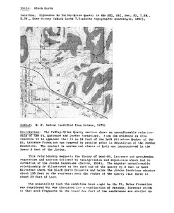
Dane County: Black Earth (T8N R6E Sec23)
Report: 10 p.
-
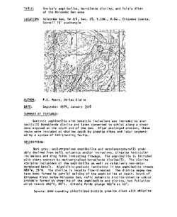
Eau Claire County: Mt. Simon (T27N R9W Sec8)
Report: 4 p.
-
Eau Claire County: Mt. Simon (T27N R9W Sec8)
Report: 4 p.
-
Fond du Lac County: Oakfield (T14N R16E Sec23)
Report: 3 p.
-
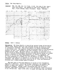
Green Lake County: Utley Rhyolite (T14N R13E Sec36)
Report: 5 p.
-
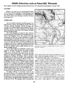
Grant County: Potosi Hill (T2N R2W Sec7)
Report: 4 p.
-
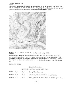
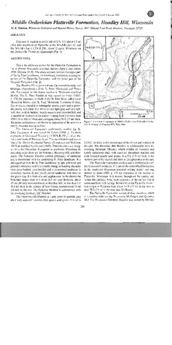
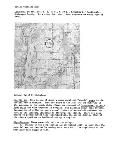
Grant County: Hoadley Hill (T2N R2W Sec12)
Report: 4 p.
-
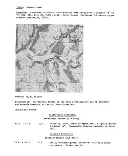
Grant County: Pigeon Creek (T4N R3W Sec19)
Report: 2 p.
-
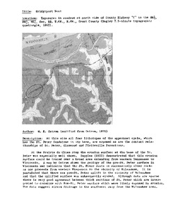
Grant County: Bridgeport West (T6N R6W Sec22)
Report: 5 p.
-
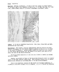
Grant County: Wyalusing (T6N R6W Sec31)
Report: 5 p.
-
Grant County: Potosi Hill (T2N R2W Sec7)
Report: 4 p.
-
Grant County: Hoadley Hill (T2N R2W Sec12)
Report: 4 p.
-
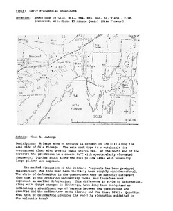
Iron County: Oma Township (T45N R2E Sec18)
Report: 2 p.
-
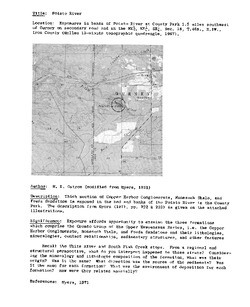
Iron County: Potato River (T46N R1W Sec18)
Report: 3 p.
-
Iron County: Hurley Overpass (T46N R2E Sec14A)
Report: 3 p.
-
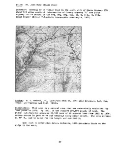
Iron County: Montreal Mine Dump (T46N R2E Sec33)
Report: 2 p.
-
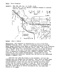
Iron County: Gile Flowage (T46N R2E Sec34)
Report: 2 p.
-
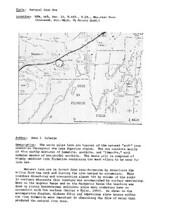
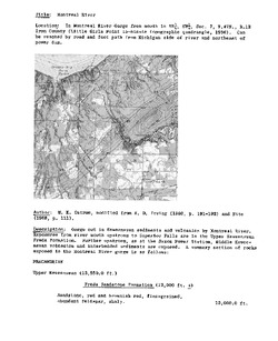
Iron County: Montreal River (T47N R1E Sec7)
Report: 4 p.
-
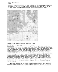
Iowa County: Blue Mounds (T6N R5E Sec1)
Report: 7 p.
-
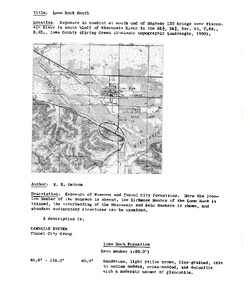
Iowa County: Lone Rock South (T8N R2E Sec13A)
Report: 3 p.
-
Iowa County: Lone Rock South (T8N R2E Sec13B)
Report: 4 p.
-
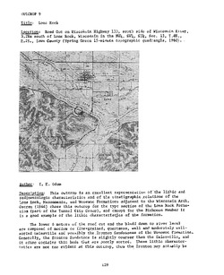
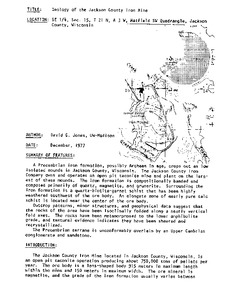
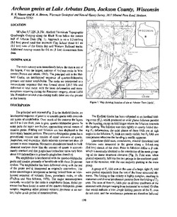
Jackson County: Arbutus Dam (T22N R3W Sec3)
Report: 2 p.
-
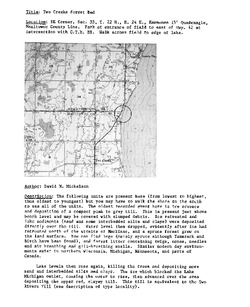
Kewaunee County: Two Creeks North (T22N R24E Sec35)
Report: 2 p.
-
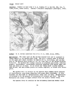
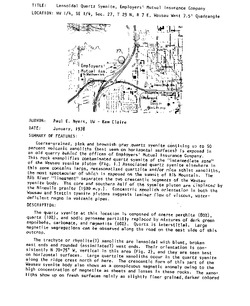
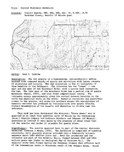
Lafayette County: Dill (T1N R5E Sec12)
Report: 2 p.
-
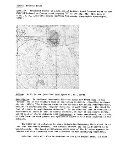
Lafayette County: Belmont Mound (T3N R3E Sec3)
Report: 2 p.
-
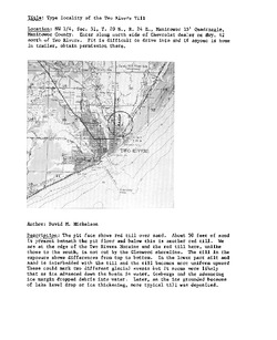
Manitowoc County: Duveneck (T18N R23E Sec24)
Report: 2 p.
-
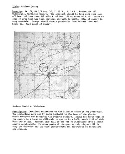
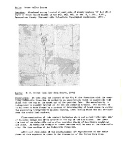
Manitowoc County: Valders Quarry (T19N R22E Sec32)
Report: 2 p.
-
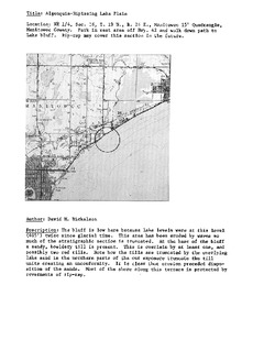
Manitowoc County: Manitowoc North (T19N R24E Sec16)
Report: 2 p.
-
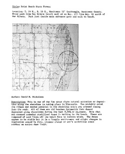
Manitowoc County: Two Rivers (T20N R24E Sec31)
Report: 2 p.
-
Marathon County: Marathon City (T28N R6E Sec18)
Report: 1 p.
-
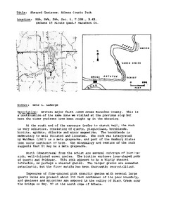
Marathon County: Athens County Park (T29N R4E Sec6)
Report: 3 p.
-
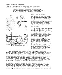
Marathon County: Artus Creek (T29N 6E Sec29)
Report: 3 p.
-
Marathon County: Brokaw East (T30N R7E Sec34)
Report: 2 p.
-
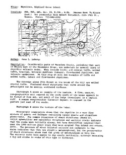
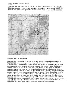
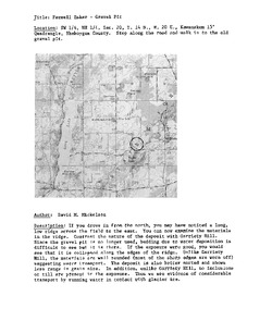
Sheboygan County: Garriety Hill (T14N R20E Sec8)
Report: 2 p.
-
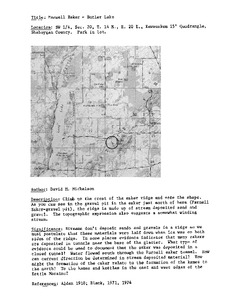
Sheboygan County: Butler Lake (T14N R20E Sec10B)
Report: 1 p.
-
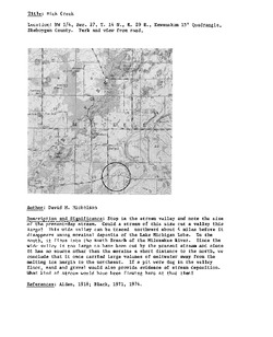
Sheboygan County: Mink Creek (T14N R20E Sec27)
Report: 1 p.
-
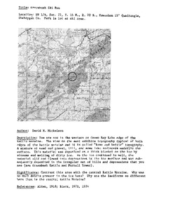
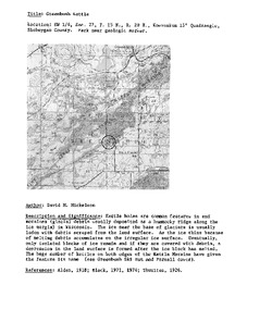
Sheboygan County: Greenbush Kettle (T15N R20E Sec27)
Report: 1 p.
-
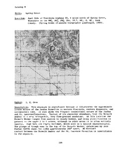
Sauk County: Spring Green (T9N R4E Sec30)
Report: 4 p.
-
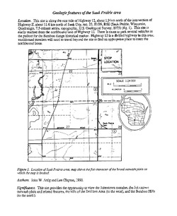
Sauk County: Sauk Prairie (T10N R6E Sec23)
Report: 2 p.
-
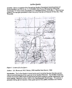
Sauk County: La Rue Quarry (T11N R5E Sec22)
Report: 5 p.
-
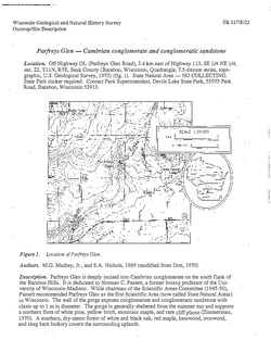
Sauk County: Parfreys Glen (T11N R7E Sec22)
Report: 5 p.
-
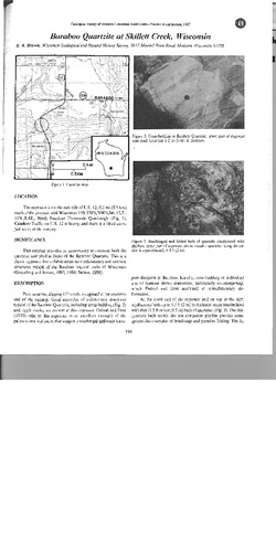
Sauk County: Skillett Creek (T11N R6E Sec15)
Report: 2 p.
-
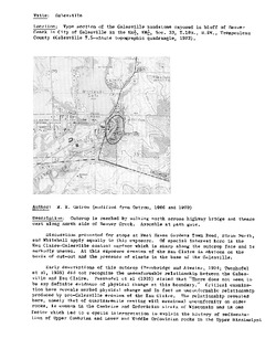
Trempealeau County: Galesville (T19N R8W Sec33)
Report: 5 p.
-
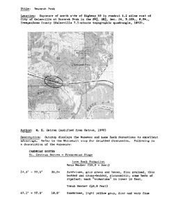
Trempealeau County: Decorah Peak (T19N R8W Sec34)
Report: 3 p.
-
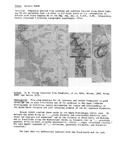
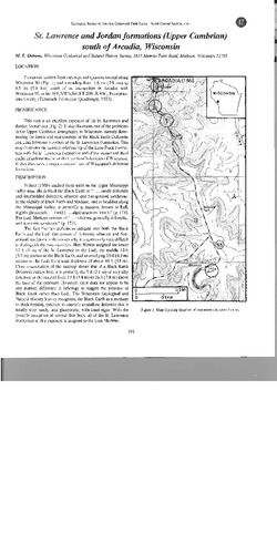
Trempealeau County: Arcadia South (T20N R9W Sec9)
Report: 5 p.
-
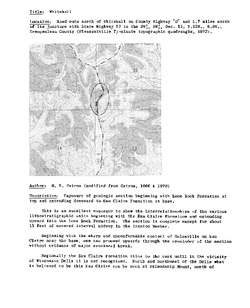
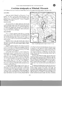
Trempealeau County: Whitehall (T22N R8W Sec12)
Report: 5 p.
-
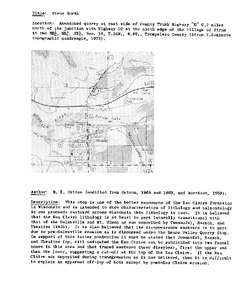
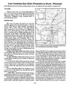
Trempealeau County: Strum North (T24N R8W Sec18)
Report: 3 p.
-
Trempealeau County: Arcadia South (T20N R9W Sec9)
Report: 4 p.
-
Trempealeau County: Whitehall (T22N R8W Sec12)
Report: 4 p.
-
Trempealeau County: Strum North (T24N R8W Sec18)
Report: 2 p.
-
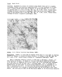
Vernon County: Reads Creek (T12N R4W Sec27)
Report: 7 p.
-
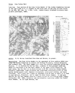
Vernon County: Coon Valley West (T14N R6W Sec11)
Report: 3 p.


Related Collections
-

Outcrops
View Outcrops