-
Depth to Bedrock in Grant County, Wisconsin
Depth-to-bedrock mapping of Grant County provides baseline information on unconsolidated surficial sediment thickness across the county. Bedrock aquifers in Grant County are susceptible to contamination from various land use activities, and depth to bedrock represents one of several factors affecting aquifer susceptibility. The results of this study...-
Depth to Bedrock in Grant County, Wisconsin [dataset 1]
2025
GIS Data: File geodatabase (.gdb file format)
-
-
Bedrock Geology of Grant County, Wisconsin
Three-dimensional bedrock mapping of Grant County at a scale of 1:100,000 provides new baseline information on the distribution of geologic units. Grant County contains Paleozoic bedrock units ranging in age from Silurian to Cambrian. Gentle folds and small faults deform the Paleozoic sequence and were mapped based on structure contours of the base of the...-
GIS Data for Bedrock Geology of Grant County, Wisconsin [dataset 1]
2025
GIS Data: GeMS Level 3 file geodatabase (.gdb file format), GeoPackage (.gpkg file format)
-
Geochemical Data for Bedrock Geology of Grant County, Wisconsin [dataset 2]
2025
Data: Spreadsheets (.csv file format)
-
GIS Data for Bedrock Geology of Grant County, Wisconsin [dataset 3]
2025
GIS Data: File geodatabase (.gdb file format)
-
Geologic Map of the Highland West and Highland East 7.5-Minute Quadrangles, Grant and Iowa Counties, Wisconsin
The geologic map of the Highland West and Highland East 7.5-minute quadrangles includes 1:24,000-scale mapping of both surficial and bedrock geology. Highland was a long-lived and important sub-district of the Upper Mississippi lead-zinc mining area in the 19th and 20th centuries. Recent and renewed interest in the presence and distrubution of critical...-
Geologic Map of the Highland West and Highland East 7.5-Minute Quadrangles, Grant and Iowa Counties, Wisconsin
2024
Map: 46 in x 36 in, scale 1:24,000
-
GIS Data for the Geologic Map of the Highland West and Highland East 7.5-Minute Quadrangles, Grant and Iowa Counties, Wisconsin [dataset 1]
2024
GIS Data: GeMS file geodatabase (.gdb file format), shapefiles (.shp file format)
-
-
Geologic Map of the Fennimore and Mount Hope 7.5-Minute Quadrangles, Grant County, Wisconsin
The geologic map of the Fennimore and Mount Hope quadrangles includes 1:24,000-scale mapping of both surficial and bedrock geology. The mapping was initiated to support groundwater studies in the area. The map and accompanying report present the Paleozoic bedrock stratigraphy, including structures, as well as data from three new bedrock drill cores...-
Geologic Map of the Fennimore and Mount Hope 7.5-Minute Quadrangles, Grant County, Wisconsin
2023
Map: 53 in x 36 in, scale 1:24,000
-
Geologic Log Data for the Geologic Map of the Fennimore and Mount Hope 7.5-Minute Quadrangles, Grant County, Wisconsin [dataset 1]
2023
Data: Spreadsheets (.xlsx file format)
-
GIS Data for the Geologic Map of the Fennimore and Mount Hope 7.5-Minute Quadrangles, Grant County, Wisconsin [dataset 2]
2023
GIS Data: GeMS Level 1 file geodatabase (.gdb file format)
-
-
Geologic map of the Stitzer and western part of the Montfort 7.5-minute quadrangles, Grant County, Wisconsin
The geologic map of the Stitzer and western part of the Montfort quadrangles includes 1:24,000-scale mapping of both surficial and bedrock geology. This area occurs at the northern margin of the historic Upper Mississippi Valley lead and zinc mining district. Paleozoic strata are folded into a regionally-significant anticline, and mapping was initiated to...-
Geologic map of the Stitzer and western part of the Montfort 7.5-minute quadrangles, Grant County, Wisconsin
2023
Map: 46.15 in x 36 in, scale 1:24,000
-
GIS data for geologic map of the Stitzer and western part of the Montfort 7.5-minute quadrangles, Grant County, Wisconsin [dataset 1]
2023
GIS Data: GeMS Level 3 file geodatabase (.gdb file format), shapefiles (.shp file format)
-
-
The Driftless Area: The extent of unglaciated and similar terrains in Wisconsin, Illinois, Iowa, and Minnesota
The Driftless Area of southwestern Wisconsin and northwestern Illinois got its name from the lack of glacial sediment ("drift") covering the landscape. The surficial geology and topography of the Driftless Area are thus distinct from the surrounding region where multiple phases of glaciation left their mark. This pamphlet, a collaborative effort between...-
GIS data for the outline of the Driftless Area and similar terrains in Wisconsin, Illinois, Iowa, and Minnesota
2023
GIS Data: Shapefiles (.shp file format)
-
Page-sized and web-version maps of the Driftless Area and similar terrains in Wisconsin, Illinois, Iowa, and Minnesota
2023
Map: Documents (.pdf file format), images (.tif file format)
-
Assessing private well contamination in Grant, Iowa, and Lafayette counties: The southwest Wisconsin groundwater and geology study
The southwest Wisconsin groundwater and geology study (SWIGG) was a cooperative effort between Grant, Iowa, and Lafayette county governments, with scientists from the U.S. Geological Survey, U.S. Department of Agriculture, Marshfield Clinic Research Institute, and WGNHS. Researchers tested water quality in hundreds of private water wells across the three... -
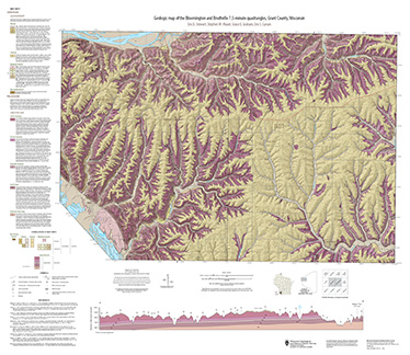
Geologic map of the Bloomington and Brodtville 7.5-minute quadrangles, Grant County, Wisconsin
The geologic map of the Bloomington and Brodtville quadrangles includes 1:24,000 scale mapping of both surficial and bedrock geology. There is little structural folding or faulting in this portion of the Driftless Area. Thus, it is ideal for studying the hydrostratigraphic framework of the mapped units. The accompanying report presents stratigraphic...-
Geologic map of the Bloomington and Brodtville 7.5-minute quadrangles, Grant County, Wisconsin
2022
Map: 41 in x 35 in, scale 1:24,000
-
GIS data for the geologic map of the Bloomington and Brodtville 7.5-minute quadrangles, Grant County, Wisconsin [dataset 1]
2022
GIS Data: File geodatabase (.gdb file format)
-
-
Wisconsin Groundwater-Level Monitoring Network Improvements, 2018-2021
This report documents work completed as part of a grant from the U.S. Geological Survey’s National Groundwater Monitoring Network (NGWMN) program. It provides an overview of the Wisconsin Groundwater-Level Monitoring Network (WGLMN) and provides detailed description of well evaluation and repair activities, and drilling of new monitoring wells across the... -
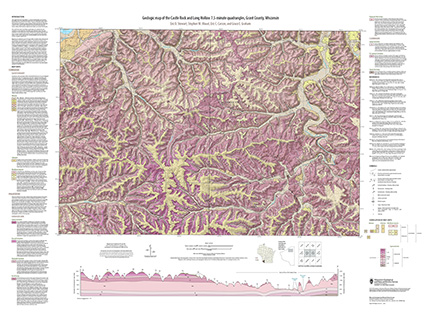
Geologic map of the Castle Rock and Long Hollow 7.5-minute quadrangles, Grant County, Wisconsin
The geologic map of the Castle Rock and Long Hollow quadrangles includes 1:24,000 scale mapping of both surficial and bedrock geology. The accompanying report presents new observations about bedrock folds and fracture sets in this portion of the Driftless Area that lies just north of the main Upper Mississippi Valley zinc-lead mineral district. The...-
Geologic map of the Castle Rock and Long Hollow 7.5-minute quadrangles, Grant County, Wisconsin (revised 2022)
2022
Map: 48 in x 36 in, scale 1:24,000
-
GIS data for the geologic map of the Castle Rock and Long Hollow 7.5-minute quadrangles, Grant County, Wisconsin [dataset 1]
2022
GIS Data: File geodatabase (.gdb file format)
-
-
Geochemistry and Mineralogy of the Wonewoc-Tunnel City Contact Interval Strata in Western Wisconsin
Results of regional study characterizing the elemental composition of rocks found at the Wonewoc-Tunnel City contact interval in west-central and southwest Wisconsin.-
Geochemistry and Mineralogy of the Wonewoc-Tunnel City Contact Interval Strata in Western Wisconsin [appendices]
2019
Data: Documents (.pdf file format), spreadsheets (.xlsx file format)
-
Field Trip: Cambrian and Ordovician Stratigraphy of Southwestern Wisconsin
Field trip route and notes looking at Cambrian and Middle Ordovician rocks of southwestern Wisconsin. -
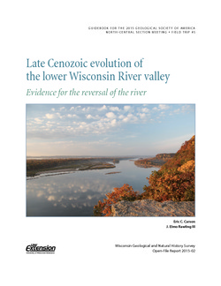
Late Cenozoic Evolution of the Lower Wisconsin River Valley: Evidence for the Reversal of the River
Field trip guidebook describes the evidence suggesting that the Wisconsin River once flowed from west to east. (Prepared for the 2015 Geological Society of America North-Central Section Meeting.) -
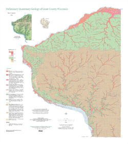
Preliminary Quaternary Geology of Grant County, Wisconsin
Open-file report; contains unpublished data that has not yet been peer-reviewed.-
Preliminary Quaternary Geology of Grant County, Wisconsin [GIS data]
2012
GIS Data: Shapefiles (.shp file format)
-
Aggregate Resources of the Sinnipee Group in Eastern and Southern Wisconsin
Open-file report; contains unpublished data that has not yet been peer-reviewed. -
Availability of Groundwater in Grant County, Wisconsin
Open-file report; contains unpublished data that has not yet been peer-reviewed. -
Discussion of the Phenomena of Local Glaciation in the Driftless Region
Open-file report; contains unpublished data that has not yet been peer-reviewed. -
Studies in the Driftless Region of Wisconsin
Open-file report; contains unpublished data that has not yet been peer-reviewed. -
Geology of Wisconsin - Outcrop Descriptions
These descriptions illustrate various geologic formations, features, and characteristics. Individual descriptions are one to ten pages long, and include a map with specific location, a description of geologic features, and a discussion of the geologic significance.-
Adams County: Upper Wisconsin Dells (T14N R6E Sec28)
Report: 3 p.
-
Adams County: Friendship Mound (T17N R6E Sec5)
Report: 2 p.
-
Adams County: Hamilton Mound (T20N R6E Sec36)
Report: 4 p.
-
Ashland County: Mt. Whittelsey (T44N R2W Sec9A)
Report: 3 p.
-
Ashland County: Mellen Gabbro (T45N R2W Sec30)
Report: 3 p.
-
Ashland County: Mellen Granite (T45N R2W Sec31)
Report: 3 p.
-
Ashland County: White River (T46N R4W Sec6)
Report: 2 p.
-
Bayfield County: South Fish Creek (T47N R5W Sec20)
Report: 2 p.
- 123 more...
-
-
A Subsurface Study of the St. Peter Sandstone in Southern and Eastern Wisconsin
-
Structure Contour Map of the Pre-St. Peter Sandstone Erosion Surface in Southern and Eastern Wisconsin [plate 1]
1985
Map: 39.7 in x 23.5 in, scale 1:750,000
-
Paleogeologic Map of the Pre-St. Peter Sandstone Surface in Southern and Eastern Wisconsin & Thickness Map of the St. Peter Sandstone in Southern and Eastern Wisconsin [plate 2]
1985
Map: 39.4 in x 23.6 in, scale 1:750,000

Publications Catalog
Wisconsin Geological and Natural History Survey