-
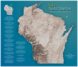
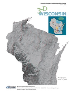
3-D Wisconsin
When viewed with 3-D glasses, Wisconsin’s land features pop off the page. Brief descriptions of major land forms paint the geologic history that shaped the state; expanded descriptions and photos are online. We’ve field-tested this map on fourth graders and can attest to its appeal. Sizes: 27.5 x 32 inches, 8.5 x 11 inches. Requires red-blue 3-D glasses. -
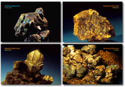
Minerals of Wisconsin Postcards (set of 4)
Set of 4 postcards featuring exquisite specimens of phenakite, galena, marcasite, and chalcocite. (To learn more about these and other minerals, visit our Minerals of Wisconsin database.) -
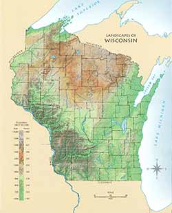
Landscapes of Wisconsin Postcard
Postcard showing Wisconsin in shaded relief. Also available as a poster and page-size map. -
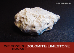
Wisconsin Rocks (set of 6 cards)
Trading cards profile five rocks (dolomite, granite, quartzite, shale, and sandstone) and one fossil (trilobite). Learn when and how the rocks formed, how the trilobite lived, plus a handful of interesting facts for each. -
Industrial Sand Potential in Wisconsin: Sandstone at or near the Surface
Shows where sandstone can be found within 100 ft (30 m) of the surface.-
Industrial Sand Potential in Wisconsin: Sandstone at or Near the Surface
2013
Map: 21 in x 22.5 in, scale 1:1,000,000
-
-
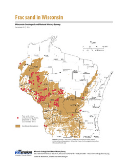
Frac Sand in Wisconsin
The state's golden sands have inspired Wisconsin's version of a gold rush. This 2-page fact sheet shows where sandstone formations occur in Wisconsin, where frac sand is being mined and processed, why our sand is so popular, and how it's being used. -
wiscLITH: A Digital Lithologic and Stratigraphic Database of Wisconsin Geology (Version 3)
Open-file report; contains unpublished data that has not yet been peer-reviewed. A collection of geologic records maintained by the WGNHS and available through a Microsoft Access database.-
wiscLITH: A Digital Lithologic and Stratigraphic Database of Wisconsin Geology, Version Three
2009
Database: Microsoft Access database (.mdb file format)
-
-
TillPro: A Database Containing Physical Properties of Unlithified Sediment Samples
Open-file report; contains unpublished data that has not yet been peer-reviewed.-
TillPro: A Database Containing Physical Properties of Unlithified Sediment Samples
2008
Database: Microsoft Access database (.mdb file format)
-
-
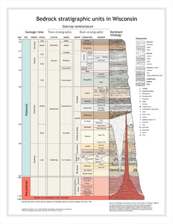
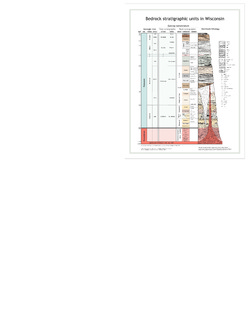
Bedrock Stratigraphic Units in Wisconsin
Large and small posters of our bedrock stratigraphy chart. (Also available as a page-size publication with a brief explanation on how to read the rock column.) -
Log of Field Trip for Western Dane County, Wisconsin
Open-file report; contains unpublished data that has not yet been peer-reviewed. -
Log of Field Trip for Boy Scout Leaders
Open-file report; contains unpublished data that has not yet been peer-reviewed. -
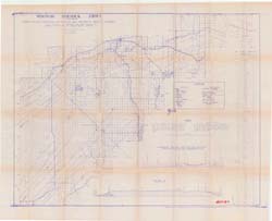
Copper Bearing Formations of Douglas and Northwest Bayfield Counties
Open-file report; contains unpublished data that has not yet been peer-reviewed.-
Copper Bearing Formations of Douglas and Northwest Bayfield Counties
1928
Map: 52.2 in x 42.4 in, scale 1 in = 1 mile
-
-
Geology of Wisconsin - Outcrop Descriptions
These descriptions illustrate various geologic formations, features, and characteristics. Individual descriptions are one to ten pages long, and include a map with specific location, a description of geologic features, and a discussion of the geologic significance.-
Adams County: Upper Wisconsin Dells (T14N R6E Sec28)
Report: 3 p.
-
Adams County: Friendship Mound (T17N R6E Sec5)
Report: 2 p.
-
Adams County: Hamilton Mound (T20N R6E Sec36)
Report: 4 p.
-
Ashland County: Mt. Whittelsey (T44N R2W Sec9A)
Report: 3 p.
-
Ashland County: Mellen Gabbro (T45N R2W Sec30)
Report: 3 p.
-
Ashland County: Mellen Granite (T45N R2W Sec31)
Report: 3 p.
-
Ashland County: White River (T46N R4W Sec6)
Report: 2 p.
-
Bayfield County: South Fish Creek (T47N R5W Sec20)
Report: 2 p.
- 123 more...
-
-
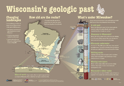
Wisconsin's Geologic Past
At different times in the past three billion years, mountains and volcanoes stood tall in Wisconsin, shallow seas covered much of the state, and glaciers plowed across the landscape. This educational poster vividly brings our past to life. Ideal for classrooms. Size: 27 x 39 inches. -
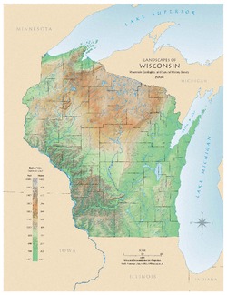
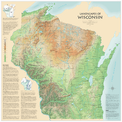
Landscapes of Wisconsin
Shows the elevation of Wisconsin through the use of color and shaded relief. Includes explanatory text about the geologic history of the state and more detailed information about 12 of the most prominent features. Poster map scale 1:500,000. Size: 42 x 42 inches.

Publications Catalog
Wisconsin Geological and Natural History Survey