-
Wisconsin Groundwater-Level Monitoring Network Improvements, 2020-2022
This report documents work completed as part of a grant from the U.S. Geological Survey's National Groundwater Monitoring Network (NGWMN) program. It provides an overview of the Wisconsin Groundwater-Level Monitoring Network (WGLMN) and provides detailed description of well evaluation and repair activities, and drilling of new monitoring wells across the... -
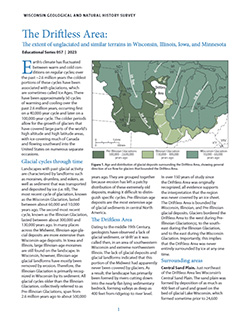
The Driftless Area: The extent of unglaciated and similar terrains in Wisconsin, Illinois, Iowa, and Minnesota
The Driftless Area of southwestern Wisconsin and northwestern Illinois got its name from the lack of glacial sediment ("drift") covering the landscape. The surficial geology and topography of the Driftless Area are thus distinct from the surrounding region where multiple phases of glaciation left their mark. This pamphlet, a collaborative effort between...-
GIS data for the outline of the Driftless Area and similar terrains in Wisconsin, Illinois, Iowa, and Minnesota
2023
GIS Data: Shapefiles (.shp file format)
-
Page-sized and web-version maps of the Driftless Area and similar terrains in Wisconsin, Illinois, Iowa, and Minnesota
2023
Map: Documents (.pdf file format), images (.tif file format)
-
Elevation contours of the Precambrian surface of south-central Wisconsin
Elevation contour data and an accompanying report provide an updated interpretation of the elevation of the top of Precambrian bedrock in south-central Wisconsin. The elevation surface was developed from geologic and geophysical data, and provides new detail on the entrenched bedrock valleys that were incised into the north and south ranges of the Baraboo...-
Elevation contours of the Precambrian surface of south-central Wisconsin [dataset 1]
2022
GIS Data: File geodatabase (.gdb file format)
-
-
Wisconsin Groundwater-Level Monitoring Network Improvements, 2018-2021
This report documents work completed as part of a grant from the U.S. Geological Survey’s National Groundwater Monitoring Network (NGWMN) program. It provides an overview of the Wisconsin Groundwater-Level Monitoring Network (WGLMN) and provides detailed description of well evaluation and repair activities, and drilling of new monitoring wells across the... -
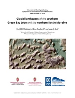
Glacial Landscapes of the Southern Green Bay Lobe and the Northern Kettle Moraine
Field trip guidebook from the International Glaciological Society Symposium on Glacial Erosion and Sedimentation, May 15, 2019. -
Geochemistry and Mineralogy of the Wonewoc-Tunnel City Contact Interval Strata in Western Wisconsin
Results of regional study characterizing the elemental composition of rocks found at the Wonewoc-Tunnel City contact interval in west-central and southwest Wisconsin.-
Geochemistry and Mineralogy of the Wonewoc-Tunnel City Contact Interval Strata in Western Wisconsin [appendices]
2019
Data: Documents (.pdf file format), spreadsheets (.xlsx file format)
-
Field Trip: Cambrian and Ordovician Stratigraphy of Southwestern Wisconsin
Field trip route and notes looking at Cambrian and Middle Ordovician rocks of southwestern Wisconsin. -
Wisconsin Groundwater-Level Monitoring Network Improvement
The Wisconsin Groundwater-Level Monitoring Network consists of 93 wells and 2 spring gaging stations. This report documents work performed on seven of the wells between August 1, 2016 and July 31, 2017, and appendices provide historical reference documents. -
Elemental Chemostratigraphy of the Cottage Grove Hole MP-18 Core: Implications for Litho- and Hydrostratigraphy in Southcentral Wisconsin
Part of a larger regional study of the Eau Claire Formation, the core, from Dane County, Wisconsin, was tested using a portable x-ray fluorescence (pXRF) elemental analyzer. The report presents the data set and discusses lithologic interpretations, subsurface lithostratigraphic correlations, and hydrostratigraphic frameworks. Includes photos of the core.-
Elemental Chemostratigraphy of the Cottage Grove Hole MP-18 Core: Implications for Litho- and Hydrostratigraphy in Southcentral Wisconsin [appendices]
2017
Data: Spreadsheets (.xlsx file format)
-
Portable X-Ray Fluorescence (pXRF) Measurements of Uranium and Thorium in Madison, Wisconsin, Water Utility Wells 4 and 27
Concentrations of radium at or above the health standard in a Madison municipal well prompted the water utility to request assistance from the Wisconsin Geological and Natural History Survey to better understand the source of the radium. This report documents a series of analyses performed on the elemental composition of rock samples from the affected... -
The 2016 Groundwater Flow Model for Dane County, Wisconsin
The 2016 groundwater flow model is a three-dimensional model using state-of-the-art representation of the hydrogeology of Dane County. This report describes the model, appendices provide data, and the user's manual provides basic instructions and recommendations for running the model.-
The 2016 Groundwater Flow Model for Dane County, Wisconsin [appendices]
2016
Data: Spreadsheets (.xlsx file format)
-
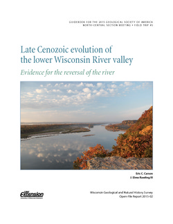
Late Cenozoic Evolution of the Lower Wisconsin River Valley: Evidence for the Reversal of the River
Field trip guidebook describes the evidence suggesting that the Wisconsin River once flowed from west to east. (Prepared for the 2015 Geological Society of America North-Central Section Meeting.) -
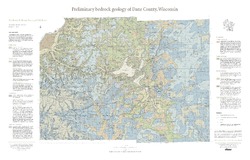
Preliminary Bedrock Geology of Dane County, Wisconsin
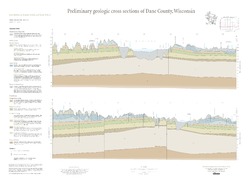
This map, produced at a scale of 1:100,000, reveals the intricate layers of bedrock below Dane County. Available as a map (plate 1), cross sections (plate 2), and GIS data. Open-file report; contains unpublished data that has not yet been peer-reviewed.-
Preliminary Bedrock Geology of Dane County, Wisconsin [plate 1]
2013
Map: 39 in x 25 in, scale 1:100,000
-
Preliminary Bedrock Geology of Dane County, Wisconsin [GIS data]
2013
GIS Data: Documents (.pdf file format), shapefiles (.shp file format)
-
-
Sources of naturally occurring chromium in bedrock aquifers underlying Madison, Wisconsin
Open-file report; contains unpublished data that has not yet been peer-reviewed.-
Sources of Naturally Occurring Chromium in Bedrock Aquifers Underlying Madison, Wisconsin [appendices]
2012
Data: Spreadsheets (.xlsx and .txt file formats)
-
Distributed Temperature Sensing (DTS) as a Hydrostratigraphic Characterization Tool
Open-file report; contains unpublished data that has not yet been peer-reviewed. -
Human Viruses as Tracers of Wastewater Pathways into Deep Municipal Wells
Open-file report; contains unpublished data that has not yet been peer-reviewed. -
Assessment of Virus Presence and Potential Virus Pathways in Deep Municipal Wells
Open-file report; contains unpublished data that has not yet been peer-reviewed. -
A Local Meteoric Water Line for Madison, Wisconsin
Open-file report; contains unpublished data that has not yet been peer-reviewed. -
Aggregate Resources of the Sinnipee Group in Eastern and Southern Wisconsin
Open-file report; contains unpublished data that has not yet been peer-reviewed. -
Hydrogeology of Dane County, Wisconsin
Open-file report; contains unpublished data that has not yet been peer-reviewed.-
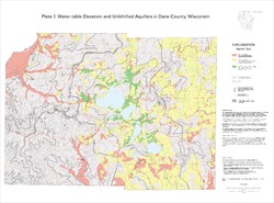
Water-Table Elevation and Unlithified Aquifers in Dane County, Wisconsin [plate 1]
1999
Map: 34.5 in x 25.5 in, scale 1:100,000
-
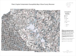
Aquifer Contamination Susceptibility Map of Dane County, Wisconsin [plate 2]
1999
Map: 34.5 in x 25.5 in, scale 1:100,000
Publications Catalog
Wisconsin Geological and Natural History Survey

