-
Depth to Silurian Bedrock in Eastern Wisconsin
Silurian-aged bedrock in eastern Wisconsin is shallow, fractured, and contains groundwater that is susceptible to surface water contamination. Revisions to Wisconsin state rules ATCP50 and NR151 to regulate manure spreading over this Silurian-aged bedrock create the need for a depth-to-bedrock map of eastern WI. The Wisconsin Geological and Natural...-
Depth to Silurian Bedrock in Eastern Wisconsin [dataset 1]
2025
GIS Data: File geodatabase (.gdb file format)
-
-
Wisconsin Groundwater-Level Monitoring Network Improvements, 2020-2022
This report documents work completed as part of a grant from the U.S. Geological Survey's National Groundwater Monitoring Network (NGWMN) program. It provides an overview of the Wisconsin Groundwater-Level Monitoring Network (WGLMN) and provides detailed description of well evaluation and repair activities, and drilling of new monitoring wells across the... -
Elevation contours of the Precambrian surface of south-central Wisconsin
Elevation contour data and an accompanying report provide an updated interpretation of the elevation of the top of Precambrian bedrock in south-central Wisconsin. The elevation surface was developed from geologic and geophysical data, and provides new detail on the entrenched bedrock valleys that were incised into the north and south ranges of the Baraboo...-
Elevation contours of the Precambrian surface of south-central Wisconsin [dataset 1]
2022
GIS Data: File geodatabase (.gdb file format)
-
-
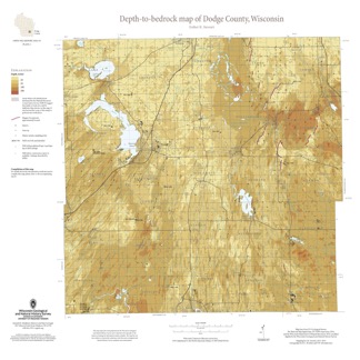
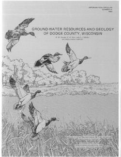
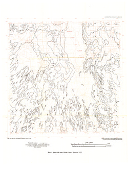
Depth-to-Bedrock Map of Dodge County, Wisconsin
This map shows thicknesses of deposits of unconsolidated materials above the bedrock. Across the county, depth to bedrock ranges from 0 feet, where bedrock is exposed, to over 250 feet within bedrock valleys. Areas with bedrock depths shallower than 20 feet are of particular importance for land-use planning and to the construction stone industry. Such... -
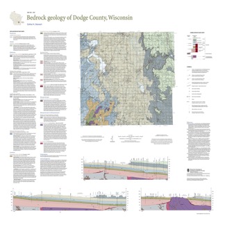
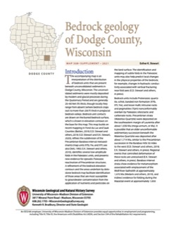
Bedrock Geology of Dodge County, Wisconsin
Dodge County lies in southeast Wisconsin, an area almost entirely covered by glacial deposits. This map interprets the distribution of the buried bedrock units across the county. Geologist Esther Stewart’s refinement of the bedrock elevation contours may help land-use planners identify areas most susceptible to groundwater contamination from applications...-
Supporting Data for the Bedrock Geology of Dodge County, Wisconsin
2021
Data: Spreadsheets (.xlsx file format)
-
GIS Data for the Bedrock Geology of Dodge County, Wisconsin [dataset 2]
2021
GIS Data: GeMS Level 3 file geodatabase (.gdb file format), shapefiles (.shp file format), GeoPackage (.gpkg file format)
-
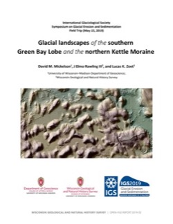
Glacial Landscapes of the Southern Green Bay Lobe and the Northern Kettle Moraine
Field trip guidebook from the International Glaciological Society Symposium on Glacial Erosion and Sedimentation, May 15, 2019. -
Mechanisms of Groundwater Flow Across the Maquoketa Formation
Open-file report; contains unpublished data that has not yet been peer-reviewed. -
Aggregate Resources of the Sinnipee Group in Eastern and Southern Wisconsin
Open-file report; contains unpublished data that has not yet been peer-reviewed. -
Stratigraphic Controls on Distribution of Hydraulic Conductivity in Carbonate Aquifers
Open-file report; contains unpublished data that has not yet been peer-reviewed. -
Merging Pleistocene Lithostratigraphy with Geotechnical and Hydrogeologic Data--Examples from Eastern Wisconsin
Open-file report; contains unpublished data that has not yet been peer-reviewed. -
Geology of Wisconsin - Outcrop Descriptions
These descriptions illustrate various geologic formations, features, and characteristics. Individual descriptions are one to ten pages long, and include a map with specific location, a description of geologic features, and a discussion of the geologic significance.-
Adams County: Upper Wisconsin Dells (T14N R6E Sec28)
Report: 3 p.
-
Adams County: Friendship Mound (T17N R6E Sec5)
Report: 2 p.
-
Adams County: Hamilton Mound (T20N R6E Sec36)
Report: 4 p.
-
Ashland County: Mt. Whittelsey (T44N R2W Sec9A)
Report: 3 p.
-
Ashland County: Mellen Gabbro (T45N R2W Sec30)
Report: 3 p.
-
Ashland County: Mellen Granite (T45N R2W Sec31)
Report: 3 p.
-
Ashland County: White River (T46N R4W Sec6)
Report: 2 p.
-
Bayfield County: South Fish Creek (T47N R5W Sec20)
Report: 2 p.
- 123 more...
-
-
A Subsurface Study of the St. Peter Sandstone in Southern and Eastern Wisconsin
-
Structure Contour Map of the Pre-St. Peter Sandstone Erosion Surface in Southern and Eastern Wisconsin [plate 1]
1985
Map: 39.7 in x 23.5 in, scale 1:750,000
-
Paleogeologic Map of the Pre-St. Peter Sandstone Surface in Southern and Eastern Wisconsin & Thickness Map of the St. Peter Sandstone in Southern and Eastern Wisconsin [plate 2]
1985
Map: 39.4 in x 23.6 in, scale 1:750,000
-
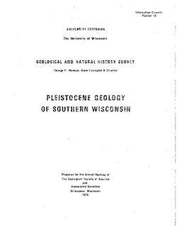
Pleistocene Geology of Southern Wisconsin
Field trip guide with special papers by R.F. Black, N.K. Bleuer, F.D. Hole, N.P. Lasca, and L.J. Maher, Jr., 1970, 175 p. -
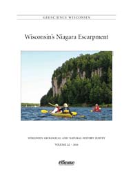
Geoscience Wisconsin Volume 22
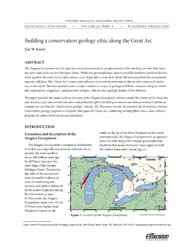
This special edition of Geoscience Wisconsin provides an overview of the Niagara Escarpment in Wisconsin. The papers cover the geology, processes that shaped the escarpment, biota, bats, caves and karst, and the concept of conservation geology.-
Geoscience Wisconsin, Volume 22: Wisconsin's Niagara Escarpment
2016
Journal: 86 p. (introduction, 6 articles)
-
-
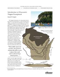
Geoscience Wisconsin Volume 17
-
Paleoecology and Sedimentology of the Prasopora Zonule in the Dunleith Formation (Ordovician), Upper Mississippi Valley
2007
Journal Article: p. 11-20
-
Trace-Element Signatures and Tectonic Affinities of Proterozoic A-Type Granites and Rhyolites in Central Wisconsin
2007
Journal Article: p. 35-51
-
Coupled Modeling of Gravity and Aeromagnetic Data to Estimate Subsurface Basement Topography in Southeastern Wisconsin
2007
Journal Article: p. 53-64
-
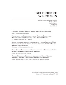
Geoscience Wisconsin Volume 14
Ordovician-Silurian boundary of the Neda Formation-
Ferruginous and Calcareous Oolites at the Ordovician-Silurian Boundary in Illinois
1991
Journal Article: p. 1-21
-
Paleomagnetic Studies of Rock at the Ordovician-Silurian Boundary in Wisconsin
1991
Journal Article: p. 53-63
-
Distribution and Age of Dolomitic and Hematitic Oolites near the Ordovician-Silurian Boundary in Nebraska and Kansas
1991
Journal Article: p. 65-72
-
Geoscience Wisconsin Volume 07
Late Pleistocene History of Southeastern Wisconsin-
Geoscience Wisconsin, Volume 7: Late Pleistocene History of Southeastern Wisconsin
1983
Journal: 111 p.
-
The Wadsworth Till Member of Illinois and the Equivalent Oak Creek Formation of Wisconsin
1983
Journal Article: p. 1-16
-
Quaternary Stratigraphy of the Lower Milwaukee and Menomonee River Valleys, Milwaukee, Wisconsin
1983
Journal Article: p. 24-42
-
The Effect of Lake-Level Fluctuations on the Geomorphic Evolution of the Lake Michigan Bluffs in Wisconsin
1983
Journal Article: p. 43-58
-
Wisconsinan Stratigraphy and Glacial Sequence in Southeastern Wisconsin
1983
Journal Article: p. 59-85
-
Fabric and Depositional Structures in Drumlins near Waukesha, Wisconsin
1983
Journal Article: p. 98-111
-
-
Geoscience Wisconsin Volume 06
-
A Summary of the Duval Massive Sulfide Deposit, Marinette County, Wisconsin
1982
Journal Article: p. 11-20
-
Some Aspects of the Petrologic and Tectonic History of the Precambrian Rocks of Waterloo, Wisconsin
1982
Journal Article: p. 21-40

Publications Catalog
Wisconsin Geological and Natural History Survey