-
Hydrogeologic Atlas of Burnett County, Wisconsin
This hydrogeologic atlas offers a comprehensive interpretation and analysis of groundwater resources across Burnett County, Wisconsin. It encompasses assessments of the water-table elevation and groundwater flow directions, depth to the water table, depth to bedrock, distribution of groundwater recharge, relative vulnerability of groundwater to...-
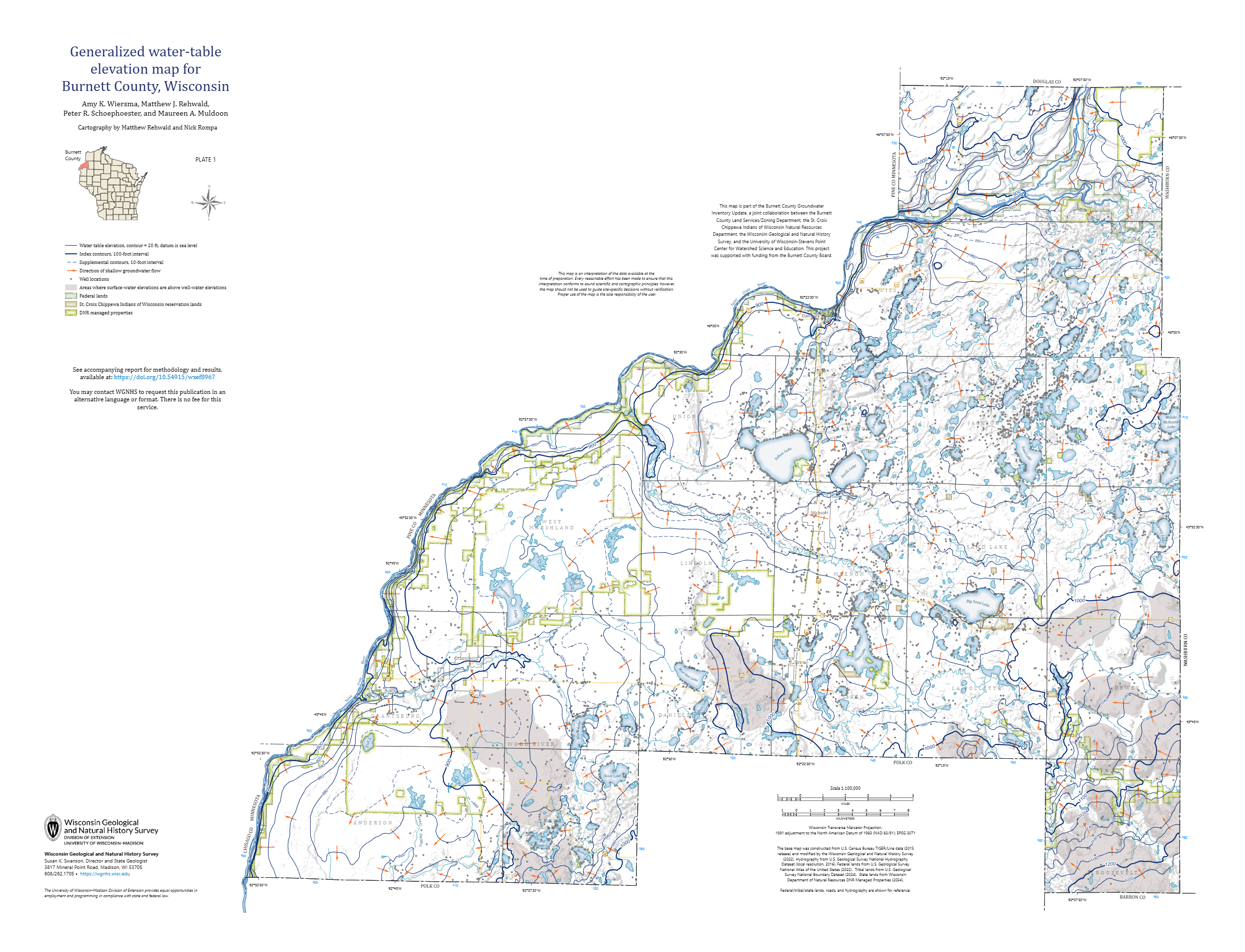
Generalized Water-Table Elevation Map for Burnett County, Wisconsin [plate 1]
2026
Map: 35 in x 26.75 in, scale 1:100,000
-
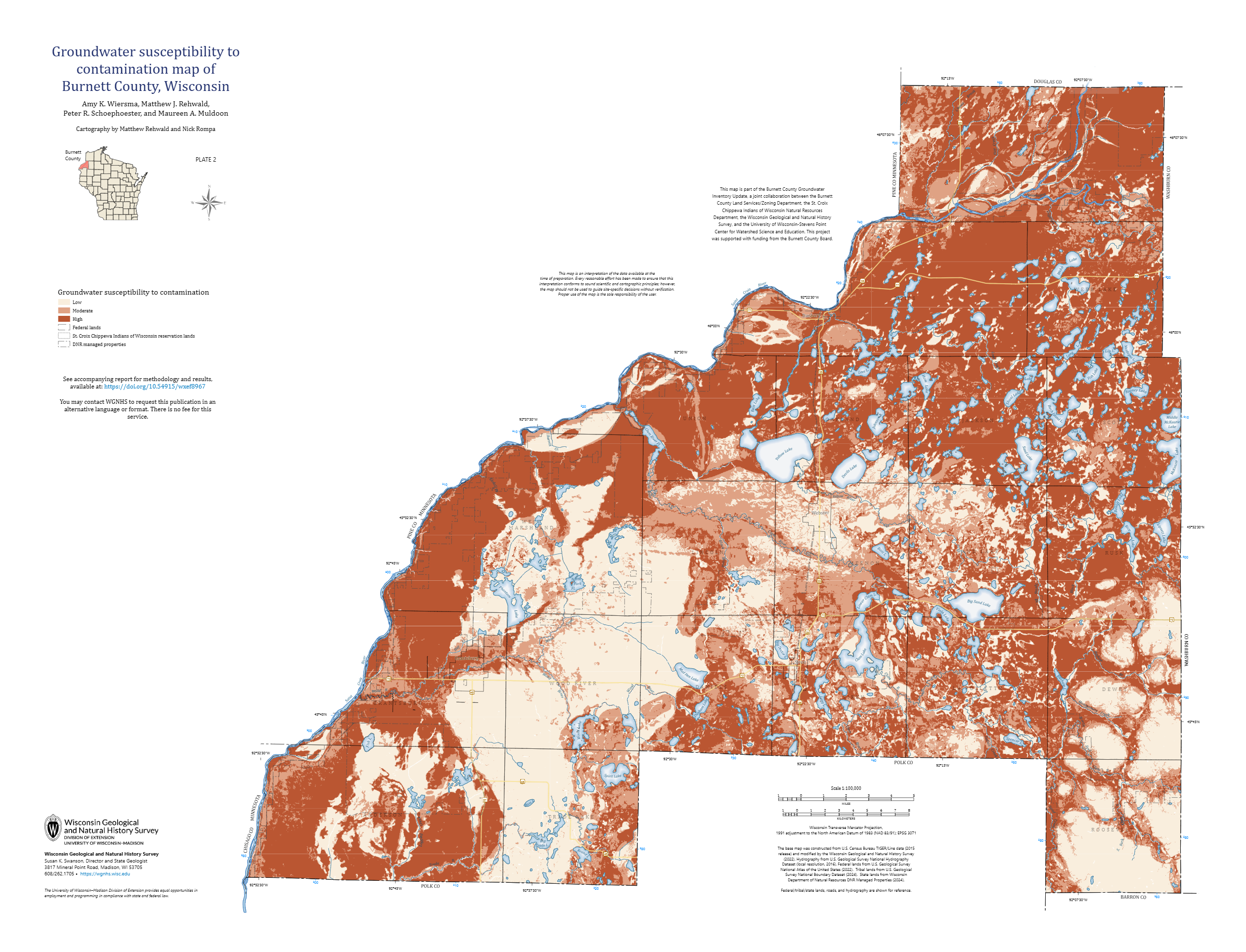
Groundwater Susceptibility to Contamination Map of Burnett County, Wisconsin [plate 2]
2026
Map: 35 in x 26.75 in, scale 1:100,000
-
GIS Data for Hydrogeologic Atlas of Burnett County, Wisconsin [dataset 1]
2026
GIS Data: File geodatabase (.gdb file format)
-
A Groundwater-Flow Model and Effective Nitrate Calculator for Waupaca, Wisconsin
The City of Waupaca, Wisconsin, uses groundwater pumped from a network of seven high-capacity wells as its municipal water supply. Recent increases in the concentration of nitrate in the municipal water supply raised questions about the source of this contamination and whether it might eventually exceed standards for drinking water. This study combines...-
Geodatabase of Study Data from Waupaca, Wisconsin [dataset 1]
2022
GIS Data: File geodatabase (.gdb file format)
-
Groundwater Flow Modeling Files from Waupaca, Wisconsin [dataset 2]
2022
Data: Groundwater flow model (.gfl file format)
-
Nitrate Calculators for Municipal Wells in Waupaca, Wisconsin [dataset 3]
2022
Data: Spreadsheets (.xlsx file format)
-
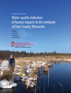
Water-Quality Indicators of Human Impacts to the Wetlands of Door County, Wisconsin
Door County, the narrow peninsula in eastern Wisconsin, is home to numerous wetlands, many of which are fed by groundwater. Poor-quality groundwater discharging to a wetland can alter the ecology of the wetland and harm native plant and animal communities. This report documents a one-year study of six wetlands. Researchers recorded water quality and... -
Hydrogeologic Atlas of Bayfield County, Wisconsin
Analysis of the groundwater resources in Bayfield County, Wisconsin. Includes report, five plates, and digital data.-
Hydrogeologic Atlas of Bayfield County, Wisconsin [appendices]
2019
Data: Documents (.pdf file format)
-
Hydrogeologic Atlas of Bayfield County, Wisconsin [GIS data]
2019
GIS Data: File geodatabase (.gdb file format)
-
Generalized Water-Table Elevation Map of Bayfield County, Wisconsin [plate 1]
2019
Plate: 29.5 in x 39.5 in, scale 1:100,000
-
Depth to Water Table Map of Bayfield County, Wisconsin [plate 2]
2019
Plate: 29.5 in x 39.5 in, scale 1:100,000
-
Depth to Bedrock Map of Bayfield County, Wisconsin [plate 3]
2019
Plate: 29.5 in x 39.5 in, scale 1:100,000
-
Groundwater Recharge Map of Bayfield County, Wisconsin [plate 4]
2019
Plate: 29.5 in x 39.5 in, scale 1:100,000
-
Groundwater Susceptibility Map of Bayfield County, Wisconsin [plate 5]
2019
Plate: 29.5 in x 39.5 in, scale 1:100,000
-
Characterization of Groundwater Resources in the Chequamegon-Nicolet National Forest, Wisconsin
Results of a comprehensive review and analysis of groundwater resources in the Chequamegon-Nicolet National Forest. The study was divided by location into four reports corresponding to the four main land units: Medford, Nicolet, Park Falls, and Washburn/Great Divide. Each report describes the results of the inventory, modeling, and analysis.-
Characterization of Groundwater Resources in the Chequamegon-Nicolet National Forest, Wisconsin: Medford Unit [GIS data]
2018
GIS Data: File geodatabase (.gdb file format)
-
Characterization of Groundwater Resources in the Chequamegon-Nicolet National Forest, Wisconsin: Medford Unit [plates]
2018
Map: 10 maps, 11 in x 17 in
-
Characterization of Groundwater Resources in the Chequamegon-Nicolet National Forest, Wisconsin: Nicolet Unit [GIS data]
2018
GIS Data: File geodatabase (.gdb file format)
-
Characterization of Groundwater Resources in the Chequamegon-Nicolet National Forest, Wisconsin: Nicolet Unit [plates]
2018
Map: 20 maps (10 each, northern and southern Nicolet Unit), 11 in x 17 in
-
Characterization of Groundwater Resources in the Chequamegon-Nicolet National Forest, Wisconsin: Park Falls Unit [GIS data]
2018
GIS Data: File geodatabase (.gdb file format)
-
Characterization of Groundwater Resources in the Chequamegon-Nicolet National Forest, Wisconsin: Park Falls Unit [plates]
2018
Map: 10 maps, 11 in x 17 in
- 2 more...
-
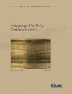
Hydrogeology of Fort McCoy Geothermal Test Well 5
Test hole drilled to 1,000 feet on Fort McCoy property provides data for understanding the geothermal gradient in Wisconsin and the hydrogeologic conditions found at Fort McCoy.-
Hydrogeology of Fort McCoy Geothermal Test Well 5 [appendices]
2016
Data: Documents (.pdf file format), spreadsheets (.xlsx file format)
-
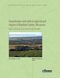
Groundwater and Wells in Agricultural Regions of Bayfield County, Wisconsin: Report to the Large-Scale Livestock Study Committee
Information and recommendations concerning groundwater and water supply wells in two agricultural regions in Bayfield County, Wisconsin. Includes a report, a water-table map, a set of four cross sections, and GIS data. (Replaces WOFR2015-02.)-
Groundwater and Wells in Agricultural Regions of Bayfield County, Wisconsin [GIS data]
2016
GIS Data: Shapefiles (.shp file format)
-
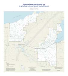
Generalized Water-Table Elevation Map in Agricultural Regions of Bayfield County, Wisconsin [plate 1]
2016
Map: 27 in x 30 in, scale 1:100,000
-
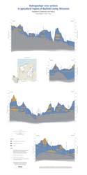
Hydrogeologic Cross Sections in Agricultural Regions of Bayfield County, Wisconsin [plate 2]
2016
Plate: 20 in x 40 in, scale 1:100,000
-
Lexicon of Pleistocene Stratigraphic Units of Wisconsin
This 180-page book marks the first update in over 20 years to the collection of formal definitions of Wisconsin's Pleistocene units. Contains over 100 color maps, photographs, and figures as well as an extensive list of references.

Publications Catalog
Wisconsin Geological and Natural History Survey