
Hydrogeologic Atlas of Burnett County, Wisconsin
Data and Resources
-
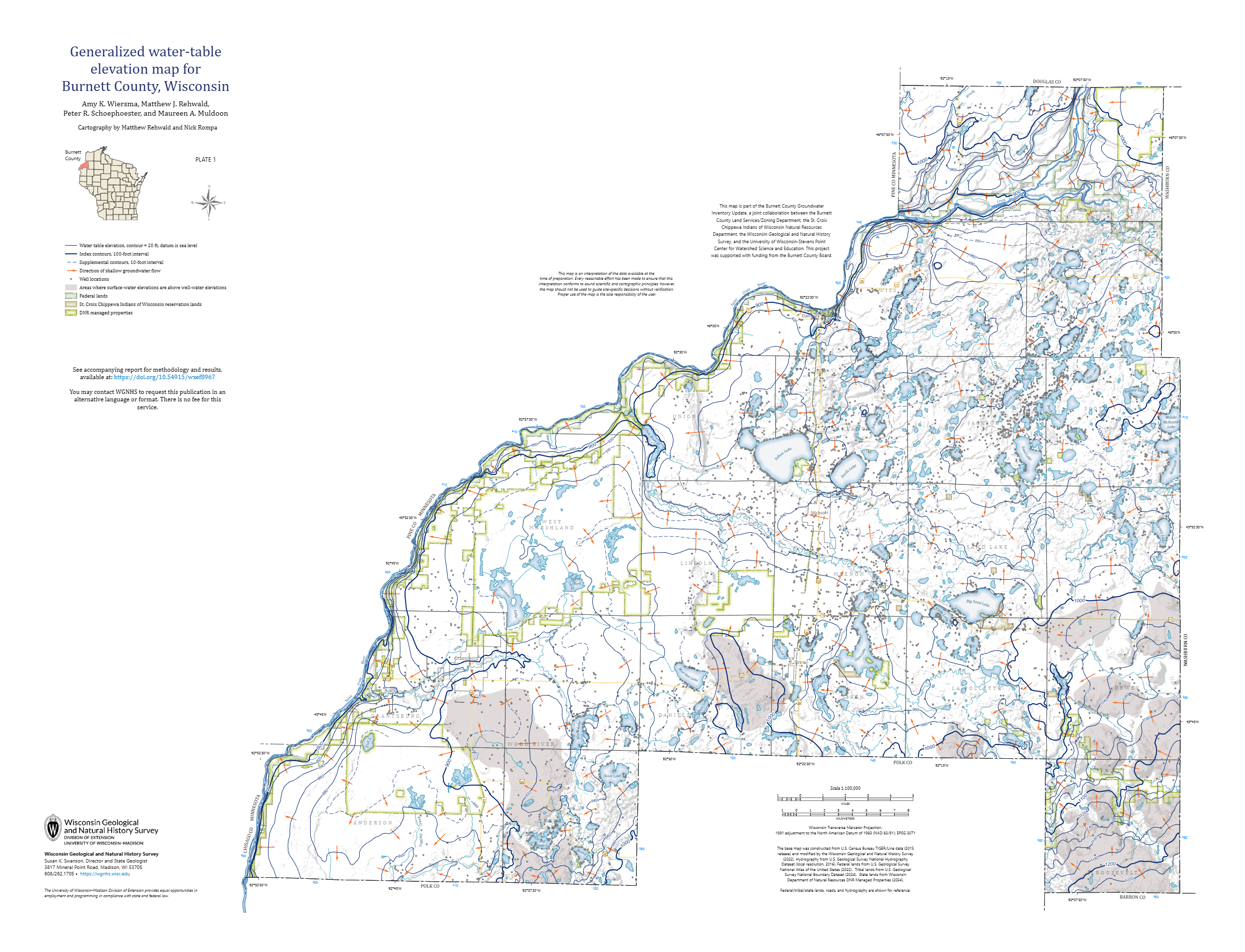
Generalized Water-Table Elevation Map for Burnett County, Wisconsin [plate 1]
2026
Map: 35 in x 26.75 in, scale 1:100,000
-
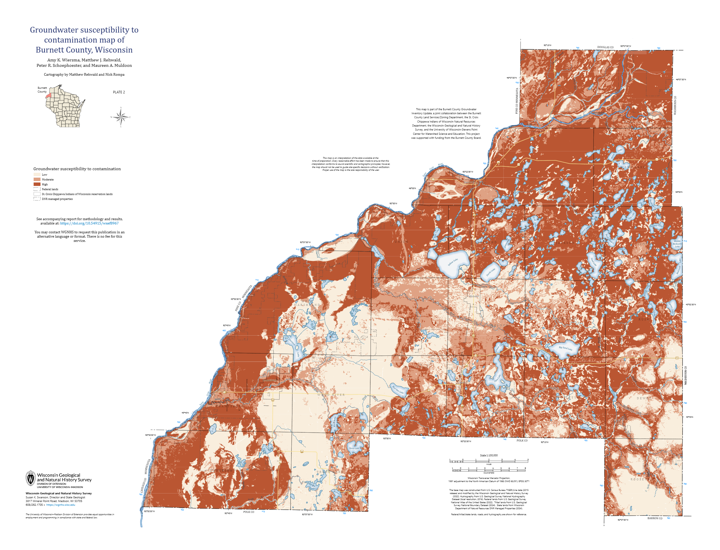
Groundwater Susceptibility to Contamination Map of Burnett County, Wisconsin [plate 2]
2026
Map: 35 in x 26.75 in, scale 1:100,000
-
GIS Data for Hydrogeologic Atlas of Burnett County, Wisconsin [dataset 1]
2026
GIS Data: File geodatabase (.gdb file format)
Related Collections
-

New Publications
View New Publications -
Technical Report
View Technical Report