-
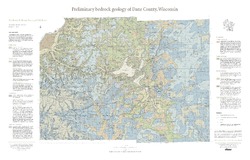
Preliminary Bedrock Geology of Dane County, Wisconsin
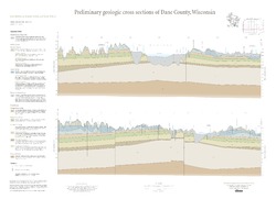
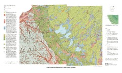
This map, produced at a scale of 1:100,000, reveals the intricate layers of bedrock below Dane County. Available as a map (plate 1), cross sections (plate 2), and GIS data. Open-file report; contains unpublished data that has not yet been peer-reviewed.-
Preliminary Bedrock Geology of Dane County, Wisconsin [plate 1]
2013
Map: 39 in x 25 in, scale 1:100,000
-
Preliminary Bedrock Geology of Dane County, Wisconsin [GIS data]
2013
GIS Data: Documents (.pdf file format), shapefiles (.shp file format)
-
-
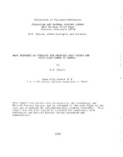
Maps Prepared as Overlays for Proposed Golf Course and Facilities North of Verona
Open-file report; contains unpublished data that has not yet been peer-reviewed. See WOFR1974-03 for companion report.-
Maps Prepared as Overlays for Proposed Golf Course and Facilities North of Verona
1975
Plate: 1 p. + 23 plates (1:24,000 scale)
-
-
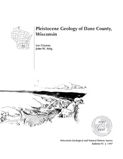
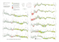
Pleistocene Geology of Dane County, Wisconsin
Description of the geologic history of Dane County. The preface points out the significance of glacial landscape research at WGNHS over the past century. Many pictures and diagrams and a four-color map and cross sections show the striking differences between glaciated and unglaciated regions of the county. Map and cross sections are folded.-
Pleistocene Geology of Dane County, Wisconsin (version 2) [GIS data]
1997
GIS Data: GeMS file geodatabase (.gdb file format)
-
Pleistocene Geologic Map of Dane County, Wisconsin [plate 1]
1997
Map: 39 in x 23.5 in, scale 1:100,000

Publications Catalog
Wisconsin Geological and Natural History Survey