-
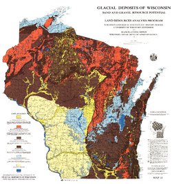
Glacial Deposits of Wisconsin: Sand and Gravel Resource Potential
Color map showing outwash, ground moraine, end moraine, and glacial deposits.-
Glacial Deposits of Wisconsin: Sand and Gravel Resource Potential
1976
Map: 45 in x 43.25 in, scale 1:500,000
-
-
Ground-Water Resources and Geology of Walworth County, Wisconsin
-
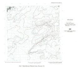
Water-Table Map of Walworth County, Wisconsin, 1973 [plate 1]
1976
Map: 18 in x 15.9 in, scale 1:125,000
-
Ground-Water Resources and Geology of Jefferson County, Wisconsin
-
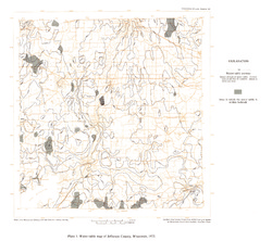
Water-Table Map of Jefferson County, Wisconsin, 1973 [plate 1]
1976
Map: 18 in x 16 in, scale 1 in = 2 miles
-
Ground-Water Resources and Geology of St. Croix County, Wisconsin
-
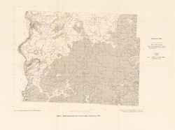
Water-Table Map of St. Croix County, Wisconsin, 1974 [plate 1]
1976
Map: 23.6 in x 17.5 in, scale 1:125,000
-
Soils of Wisconsin
A comprehensive summary of the soil resources of the state. Includes definitions of terms and concepts relating to the processes of soil formation, soil properties, soil classification, and descriptions of major soil regions and of the specific kinds of soils that characterize them.

Publications Catalog
Wisconsin Geological and Natural History Survey