-
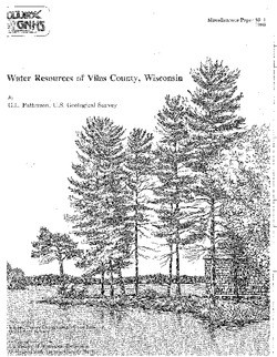
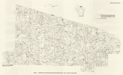
Water Resources of Vilas County, Wisconsin
-
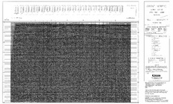
Altitude and Configuration of the Water Table, Vilas County, Wisconsin [plate 1]
1989
Map: 35.5 in x 21.8 in, scale 1:100,000
-
Lower Proterozoic Volcanic Rocks and Their Setting in the Southern Lake Superior District
Reprinted from Geological Society of America Memoir 160. -
Irrigable Lands Inventory--Phase I Groundwater and Related Information
This paper contains hydrogeologic information for the Golden Sands Resource Conservation and Development Area in central Wisconsin. The set of maps includes water-table elevation maps for the following counties: Adams, Jackson, Juneau, Marathon, Marquette, Monroe, Portage, Waupaca, Waushara, and Wood (scale 1:126,720). It also includes a regional aquifer...-
Irrigable Lands Inventory - Phase I Groundwater and Related Information
1981
Report: 13 p., 11 maps, scale 1:126,720 and 1:500,000
- 2 more...
-

Publications Catalog
Wisconsin Geological and Natural History Survey