-
The 2016 Groundwater Flow Model for Dane County, Wisconsin
The 2016 groundwater flow model is a three-dimensional model using state-of-the-art representation of the hydrogeology of Dane County. This report describes the model, appendices provide data, and the user's manual provides basic instructions and recommendations for running the model.-
The 2016 Groundwater Flow Model for Dane County, Wisconsin [appendices]
2016
Data: Spreadsheets (.xlsx file format)
-
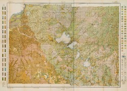
Groundwater Recharge in Dane County, Wisconsin: Estimating Recharge Using a GIS-Based Water-Balance Model
Hydrogeologists at the Survey developed a groundwater management tool to help guide land-use decisions in Dane County. The publication describes the inputs used to calculate recharge and includes a reduced-scale version of the recharge map. A full-scale version of the recharge data has been subsequently added as Dataset 1.-
GIS Data for Groundwater Recharge in Dane County, Wisconsin [dataset 1]
2012
GIS Data: File geodatabase (.gdb file format)
-
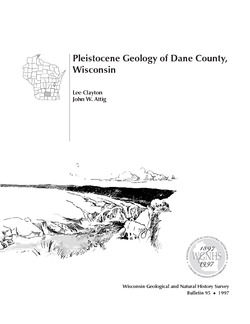
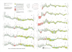
Pleistocene Geology of Dane County, Wisconsin
Description of the geologic history of Dane County. The preface points out the significance of glacial landscape research at WGNHS over the past century. Many pictures and diagrams and a four-color map and cross sections show the striking differences between glaciated and unglaciated regions of the county. Map and cross sections are folded.-
Pleistocene Geology of Dane County, Wisconsin (version 2) [GIS data]
1997
GIS Data: GeMS file geodatabase (.gdb file format)
-
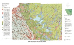
Pleistocene Geologic Map of Dane County, Wisconsin [plate 1]
1997
Map: 39 in x 23.5 in, scale 1:100,000
-
On the Lakes of Southeastern Wisconsin
-
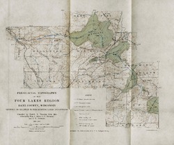
Pre-Glacial Topography of the Four Lakes Region, Dane County, Wisconsin: Showing Its Relation to the Existing Lakes and Streams [plate 37]
1910
Map: 11.6 in x 9.7 in, scale 1 in = 2 miles

Publications Catalog
Wisconsin Geological and Natural History Survey