-
Pleistocene Geology of Wood County, Wisconsin
-
Pleistocene Geology of Wood County, Wisconsin [GIS data]
1991
GIS Data: Shapefiles (.shp file format), MrSID files (.sid file format)
-
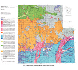
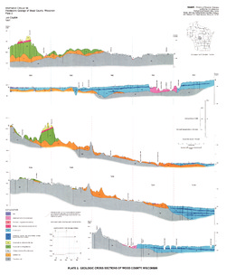
Map Showing the Pleistocene Geology of Wood County, Wisconsin [plate 1]
1991
Map: 25.5 in x 23 in, scale 1:100,000
-
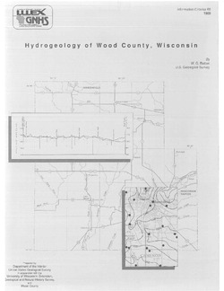
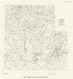
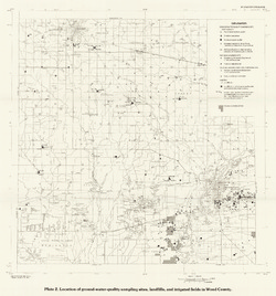
Hydrogeology of Wood County, Wisconsin
-
Location of Ground-Water-Quality Sampling Sites, Landfills, and Irrigated Fields in Wood County [plate 2]
1989
Map: 21.6 in x 23.1 in, scale 1:100,000
-
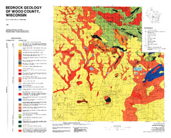
Bedrock Geology of Wood County, Wisconsin
-
Bedrock Geology of Wood County, Wisconsin [GIS data]
1986
GIS Data: Shapefiles (.shp file format), MrSID files (.sid file format)
-
-
Effects of Irrigation on Water Quality in the Sand Plain of Central Wisconsin
-
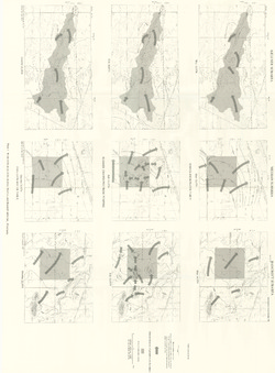
Water-Table Maps of the Kellner, Meehan, and Bancroft Subareas, Wisconsin [plate 1]
1978
Map: 32.5 in x 24 in, scale 1:24,000

Publications Catalog
Wisconsin Geological and Natural History Survey