-
Chemical Analyses of Wisconsin Clays and Shales from Publications and Files of the Wisconsin Geological and Natural History Survey
Open-file report; contains unpublished data that has not yet been peer-reviewed. -
Annotated Bibliography of Geological, Hydrologic, Soils, and Climatologic Information for Wisconsin's Great Lakes Coastal Zone Counties
Open-file report; contains unpublished data that has not yet been peer-reviewed. -
Maps Prepared as Overlays for Proposed Golf Course and Facilities North of Verona
Open-file report; contains unpublished data that has not yet been peer-reviewed. See WOFR1974-03 for companion report.-
Maps Prepared as Overlays for Proposed Golf Course and Facilities North of Verona
1975
Plate: 1 p. + 23 plates (1:24,000 scale)
-
-
Stability of Rock Masses on East Side of Rocky Gorge, Manitou Falls Area, Pattison State Park
Open-file report; contains unpublished data that has not yet been peer-reviewed. -
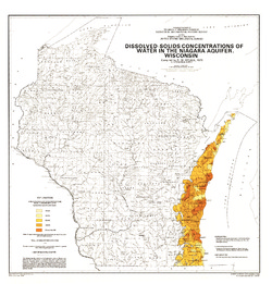
Dissolved-Solids Concentrations of Water in the Niagara Aquifer, Wisconsin
-
Dissolved-Solids Concentrations of Water in the Niagara Aquifer, Wisconsin
1975
Map: 23 in x 24 in, scale 1:1,000,000
-
-
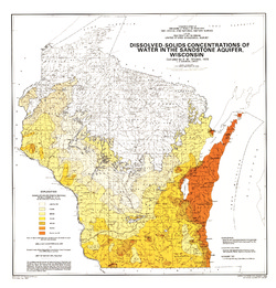
Dissolved-Solids Concentrations of Water in the Sandstone Aquifer, Wisconsin
-
Dissolved-Solids Concentrations of Water in the Sandstone Aquifer, Wisconsin
1975
Map: 23 in x 24 in, scale 1:1,000,000
-
-
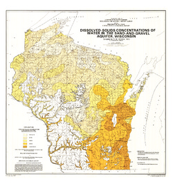
Dissolved-Solids Concentrations of Water in the Sand-and-Gravel Aquifer, Wisconsin
-
Dissolved-Solids Concentrations of Water in the Sand-and-Gravel Aquifer, Wisconsin
1975
Map: 23 in x 24.5 in, scale 1:1,000,000
-
-
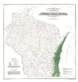
Probable Yields of Wells in the Niagara Aquifer, Wisconsin
-
Probable Yields of Wells in the Niagara Aquifer, Wisconsin
1975
Map: 23 in x 24 in, scale 1:1,000,000
-
-
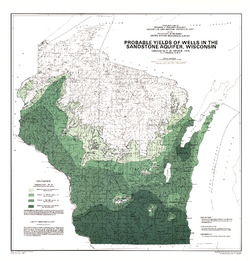
Probable Yields of Wells in the Sandstone Aquifer, Wisconsin
-
Probable Yields of Wells in the Sandstone Aquifer, Wisconsin
1975
Map: 23 in x 24 in, scale 1:1,000,000
-
-
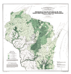
Probable Yields of Wells in the Sand-and-Gravel Aquifer, Wisconsin
-
Probable Yields of Wells in the Sand-and-Gravel Aquifer, Wisconsin
1975
Map: 23 in x 24 in, scale 1:1,000,000
-
-
Ground-Water Resources of Waukesha County, Wisconsin
-
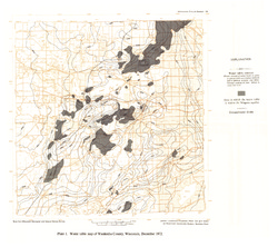
Water Table Map of Waukesha County, Wisconsin, December 1972 [plate 1]
1975
Map: 18 in x 16 in, scale 1:125,000

Publications Catalog
Wisconsin Geological and Natural History Survey