-
Hydrogeologic Atlas of Burnett County, Wisconsin
This hydrogeologic atlas offers a comprehensive interpretation and analysis of groundwater resources across Burnett County, Wisconsin. It encompasses assessments of the water-table elevation and groundwater flow directions, depth to the water table, depth to bedrock, distribution of groundwater recharge, relative vulnerability of groundwater to...-
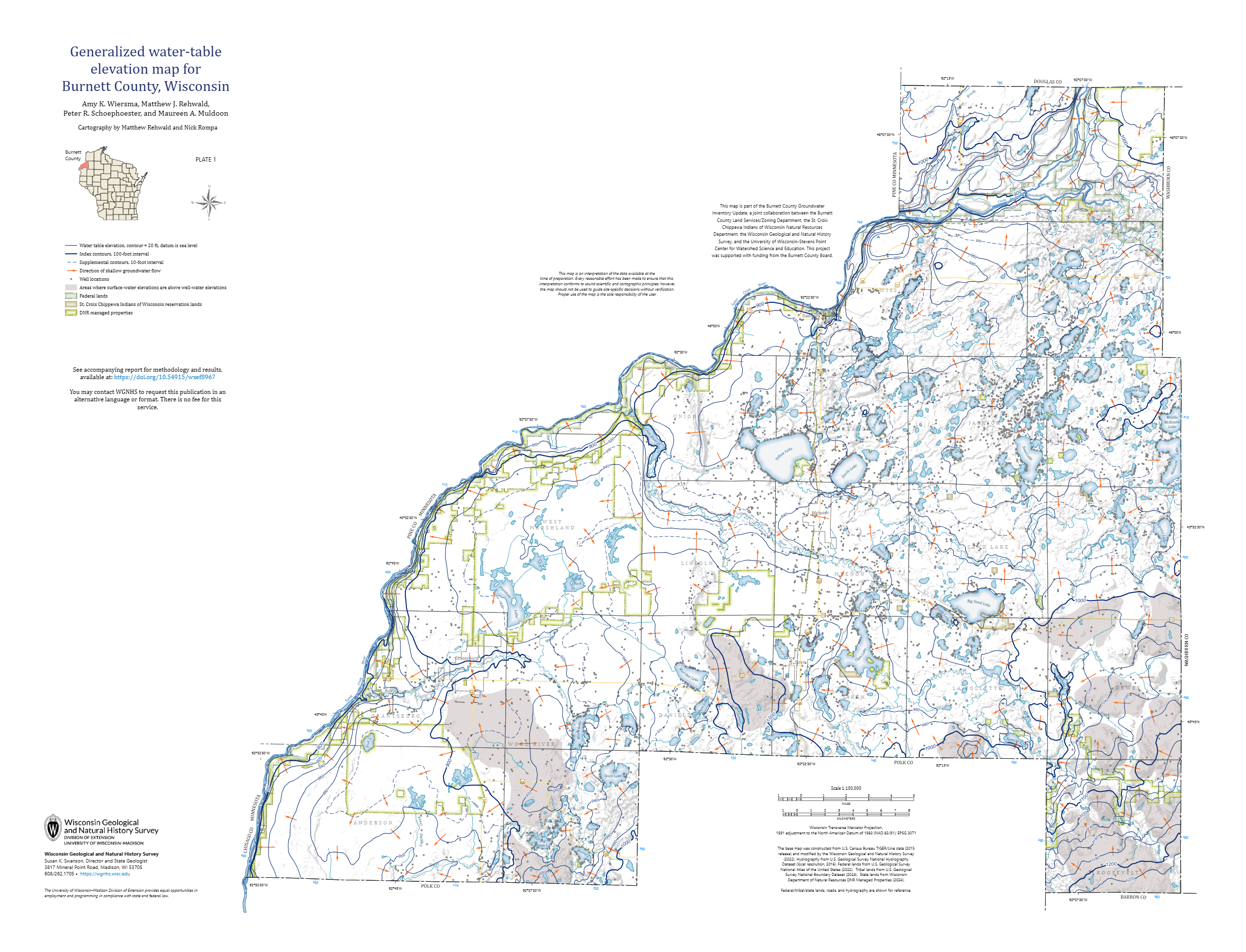
Generalized Water-Table Elevation Map for Burnett County, Wisconsin [plate 1]
2026
Map: 35 in x 26.75 in, scale 1:100,000
-
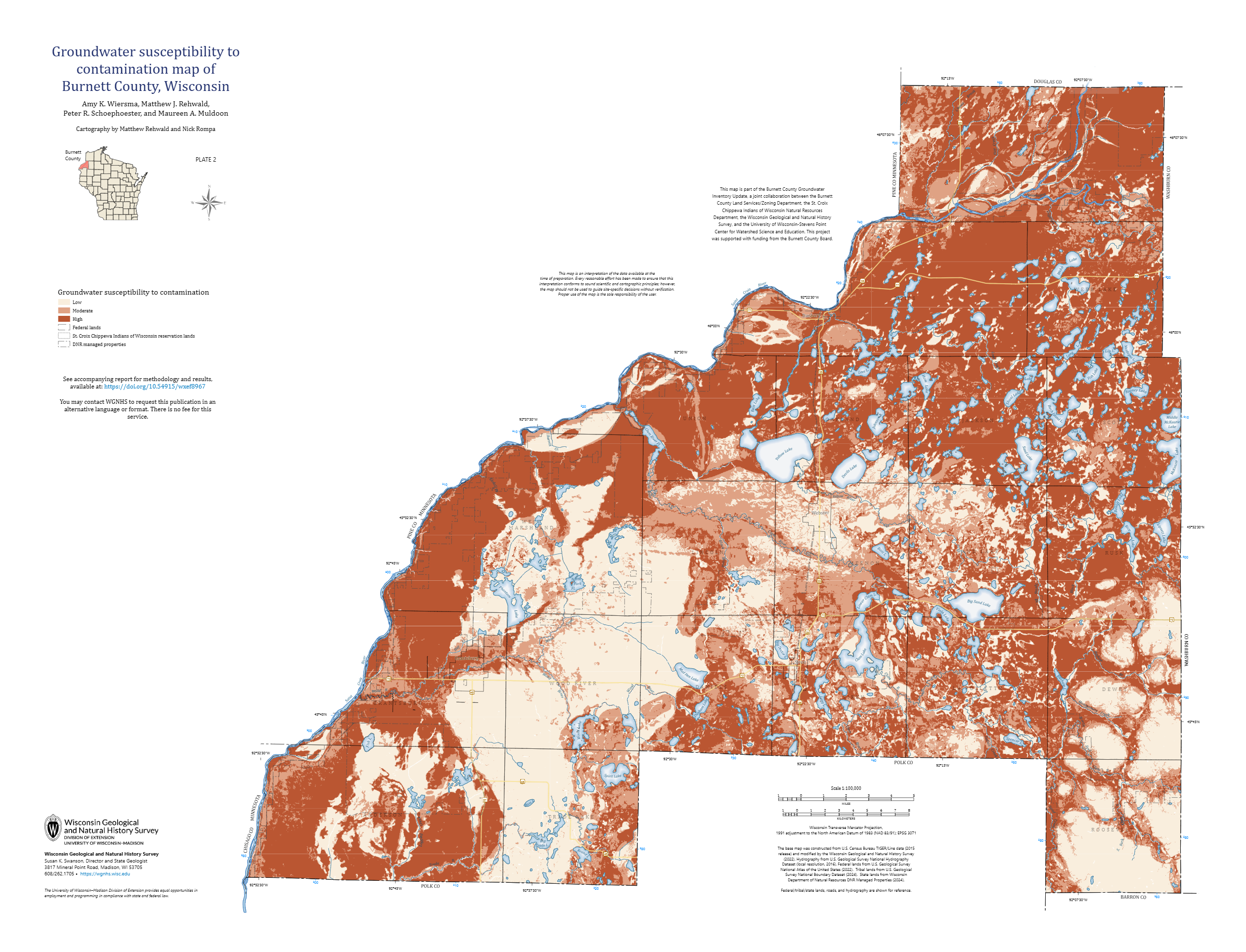
Groundwater Susceptibility to Contamination Map of Burnett County, Wisconsin [plate 2]
2026
Map: 35 in x 26.75 in, scale 1:100,000
-
GIS Data for Hydrogeologic Atlas of Burnett County, Wisconsin [dataset 1]
2026
GIS Data: File geodatabase (.gdb file format)
-
Wisconsin Bedrock Topography, 100-Meter Resolution
The elevation of the bedrock surface in Wisconsin is an important metric for decision makers around the state. Here, data and interpretations from a variety of sources were compiled to model the statewide, three-dimensional bedrock surface using modern GIS tools.-
Wisconsin Bedrock Topography, 100-Meter Resolution [dataset 1]
2026
GIS Data: File geodatabase (.gdb file format)
-

Publications Catalog
Wisconsin Geological and Natural History Survey