-
Bedrock Geology of Fond du Lac County, Wisconsin
Two plates showing the bedrock geology and depth to bedrock in Fond du Lac County, Wisconsin. Includes GIS data (shapefiles and grid files).-
GIS Data for the Bedrock Geology of Fond du Lac County, Wisconsin (version 2) [dataset 1]
2018
GIS Data: GeMS file geodatabase (.gdb file format), shapefiles (.shp file format)
-
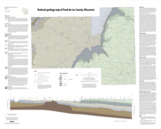
Bedrock Geology Map of Fond du Lac County, Wisconsin [plate 1]
2018
Plate: 35.75 in x 28.75 in, scale 1:100,000
-
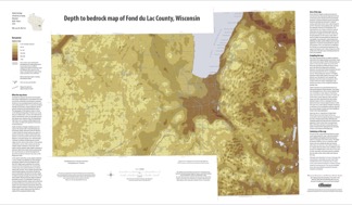
Depth to Bedrock Map of Fond du Lac County, Wisconsin [plate 2]
2018
Plate: 33 in x 19.25 in, scale 1:100,000
-
-
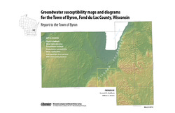
Groundwater Susceptibility Maps, Diagrams, and Report for the Town of Byron, Fond du Lac County, Wisconsin
Open-file report; contains unpublished data that has not yet been peer-reviewed.-
Groundwater Susceptibility Maps and Diagrams for the Town of Byron, Fond du Lac County, Wisconsin
2010
Report: 16 p., 7 plates
-
-
Preliminary Paleozoic Geologic Map of Fond du Lac County, Wisconsin
Open-file report; contains unpublished data that has not yet been peer-reviewed.-
Preliminary Bedrock Geologic Map of Fond du Lac County, Wisconsin [plate 1]
2004
Map: 26 in x 21 in, scale 1:100,000
-

Publications Catalog
Wisconsin Geological and Natural History Survey