-
Bedrock Geology of Fond du Lac County, Wisconsin
Two plates showing the bedrock geology and depth to bedrock in Fond du Lac County, Wisconsin. Includes GIS data (shapefiles and grid files).-
GIS Data for the Bedrock Geology of Fond du Lac County, Wisconsin (version 2) [dataset 1]
2018
GIS Data: GeMS file geodatabase (.gdb file format), shapefiles (.shp file format)
-
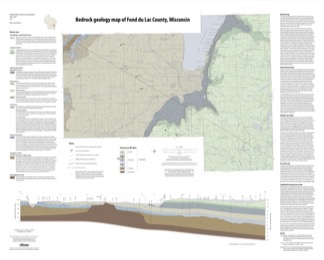
Bedrock Geology Map of Fond du Lac County, Wisconsin [plate 1]
2018
Plate: 35.75 in x 28.75 in, scale 1:100,000
-
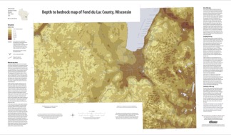
Depth to Bedrock Map of Fond du Lac County, Wisconsin [plate 2]
2018
Plate: 33 in x 19.25 in, scale 1:100,000
-
-
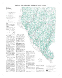
Generalized Water-Table Elevation Map of Buffalo County, Wisconsin
-
Generalized Water-Table Elevation Map of Buffalo County, Wisconsin
2000
Map: 28 in x 35 in, scale 1:100,000
-
-
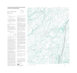
Generalized Water-Table Elevation Map of Price County, Wisconsin
-
Generalized Water-Table Elevation Map of Price County, Wisconsin
1999
Map: 31.5 in x 30 in, scale 1:100,000
-

Publications Catalog
Wisconsin Geological and Natural History Survey