-
Elevation contours of the Precambrian surface of south-central Wisconsin
Elevation contour data and an accompanying report provide an updated interpretation of the elevation of the top of Precambrian bedrock in south-central Wisconsin. The elevation surface was developed from geologic and geophysical data, and provides new detail on the entrenched bedrock valleys that were incised into the north and south ranges of the Baraboo...-
Elevation contours of the Precambrian surface of south-central Wisconsin [dataset 1]
2022
GIS Data: File geodatabase (.gdb file format)
-
-
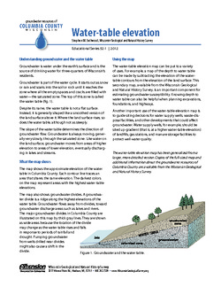
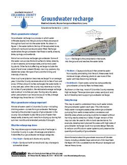
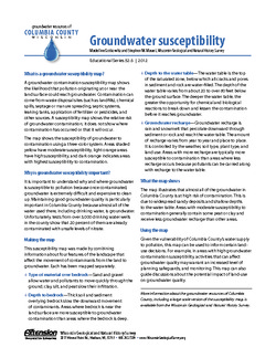
Groundwater Resources of Columbia County, Wisconsin
Three-part series describes the results of a comprehensive inventory and assessment of Columbia County's groundwater resources. Covers water-table elevation, groundwater recharge, and groundwater susceptibility. -
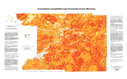
Groundwater Susceptibility Map of Columbia County, Wisconsin
Open-file report; contains unpublished data that has not yet been peer-reviewed.-
Groundwater Susceptibility Map of Columbia County, Wisconsin
2012
Map: 34.5 in x 20.5 in, scale 1:100,000
-
Groundwater Susceptibility Map of Columbia County, Wisconsin [GIS data]
2012
GIS Data: Layer files (.lyr file format), Esri grid files
-

Publications Catalog
Wisconsin Geological and Natural History Survey