-
Geologic Summary of the Ashland 2° Quadrangle
Open-file report; contains unpublished data that has not yet been peer-reviewed.-
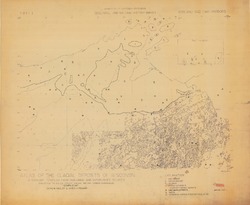
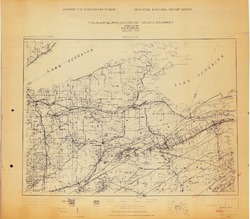
Preliminary Bedrock Geologic Map: Ashland Quadrangle
1979
Map: 4 p., 1 plate, 29.22 in x 25.65 in, scale 1:250,000
-
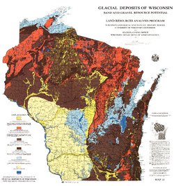
Glacial Deposits of Wisconsin: Sand and Gravel Resource Potential
Color map showing outwash, ground moraine, end moraine, and glacial deposits.-
Glacial Deposits of Wisconsin: Sand and Gravel Resource Potential
1976
Map: 45 in x 43.25 in, scale 1:500,000
-

Publications Catalog
Wisconsin Geological and Natural History Survey