-
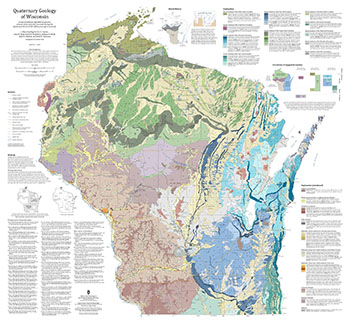
Quaternary Geology of Wisconsin
This 1:500,000 scale map of Wisconsin depicts sediment deposited by glaciers, streams, wind, and other processes during the Quaternary Period (2.58 million years ago to present). The map was made by compiling detailed Quaternary mapping and lithostratigraphic studies previously conducted by the WGNHS to generate consistent statewide Quaternary map units....-
GIS Data for the Quaternary Geology of Wisconsin (revised 2025) [dataset 1]
2025
GIS Data: GeMS file geodatabase, GeoPackage, shapefiles, metadata
-
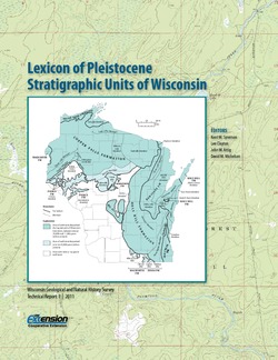
Lexicon of Pleistocene Stratigraphic Units of Wisconsin
This 180-page book marks the first update in over 20 years to the collection of formal definitions of Wisconsin's Pleistocene units. Contains over 100 color maps, photographs, and figures as well as an extensive list of references. -
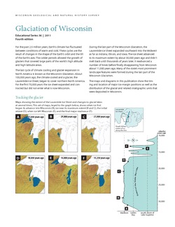
Glaciation of Wisconsin
Brief technical description of Wisconsin’s geologic history, glacial phases and lobes, and correlation and distribution of Pleistocene units. Heavily illustrated.

Publications Catalog
Wisconsin Geological and Natural History Survey