-
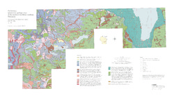
Geologic Map of the Durwards Glen 7.5-Minute Quadrangle, Columbia and Sauk Counties, Wisconsin
The Durwards Glen 7.5-minute quadrangle map is located in Columbia and Sauk counties, southeast of the city of Baraboo. This geologic map includes Precambrian through Quaternary units. New mapping has focused on subdividing the Baraboo Quartzite into four separate members and delineating Quaternary deposits in greater detail than prior work.-
Geologic Map of the Durwards Glen 7.5-Minute Quadrangle, Columbia and Sauk Counties, Wisconsin
2024
Map: 35 x 40 in, scale 1:24,000
-
GIS Data for the Geologic Map of the Durwards Glen 7.5-Minute Quadrangle, Columbia and Sauk Counties, Wisconsin [dataset 1]
2024
GIS Data: GeMS Level 3 file geodatabase (.gdb file format), shapefiles (.shp file format), GeoPackage (.gpkg file format)
-
-
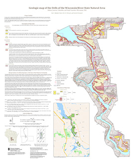
Geologic Map of the Dells of the Wisconsin River State Natural Area
The geologic map of the Dells of the Wisconsin River State Natural Area provides a detailed look at the bedrock geology present at one of Wisconsin's most cherished natural sites. The map and accompanying report present the Paleozoic bedrock stratigraphy of the visible formations, as well as an interpretation of their depositional environment. This map...-
Geologic Map of the Dells of the Wisconsin River State Natural Area
2023
Map: 30 x 36 in, scale 1:12,000
-
-
Wisconsin Groundwater-Level Monitoring Network Improvements, 2018-2021
This report documents work completed as part of a grant from the U.S. Geological Survey’s National Groundwater Monitoring Network (NGWMN) program. It provides an overview of the Wisconsin Groundwater-Level Monitoring Network (WGLMN) and provides detailed description of well evaluation and repair activities, and drilling of new monitoring wells across the... -
Applications of the Columbia County, Wisconsin, Groundwater-Flow Model
Computerized groundwater-flow models provide scientific analysis of water resources. Since its initial development in 2014, the Columbia County groundwater-flow model has been used to respond to requests for information about specific groundwater and land use issues. This companion report to the Hydrogeology and simulation of groundwater flow in Columbia... -
Geochemistry and Mineralogy of the Wonewoc-Tunnel City Contact Interval Strata in Western Wisconsin
Results of regional study characterizing the elemental composition of rocks found at the Wonewoc-Tunnel City contact interval in west-central and southwest Wisconsin.-
Geochemistry and Mineralogy of the Wonewoc-Tunnel City Contact Interval Strata in Western Wisconsin [appendices]
2019
Data: Documents (.pdf file format), spreadsheets (.xlsx file format)
-
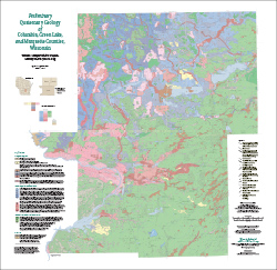
Preliminary Quaternary Geology of Columbia, Green Lake, and Marquette Counties, Wisconsin
This open-file report contains a map (PDF), GIS data (shapefiles), and metadata for Columbia, Green Lake, and Marquette Counties in central Wisconsin.-
Preliminary Quaternary Geology of Columbia, Green Lake, and Marquette Counties, Wisconsin [plate 1]
2015
Map: 35 in x 34 in, scale 1:100,000
-
Preliminary Quaternary Geology of Columbia, Green Lake, and Marquette Counties, Wisconsin [GIS data]
2015
GIS Data: Shapefiles (.shp file format)
-
-
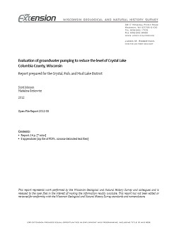
Evaluation of Groundwater Pumping to Reduce the Level of Crystal Lake in Columbia County, Wisconsin
Open-file report; contains unpublished data that has not yet been peer-reviewed.-
Evaluation of Groundwater Pumping to Reduce the Level of Crystal Lake, Columbia County, Wisconsin [appendices]
2012
Data: Documents (.pdf file format), spreadsheets (.csv file format)
-
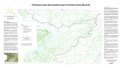
Preliminary Water-Table Elevation Map of Columbia County, Wisconsin
Open-file report; contains unpublished data that has not yet been peer-reviewed.-
Preliminary Water-Table Elevation Map of Columbia County, Wisconsin
2012
Map: 36 in x 20 in, scale 1:100,000
-
Preliminary Water-Table Elevation Map of Columbia County, Wisconsin [GIS data]
2012
GIS Data: Shapefiles (.shp file format)
-
-
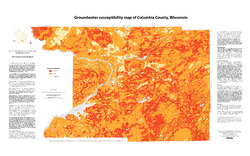
Groundwater Susceptibility Map of Columbia County, Wisconsin
Open-file report; contains unpublished data that has not yet been peer-reviewed.-
Groundwater Susceptibility Map of Columbia County, Wisconsin
2012
Map: 34.5 in x 20.5 in, scale 1:100,000
-
Groundwater Susceptibility Map of Columbia County, Wisconsin [GIS data]
2012
GIS Data: Layer files (.lyr file format), Esri grid files
-
-
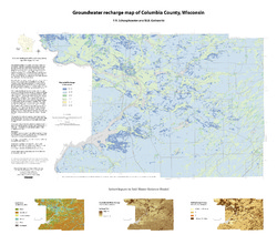
Groundwater Recharge Map of Columbia County, Wisconsin
Open-file report; contains unpublished data that has not yet been peer-reviewed.-
Groundwater Recharge Map of Columbia County, Wisconsin [GIS data]
2012
GIS Data: Layer files (.lyr file format), Esri grid files
-
Preliminary Quaternary Geologic Map of the Southern Fox River Lowland, Wisconsin
Open-file report; contains unpublished data that has not yet been peer-reviewed.-
Preliminary Quaternary Geologic Map of the Southern Fox River Lowland, Wisconsin
2005
Map: 48 in x 27 in, scale 1:100,000
-

Publications Catalog
Wisconsin Geological and Natural History Survey