-
A Groundwater Flow Model for the Little Plover River Basin in Wisconsin's Central Sands
The bulletin describes the state-of-the-art scientific tool that can be used to help make good decisions about high-capacity well placement and pumping, as well as land use in Wisconsin's Central Sands region. It can also be used to predict which wells and well locations would have the greatest impact on nearby lakes and streams. The user's manual...-
A Groundwater Flow Model for the Little Plover River Basin in Wisconsin’s Central Sands [appendices]
2017
Data: Spreadsheets (.xlsx file format), documents (.pdf file format)
-
The Geology of North Central Wisconsin
-
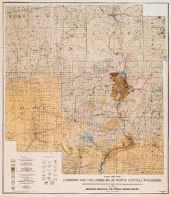
Map of the Cambrian and Pre-Cambrian of North Central Wisconsin: Clark, Wood, Portage, Marathon, Lincoln, Taylor and Parts of Langlade, Rusk and Price Counties [plate 1]
1907
Map: 20.0 in x 22.9 in, scale 1 in = 3 miles
-
Map of the Pleistocene of North Central Wisconsin: Clark, Wood, Portage, Marathon, Lincoln, Taylor and Parts of Langlade, Rusk and Price Counties [plate 2]
1907
Map: 20.1 in x 23.1 in, scale 1 in = 3 miles
-
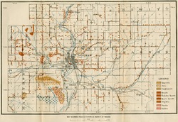
Map Showing Rock Outcrops in Vicinity of Athens and Upper Rib River [plate 8]
1907
Map: 13.6 in x 8.8 in
-
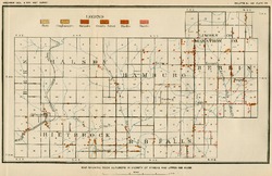
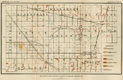
Map Showing Rock Outcrops in Vicinity of Arpin and Junction City [plate 12]
1907
Map: 15.1 in x 9.9 in
-
Map Showing Rock Outcrops in Vicinity of Hewitt and Rozellville [plate 15]
1907
Map: 10.9 in x 7.5 in

Publications Catalog
Wisconsin Geological and Natural History Survey