-
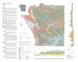
Geology of the Baraboo Hills, Sauk and Columbia Counties, Wisconsin
Located in the south-central portion of the state, new geologic mapping of the frequently-visited Baraboo Hills has resulted in a revision of the stratigraphy of the Precambrian-aged bedrock. The Baraboo Quartzite is now divided into four informal members, and the maximum depositional age for the Baraboo Quartzite is 1714±17 million years old. These...-
Geology of the Baraboo Hills, Sauk and Columbia Counties, Wisconsin [plate 1]
2025
Map: 48.25 in x 29.25 in, scale 1:50,000
-
GIS Data for Geology of the Baraboo Hills, Sauk and Columbia Counties, Wisconsin [dataset 1]
2025
GIS Data: GeMS Level 3 file geodatabase (.gdb file format) and GeoPackage (.gpkg file fomat)
-
Bedrock Geology of Grant County, Wisconsin
Three-dimensional bedrock mapping of Grant County at a scale of 1:100,000 provides new baseline information on the distribution of geologic units. Grant County contains Paleozoic bedrock units ranging in age from Silurian to Cambrian. Gentle folds and small faults deform the Paleozoic sequence and were mapped based on structure contours of the base of the...-
GIS Data for Bedrock Geology of Grant County, Wisconsin [dataset 1]
2025
GIS Data: GeMS Level 3 file geodatabase (.gdb file format), GeoPackage (.gpkg file format)
-
Geochemical Data for Bedrock Geology of Grant County, Wisconsin [dataset 2]
2025
Data: Spreadsheets (.csv file format)
-
GIS Data for Bedrock Geology of Grant County, Wisconsin [dataset 3]
2025
GIS Data: File geodatabase (.gdb file format)
-
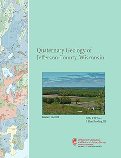
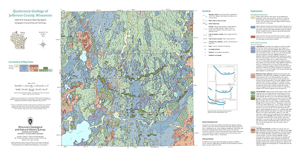
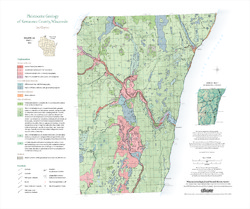
Quaternary Geology of Jefferson County, Wisconsin
The Quaternary geologic map of Jefferson County, Wisconsin, provides details about the surficial sediment and landscapes that were formed largely in the footprint of the Laurentide Ice Sheet's southern Green Bay Lobe during the late Wisconsin Glaciation (ca. 20,000 years before present). These landscapes include lowlands underlain by glacial and...-
GIS Data for Quaternary Geology of Jefferson County, Wisconsin [dataset 1]
2022
GIS Data: GeMS file geodatabase (.gdb file format), shapefiles (.shp file format)
-
Quaternary Geology of Jefferson County, Wisconsin [plate 1]
2022
Map: 34.5 in x 18 in, scale 1:100,000
-
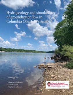
Hydrogeology and Simulation of Groundwater Flow in Columbia County, Wisconsin
The WGNHS and the U.S. Geological Survey characterized the hydrogeology and developed a groundwater flow model to assess groundwater resources in Columbia County. This report describes regionally extensive aquifers and presents several extensive datasets collected from deep wells across the county. The report also documents the construction and... -
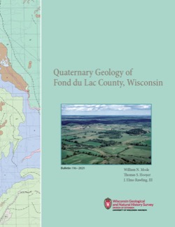
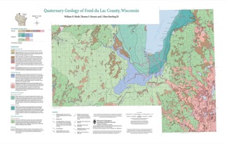
Quaternary Geology of Fond du Lac County, Wisconsin
The Quaternary geology of Fond du Lac County consists of glacial deposits and landforms dating to the last part of the Wisconsin Glaciation (ca. 20,000 to 12,000 yr BP) and nonglacial deposits and landforms of Holocene age (11,700 yr BP to present). Glacial till and meltwater sediment were deposited by the Green Bay and Lake Michigan Lobes of the...-
GIS Data for the Quaternary Geology of Fond du Lac County, Wisconsin [dataset 2]
2021
GIS Data: GeMS Level 3 file geodatabase (.gdb file format), shapefiles (.shp file format)
-
Quaternary Geology of Fond du Lac County, Wisconsin [plate 1]
2021
Map: 32 in x 20.25 in, scale 1:100,000
-
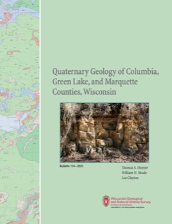
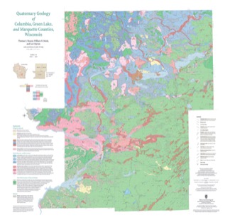
Quaternary Geology of Columbia, Green Lake, and Marquette Counties, Wisconsin
Columbia, Green Lake, and Marquette Counties were glaciated during the last ice age, and large areas were inundated with water from proglacial lakes and large meltwater rivers that occupied the valleys of the existing Wisconsin and Fox Rivers. These processes resulted in rolling upland hills, including drumlins punctuated by low-lying areas dominated by...-
GIS Data for the Quaternary Geology of Columbia, Green Lake, and Marquette Counties, Wisconsin [dataset 1]
2021
GIS Data: GeMS Level 3 file geodatabase (.gdb file format), shapefiles (.shp file format), GeoPackage (.gpkg file format)
-
Quaternary Geology of Columbia, Green Lake, and Marquette Counties, Wisconsin [plate 1]
2021
Map: 35 in x 34 in, scale 1:100,000
-
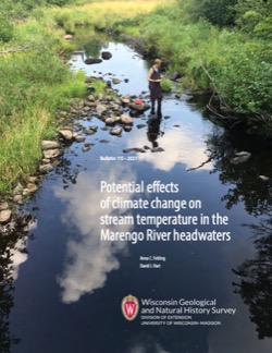
Potential Effects of Climate Change on Stream Temperature in the Marengo River Headwaters
Cold-water trout habitat in Wisconsin is projected to substantially decrease as a result of climate change. The extent of habitat loss depends, in part, on groundwater discharge to streams, which can provide cool-water refuges for trout. Survey hydrogeologists used field measurements and models of groundwater flow and stream temperature to evaluate how...-
GFLOW Groundwater Flow Model of the Marengo River Headwaters [dataset 1]
2021
Data: Groundwater flow model (.gfl file format), shapefiles (.shp file format)
-
Geodatabase - Three Baseflow Scenarios for the Marengo River Headwaters [dataset 2]
2021
GIS Data: File geodatabase (.gdb file format)
-
Measurements of Water Chemistry, Streamflow, and Stream Temperature from the Marengo River Headwaters [dataset 3]
2021
Data: Spreadsheets (.xlsx file format)
-
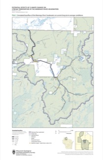
Simulated Baseflow of the Marengo River Headwaters with 21% Increase in Recharge [plate 2]
2021
Map: 11 in x 17 in
-
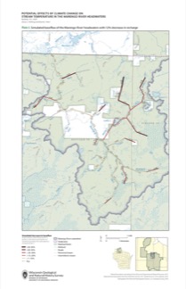
Simulated Baseflow of the Marengo River Headwaters with 12% Decrease in Recharge [plate 3]
2021
Map: 11 in x 17 in
-
An Inventory of Springs in Wisconsin
Report, database, field protocol, photos, and site sketches documenting the multi-year project inventorying springs in Wisconsin with discharge rates of at least 0.25 cubic feet per second. -
Groundwater Flow Model for Western Chippewa County
This report documents the groundwater flow model that was developed for western Chippewa County, Wisconsin. It also presents analyses that were run to evaluate how industrial sand (frac sand) mining and irrigated agriculture--might affect the water table and base flows of nearby headwater streams.-
Groundwater Flow Model for Western Chippewa County, Wisconsin, Including Analysis of Water Resources Related to Industrial Sand Mining and Irrigated Agriculture [appendices]
2019
Data: Spreadsheets (.xlsx file format), documents (.pdf file format)
-
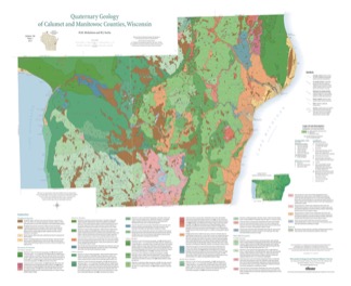
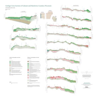
Quaternary Geology of Calumet and Manitowoc Counties, Wisconsin
All of what is now Calumet and Manitowoc Counties was covered by ice during the last great glaciation, between 30,000 and 11,000 years ago. This bulletin explains the glacial history, interprets the deposits left behind, and portrays the distribution of the deposits on a map and cross sections. This report should be useful to planners and development...-
Quaternary Geology of Calumet and Manitowoc Counties, Wisconsin [GIS data]
2017
GIS Data: Shapefiles (.shp file format)
-
Quaternary Geology of Calumet and Manitowoc Counties, Wisconsin [plate 1]
2017
Plate: 35.5 in x 29 in, scale 1:100,000
-
Geologic Cross Sections of Calumet and Manitowoc Counties, Wisconsin [plate 2]
2017
Plate: 36.67 in x 36.67 in, scale 1:100,000
-
A Groundwater Flow Model for the Little Plover River Basin in Wisconsin's Central Sands
The bulletin describes the state-of-the-art scientific tool that can be used to help make good decisions about high-capacity well placement and pumping, as well as land use in Wisconsin's Central Sands region. It can also be used to predict which wells and well locations would have the greatest impact on nearby lakes and streams. The user's manual...-
A Groundwater Flow Model for the Little Plover River Basin in Wisconsin’s Central Sands [appendices]
2017
Data: Spreadsheets (.xlsx file format), documents (.pdf file format)
-
Quaternary Geology of Door County, Wisconsin
Traces the complex glacial history of Door County. Map shows glacial units with shaded relief.-
Quaternary Geology of Door County, Wisconsin [GIS data]
2016
GIS Data: Shapefiles (.shp file format)
-
The 2016 Groundwater Flow Model for Dane County, Wisconsin
The 2016 groundwater flow model is a three-dimensional model using state-of-the-art representation of the hydrogeology of Dane County. This report describes the model, appendices provide data, and the user's manual provides basic instructions and recommendations for running the model.-
The 2016 Groundwater Flow Model for Dane County, Wisconsin [appendices]
2016
Data: Spreadsheets (.xlsx file format)
-
Pleistocene Geology of Kewaunee County, Wisconsin
Kewaunee County, at the southern end of the Door Peninsula, was overrun by glaciers many times. Author Lee Clayton describes the county's complex glacial geology, from the surface soil down to solid rock. The accompanying map shows the placement of glacial sediments as well as glacial and post-glacial stream and lake sediments.-
Pleistocene Geology of Kewaunee County, Wisconsin [GIS data]
2013
GIS Data: Shapefiles (.shp file format)
-
Pleistocene Geology of Kewaunee County, Wisconsin [plate 1]
2013
Map: 21.5 in x 18 in, scale 1:100,000
-
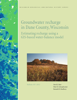
Groundwater Recharge in Dane County, Wisconsin: Estimating Recharge Using a GIS-Based Water-Balance Model
Hydrogeologists at the Survey developed a groundwater management tool to help guide land-use decisions in Dane County. The publication describes the inputs used to calculate recharge and includes a reduced-scale version of the recharge map. A full-scale version of the recharge data has been subsequently added as Dataset 1.-
GIS Data for Groundwater Recharge in Dane County, Wisconsin [dataset 1]
2012
GIS Data: File geodatabase (.gdb file format)
-
Quaternary Geology of Sheboygan County, Wisconsin
This report traces the advances and retreats of glaciers through Sheboygan County in eastern Wisconsin. Available as a bulletin, map, cross sections, and GIS data.-
Quaternary Geology of Sheboygan County, Wisconsin [GIS data]
2011
GIS Data: Shapefiles (.shp file format), MrSID files (.sid file format)
-
Quaternary Geology of Sheboygan County, Wisconsin [plate 1]
2011
Map: 32 in x 22 in, scale 1:100,000
-
Geologic Cross Sections of Sheboygan County, Wisconsin [plate 2]
2011
Plate: 33 in x 24 in, scale 1:100,000
-
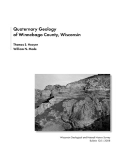
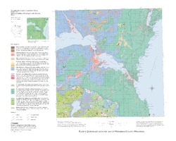
Quaternary Geology of Winnebago County, Wisconsin
-
Quaternary Geology of Winnebago County, Wisconsin (version 2) [GIS data]
2008
GIS Data: GeMS Level 3 file geodatabase (.gdb file format)
-
Quaternary Geologic Map of Winnebago County, Wisconsin [plate 1]
2008
Map: 25 in x 20 in, scale 1:100,000
-
Geologic Cross Sections of Winnebago County, Wisconsin [plate 2]
2008
Plate: 25 in x 27 in, scale 1:100,000
-
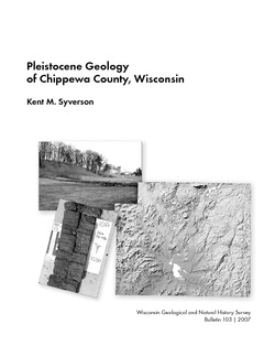
Pleistocene Geology of Chippewa County, Wisconsin
-
Pleistocene Geology of Chippewa County, Wisconsin (version 2) [GIS data]
2007
GIS Data: GeMS file geodatabase (.gdb file format)
-
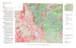
Pleistocene Geologic Map of Chippewa County, Wisconsin [plate 1]
2007
Plate: 36 in x 23 in, scale 1:100,000
-
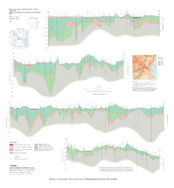
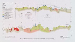
Pleistocene Geologic Cross Sections of Chippewa County, Wisconsin [plate 2]
2007
Plate: 16.5 in x 9.4 in, scale 1:100,000
-
Geology of La Crosse County, Wisconsin
-
Geology of La Crosse County, Wisconsin (version 2) [GIS Data]
2003
GIS Data: GeMS file geodatabase (.gdb file format)
-
Geologic Map and Cross Sections of La Crosse County, Wisconsin [plate 1]
2003
Map: 29 in x 23 in, scale 1:100,000

Publications Catalog
Wisconsin Geological and Natural History Survey