-
Groundwater Flow Model for Western Chippewa County
This report documents the groundwater flow model that was developed for western Chippewa County, Wisconsin. It also presents analyses that were run to evaluate how industrial sand (frac sand) mining and irrigated agriculture--might affect the water table and base flows of nearby headwater streams.-
Groundwater Flow Model for Western Chippewa County, Wisconsin, Including Analysis of Water Resources Related to Industrial Sand Mining and Irrigated Agriculture [appendices]
2019
Data: Spreadsheets (.xlsx file format), documents (.pdf file format)
-
Bedrock Geology of Wisconsin, Northwest Sheet
Types of bedrock, formation names, major faults, and time period of formation.-
Bedrock Geology of Wisconsin, Northwest Sheet
1987
Map: 37.5 in x 22 in, scale 1:250,000; 35.5 in x 20 in
-
Bedrock Geology of Wisconsin, Northwest Sheet [GIS data]
1987
GIS Data: MrSID files (.sid file format)
-
-
Geoscience Wisconsin Volume 01
-
Discovery of the Flambeau Deposit, Rusk County, Wisconsin: A Geophysical Case Study
1977
Journal Article: p. 27-42
-
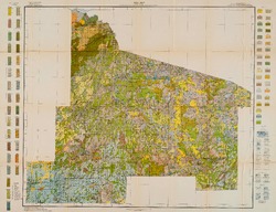
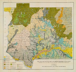
Reconnoissance [sic] Soil Survey of North Part of North Central Wisconsin
-
Soil Map: Wisconsin, Reconnoissance [sic] Survey - North Part of North Central Wisconsin Sheet
1916
Map: 26.0 in x 20.0 in, scale 1 in = 3 miles
-
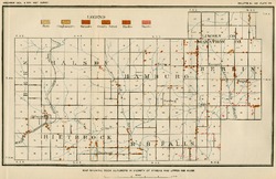
Mineral Land Classification, Showing Indications of Iron Formation in Parts of Ashland, Bayfield, Washburn, Sawyer, Price, Oneida, Forest, Rusk, Barron, and Chippewa Counties
-
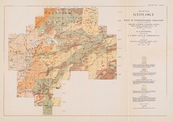
Map Showing Geology of Part of Northwestern Wisconsin Including Parts of Ashland, Bayfield, Washburn, Sawyer, Price, Oneida, Barron, Rusk, and Chippewa Counties [plate 1]
1915
Map: 20.7 in x 13.5 in, scale 1 in = 6 miles
-
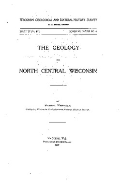
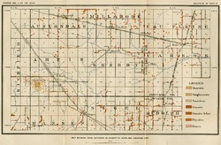
The Geology of North Central Wisconsin
-
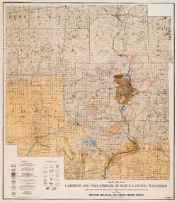
Map of the Cambrian and Pre-Cambrian of North Central Wisconsin: Clark, Wood, Portage, Marathon, Lincoln, Taylor and Parts of Langlade, Rusk and Price Counties [plate 1]
1907
Map: 20.0 in x 22.9 in, scale 1 in = 3 miles
-
Map of the Pleistocene of North Central Wisconsin: Clark, Wood, Portage, Marathon, Lincoln, Taylor and Parts of Langlade, Rusk and Price Counties [plate 2]
1907
Map: 20.1 in x 23.1 in, scale 1 in = 3 miles
-
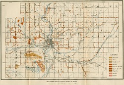
Map Showing Rock Outcrops in Vicinity of Athens and Upper Rib River [plate 8]
1907
Map: 13.6 in x 8.8 in
-
Map Showing Rock Outcrops in Vicinity of Arpin and Junction City [plate 12]
1907
Map: 15.1 in x 9.9 in
-
Map Showing Rock Outcrops in Vicinity of Hewitt and Rozellville [plate 15]
1907
Map: 10.9 in x 7.5 in

Publications Catalog
Wisconsin Geological and Natural History Survey