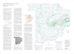
Water-Table Elevation Map of Sauk County, Wisconsin
Data and Resources
-
Water-Table Elevation Map of Sauk County, Wisconsin [GIS data]
2002
Map: Coverage (.e00 file format)
Related Collections
-

Map
View Map

2002
Map: Coverage (.e00 file format)