
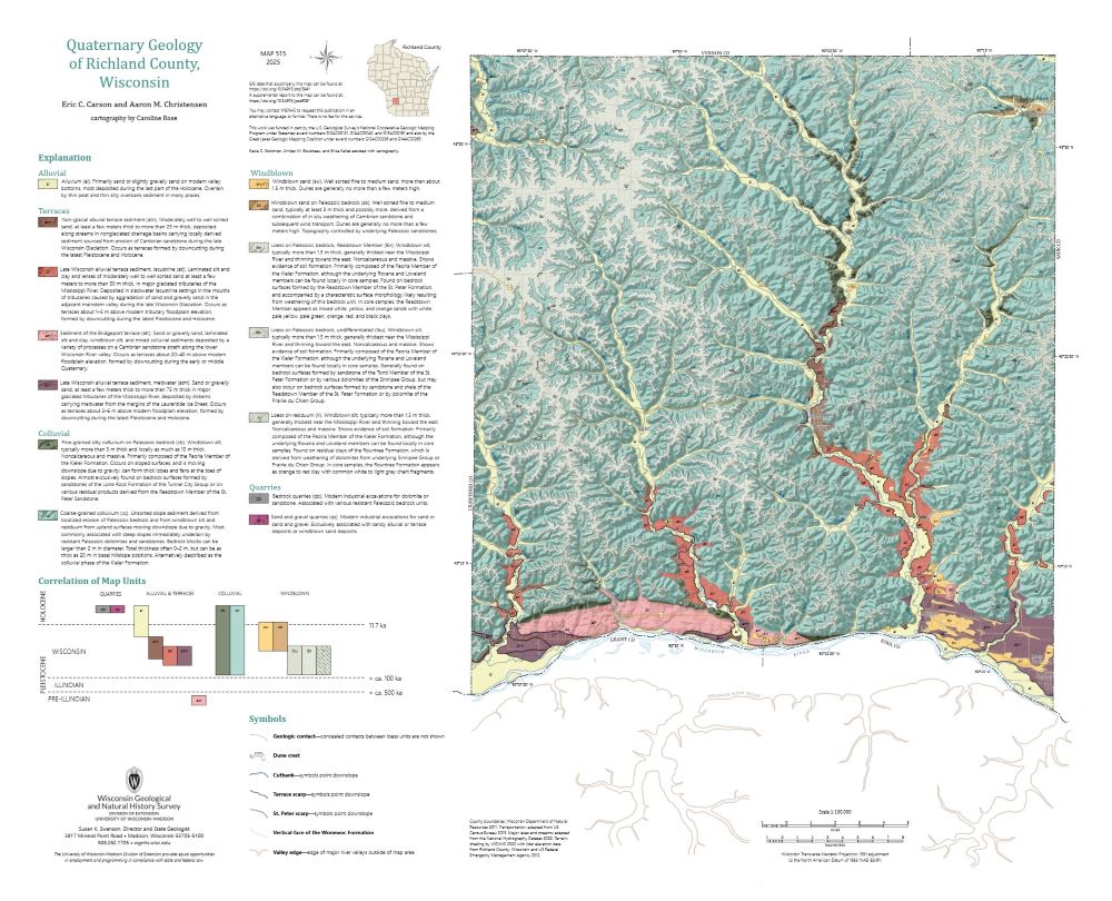
Quaternary Geology of Richland County, Wisconsin
Data and Resources
-
Quaternary Geology of Richland County, Wisconsin (revised 2025)
2025
Map: 29 in x 23.5 in, scale 1:100,000
-
GIS Data for Quaternary Geology of Richland County, Wisconsin [dataset 1] (revised 2025)
2025
GIS Data: GeMS Level 3 file geodatabase (.gdb file format)
-
Core Data for Quaternary Geology of Richland County, Wisconsin [dataset 2]
2025
Data: Spreadsheet (.csv file format)
Related Collections
-

Map
View Map -
New Publications
View New Publications