-
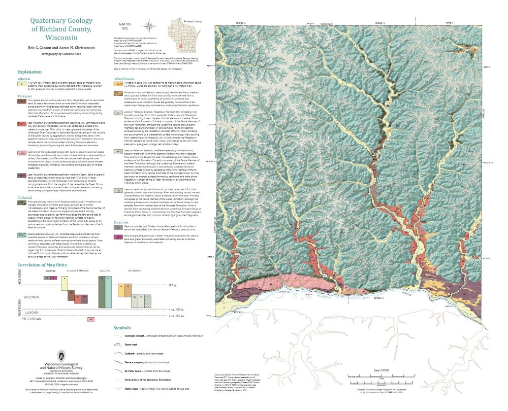
Quaternary Geology of Richland County, Wisconsin
The topography of the Driftless Area, which was never glaciated during the Quaternary Period, is dominated by fluvial incision into flat-lying Paleozoic bedrock, resulting in deep, dendritic valleys. Local relief reaches 115 meters. Sediment coring across the region reveals that the geology of unconsolidated surficial materials is often controlled by the...-
Quaternary Geology of Richland County, Wisconsin (revised 2025)
2025
Map: 29 in x 23.5 in, scale 1:100,000
-
GIS Data for Quaternary Geology of Richland County, Wisconsin [dataset 1] (revised 2025)
2025
GIS Data: GeMS Level 3 file geodatabase (.gdb file format)
-
Core Data for Quaternary Geology of Richland County, Wisconsin [dataset 2]
2025
Data: Spreadsheet (.csv file format)
-
-
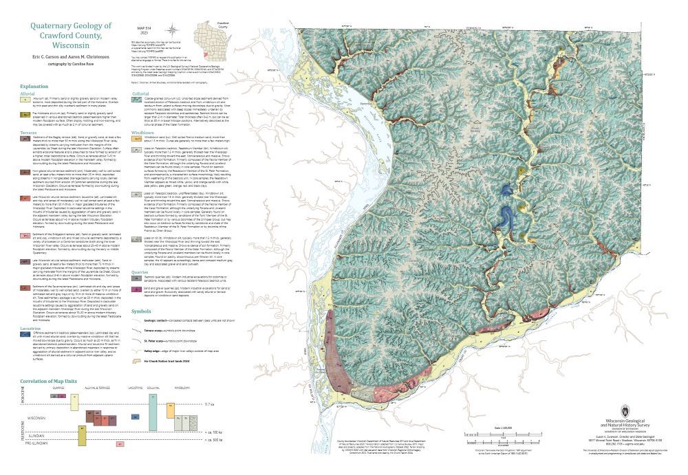
Quaternary Geology of Crawford County, Wisconsin
The topography of the Driftless Area, which was never glaciated during the Quaternary Period, is dominated by fluvial incision into flat-lying Paleozoic bedrock, resulting in deep, dendritic valleys. Local relief reaches 115 meters. Sediment coring across the region reveals that the geology of unconsolidated surficial materials is often controlled by the...-
Quaternary Geology of Crawford County, Wisconsin (revised 2025)
2025
Map: 34 in x 23.5 in, scale 1:100,000
-
GIS Data for Quaternary Geology of Crawford County, Wisconsin [dataset 1] (revised 2025)
2025
GIS Data: GeMS Level 3 file geodatabase (.gdb file format)
-
Core Data for Quaternary Geology of Crawford County, Wisconsin [dataset 2]
2025
Data: Spreadsheet (.csv file format)
-
-
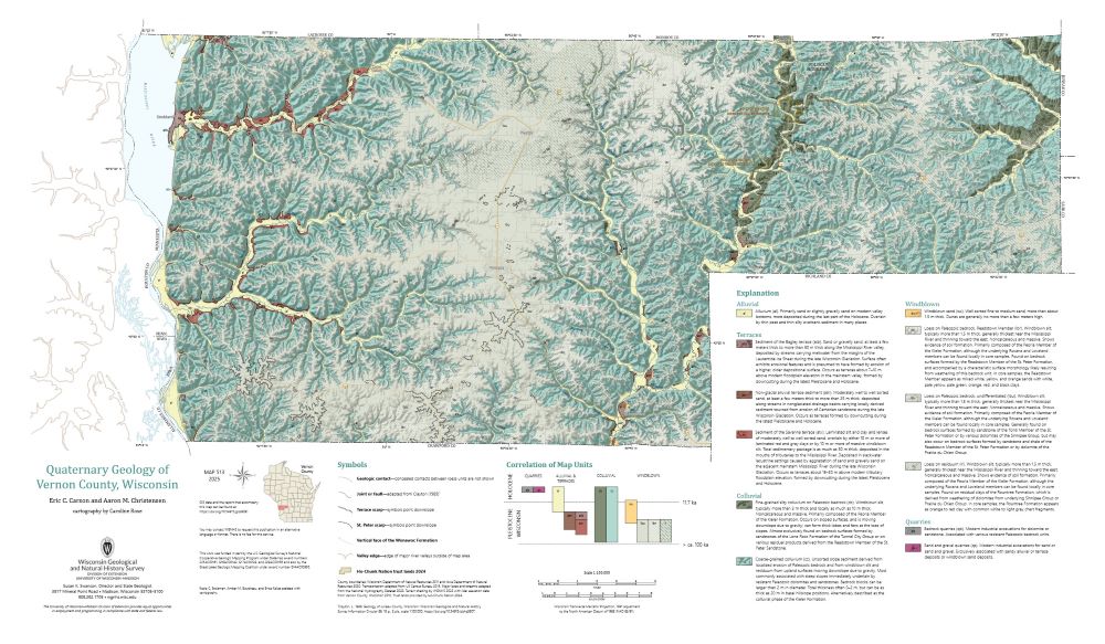
Quaternary Geology of Vernon County, Wisconsin
The topography of the Driftless Area, which was never glaciated during the Quaternary Period, is dominated by fluvial incision into flat-lying Paleozoic bedrock, resulting in deep, dendritic valleys. Local relief reaches 115 meters. Sediment coring across the region reveals that the geology of unconsolidated surficial materials is often controlled by the...-
GIS Data for Quaternary Geology of Vernon County, Wisconsin [dataset 1]
2025
GIS Data: GeMS Level 3 file geodatabase (.gdb file format)
-
Core Data for Quaternary Geology of Vernon County, Wisconsin [dataset 2]
2025
Data: Spreadsheet (.csv file format)
-
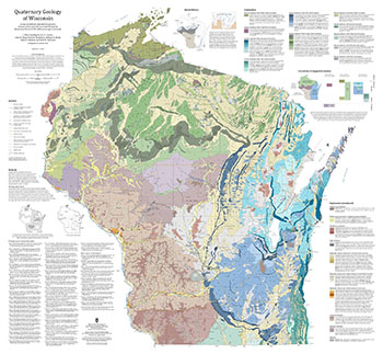
Quaternary Geology of Wisconsin
This 1:500,000 scale map of Wisconsin depicts sediment deposited by glaciers, streams, wind, and other processes during the Quaternary Period (2.58 million years ago to present). The map was made by compiling detailed Quaternary mapping and lithostratigraphic studies previously conducted by the WGNHS to generate consistent statewide Quaternary map units....-
GIS Data for the Quaternary Geology of Wisconsin (revised 2025) [dataset 1]
2025
GIS Data: GeMS file geodatabase, GeoPackage, shapefiles, metadata
-
Geologic Map of the Durwards Glen 7.5-Minute Quadrangle, Columbia and Sauk Counties, Wisconsin
The Durwards Glen 7.5-minute quadrangle map is located in Columbia and Sauk counties, southeast of the city of Baraboo. This geologic map includes Precambrian through Quaternary units. New mapping has focused on subdividing the Baraboo Quartzite into four separate members and delineating Quaternary deposits in greater detail than prior work.-
Geologic Map of the Durwards Glen 7.5-Minute Quadrangle, Columbia and Sauk Counties, Wisconsin
2024
Map: 35 x 40 in, scale 1:24,000
-
GIS Data for the Geologic Map of the Durwards Glen 7.5-Minute Quadrangle, Columbia and Sauk Counties, Wisconsin [dataset 1]
2024
GIS Data: GeMS Level 3 file geodatabase (.gdb file format), shapefiles (.shp file format), GeoPackage (.gpkg file format)
-
-
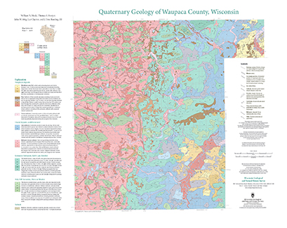
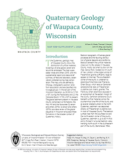
Quaternary Geology of Waupaca County, Wisconsin
The Quaternary geologic map of Waupaca County, Wisconsin, provides details about the surficial sediment and landscapes that were formed underneath and adjacent to the Laurentide Ice Sheet during the late Wisconsin Glaciation (ca. 20,000 years before present). These landscapes include lowlands underlain by glacial and postglacial lake sediment, uplands...-
Geologic Log Data for Quaternary Geology of Waupaca County, Wisconsin [dataset 1]
2023
Data: Spreadsheets (.xlsx file format)
-
GIS Data for Quaternary Geology of Waupaca County, Wisconsin [dataset 2]
2023
GIS Data: GeMS Level 3 file geodatabase (.gdb file format), shapefiles (.shp file format), GeoPackage (.gpkg file format)
-
The Driftless Area: The extent of unglaciated and similar terrains in Wisconsin, Illinois, Iowa, and Minnesota
The Driftless Area of southwestern Wisconsin and northwestern Illinois got its name from the lack of glacial sediment ("drift") covering the landscape. The surficial geology and topography of the Driftless Area are thus distinct from the surrounding region where multiple phases of glaciation left their mark. This pamphlet, a collaborative effort between...-
GIS data for the outline of the Driftless Area and similar terrains in Wisconsin, Illinois, Iowa, and Minnesota
2023
GIS Data: Shapefiles (.shp file format)
-
Page-sized and web-version maps of the Driftless Area and similar terrains in Wisconsin, Illinois, Iowa, and Minnesota
2023
Map: Documents (.pdf file format), images (.tif file format)
-
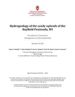
Hydrogeology of the sandy uplands of the Bayfield Peninsula, Wisconsin
The sandy uplands of the Bayfield Peninsula are primary contributors to regional groundwater recharge and provide baseflow to streams in the area. Few data exist, however, to characterize upland hydrogeology or its susceptibility to groundwater contamination. Here, data from two new cores and wells, one existing well, and a lake in the sandy uplands...-
Rotosonic core data from the sandy uplands of the Bayfield Peninsula, Wisconsin [dataset 1]
2022
Data: Spreadsheets (.csv file format)
-
Water-level measurements from two monitoring wells in the sandy uplands of the Bayfield Peninsula, Wisconsin [dataset 2]
2022
Data: Spreadsheets (.csv file format)
-
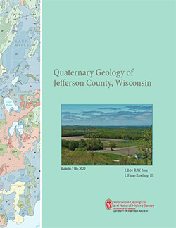
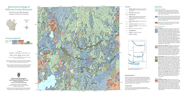
Quaternary Geology of Jefferson County, Wisconsin
The Quaternary geologic map of Jefferson County, Wisconsin, provides details about the surficial sediment and landscapes that were formed largely in the footprint of the Laurentide Ice Sheet's southern Green Bay Lobe during the late Wisconsin Glaciation (ca. 20,000 years before present). These landscapes include lowlands underlain by glacial and...-
GIS Data for Quaternary Geology of Jefferson County, Wisconsin [dataset 1]
2022
GIS Data: GeMS file geodatabase (.gdb file format), shapefiles (.shp file format)
-
Quaternary Geology of Jefferson County, Wisconsin [plate 1]
2022
Map: 34.5 in x 18 in, scale 1:100,000
-
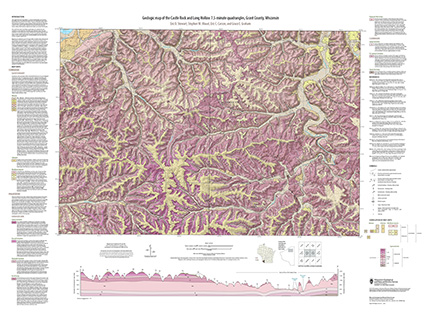
Geologic map of the Castle Rock and Long Hollow 7.5-minute quadrangles, Grant County, Wisconsin
The geologic map of the Castle Rock and Long Hollow quadrangles includes 1:24,000 scale mapping of both surficial and bedrock geology. The accompanying report presents new observations about bedrock folds and fracture sets in this portion of the Driftless Area that lies just north of the main Upper Mississippi Valley zinc-lead mineral district. The...-
Geologic map of the Castle Rock and Long Hollow 7.5-minute quadrangles, Grant County, Wisconsin (revised 2022)
2022
Map: 48 in x 36 in, scale 1:24,000
-
GIS data for the geologic map of the Castle Rock and Long Hollow 7.5-minute quadrangles, Grant County, Wisconsin [dataset 1]
2022
GIS Data: File geodatabase (.gdb file format)
-
-
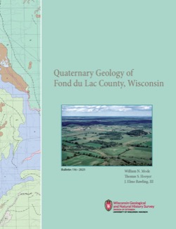
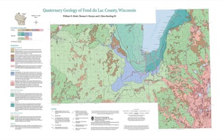
Quaternary Geology of Fond du Lac County, Wisconsin
The Quaternary geology of Fond du Lac County consists of glacial deposits and landforms dating to the last part of the Wisconsin Glaciation (ca. 20,000 to 12,000 yr BP) and nonglacial deposits and landforms of Holocene age (11,700 yr BP to present). Glacial till and meltwater sediment were deposited by the Green Bay and Lake Michigan Lobes of the...-
GIS Data for the Quaternary Geology of Fond du Lac County, Wisconsin [dataset 2]
2021
GIS Data: GeMS Level 3 file geodatabase (.gdb file format), shapefiles (.shp file format)
-
Quaternary Geology of Fond du Lac County, Wisconsin [plate 1]
2021
Map: 32 in x 20.25 in, scale 1:100,000
-
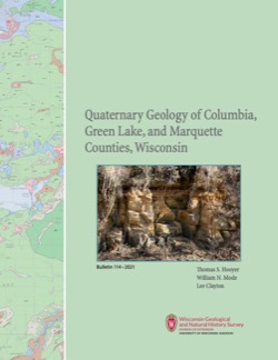
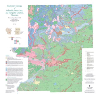
Quaternary Geology of Columbia, Green Lake, and Marquette Counties, Wisconsin
Columbia, Green Lake, and Marquette Counties were glaciated during the last ice age, and large areas were inundated with water from proglacial lakes and large meltwater rivers that occupied the valleys of the existing Wisconsin and Fox Rivers. These processes resulted in rolling upland hills, including drumlins punctuated by low-lying areas dominated by...-
GIS Data for the Quaternary Geology of Columbia, Green Lake, and Marquette Counties, Wisconsin [dataset 1]
2021
GIS Data: GeMS Level 3 file geodatabase (.gdb file format), shapefiles (.shp file format), GeoPackage (.gpkg file format)
-
Quaternary Geology of Columbia, Green Lake, and Marquette Counties, Wisconsin [plate 1]
2021
Map: 35 in x 34 in, scale 1:100,000
-
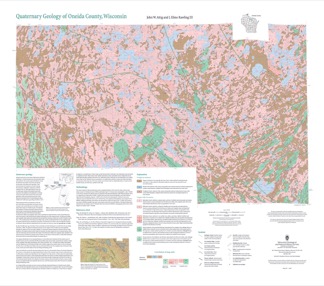
Quaternary Geology of Oneida County, Wisconsin
Oneida County, in northern Wisconsin, is a mostly forested area dotted with lakes and wetlands. The watery landscape is a legacy of a time when glaciers flowed across the area. Geologists Attig and Rawling mapped the Quaternary geology of the county, documenting where the glaciers paused, the sediments that were deposited, and the landforms that were...-
Quaternary Geology of Oneida County, Wisconsin (version 2) [GIS data]
2020
GIS Data: GeMS Level 3 file geodatabase (.gdb file format), shapefiles (.shp file format), GeoPackage (.gpkg file format)
-
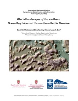
Glacial Landscapes of the Southern Green Bay Lobe and the Northern Kettle Moraine
Field trip guidebook from the International Glaciological Society Symposium on Glacial Erosion and Sedimentation, May 15, 2019. -
Central Sands Lakes Study: Annotated Bibliography
The authors of this open-file report scoured the literature for previous studies about the Central Sands area. This bibliography provides an overview of available research related to the hydrogeologic setting and water-budget components of the Central Sands Lakes Study (CSLS). -
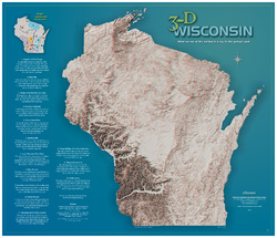
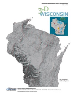
3-D Wisconsin
When viewed with 3-D glasses, Wisconsin’s land features pop off the page. Brief descriptions of major land forms paint the geologic history that shaped the state; expanded descriptions and photos are online. We’ve field-tested this map on fourth graders and can attest to its appeal. Sizes: 27.5 x 32 inches, 8.5 x 11 inches. Requires red-blue 3-D glasses. -
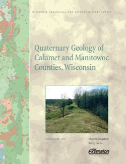
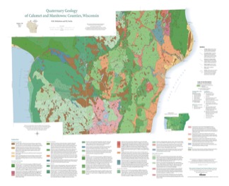
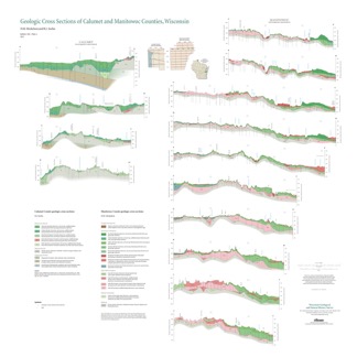
Quaternary Geology of Calumet and Manitowoc Counties, Wisconsin
All of what is now Calumet and Manitowoc Counties was covered by ice during the last great glaciation, between 30,000 and 11,000 years ago. This bulletin explains the glacial history, interprets the deposits left behind, and portrays the distribution of the deposits on a map and cross sections. This report should be useful to planners and development...-
Quaternary Geology of Calumet and Manitowoc Counties, Wisconsin [GIS data]
2017
GIS Data: Shapefiles (.shp file format)
-
Quaternary Geology of Calumet and Manitowoc Counties, Wisconsin [plate 1]
2017
Plate: 35.5 in x 29 in, scale 1:100,000
-
Geologic Cross Sections of Calumet and Manitowoc Counties, Wisconsin [plate 2]
2017
Plate: 36.67 in x 36.67 in, scale 1:100,000
-
Quaternary Geology of Door County, Wisconsin
Traces the complex glacial history of Door County. Map shows glacial units with shaded relief.-
Quaternary Geology of Door County, Wisconsin [GIS data]
2016
GIS Data: Shapefiles (.shp file format)
-
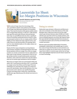
Laurentide Ice Sheet: Ice-Margin Positions in Wisconsin
Series of 43 page-size maps showing the chronology of the last glaciation's advances and retreats across Wisconsin. Includes a brief discussion about how the maps were made, how lake positions were determined, as well as a list of selected references. -
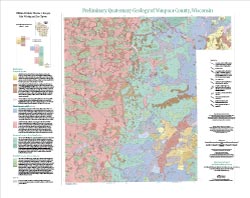
Preliminary Quaternary Geology of Waupaca County, Wisconsin
This open-file report contains a map (PDF) and GIS data (shapefiles) of the glacial and post-glacial deposits of Waupaca County in central Wisconsin. This map and GIS data were superseded by a Map Series publication in 2023: https://doi.org/10.54915/bger3320.-
Preliminary Quaternary Geology of Waupaca County, Wisconsin [plate 1]
2015
Map: 29 in x 23 in, scale 1:100,000
-
Preliminary Quaternary Geology of Waupaca County, Wisconsin [GIS data]
2015
GIS Data: Shapefiles (.shp file format)
-

Publications Catalog
Wisconsin Geological and Natural History Survey