-
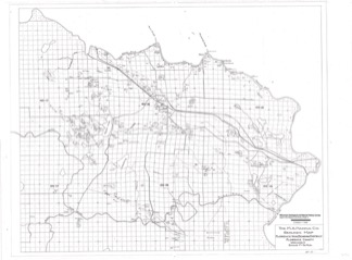
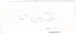
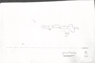
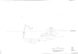
Florence Iron Mine: Historical Maps Showing Location of Surface Development, Regional Setting, and Underground Workings
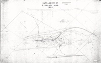
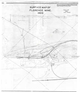
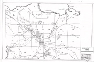
From 1880 to 1931, an extensive iron mine operated near the city of Florence in northeast Wisconsin. These 21 maps from its middle years of operation are the only surviving records of what exists below the surface. These maps are of historical interest for their record of surface features that are no longer in existence. They may also have potential...-
Extent of Florence Mine Surface Development in 1903 [plate 1]
2021
Map: 56 in x 35.1 in, scale 1 in = 100 ft
-
Florence Mine Surface Development in 1903 With Annotated Shaft Locations [plate 2]
2021
Map: 33.3 in x 38.2 in, scale 1 in = 100 ft
-
Mines in the Area Adjacent to the City of Florence in 1928 [plate 3]
2021
Map: 29.7 in x 19.7 in, scale 1 in = 1/4 mile
-
Florence Iron Mining District Covering Part of Florence County [plate 4]
2021
Map: 36.3 in x 26.8 in, scale 1 in = 1/2 mile
-
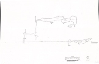
Florence Mine Level 1 With Annotated Shaft Locations and Surface Features [plate 5]
2021
Map: 52.8 in x 24.3 in, scale 1 in = 100 ft
-
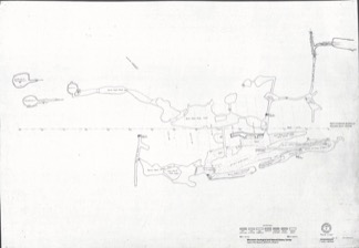
Florence Mine Level 1 (1910), Northwest Ore Zone [plate 7]
2021
Map: 27 in x 19 in, scale 1 in = 60 ft
-
Florence Mine Level 2 (1907), Northwest Ore Zone [plate 9]
2021
Map: 27.1 in x 18.8 in, scale 1 in = 60 ft
- 12 more...
-
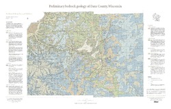
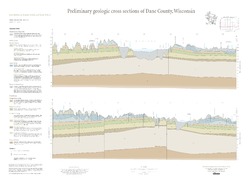
Preliminary Bedrock Geology of Dane County, Wisconsin
This map, produced at a scale of 1:100,000, reveals the intricate layers of bedrock below Dane County. Available as a map (plate 1), cross sections (plate 2), and GIS data. Open-file report; contains unpublished data that has not yet been peer-reviewed.-
Preliminary Bedrock Geology of Dane County, Wisconsin [plate 1]
2013
Map: 39 in x 25 in, scale 1:100,000
-
Preliminary Bedrock Geology of Dane County, Wisconsin [GIS data]
2013
GIS Data: Documents (.pdf file format), shapefiles (.shp file format)
-
-
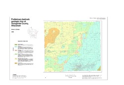
Preliminary Bedrock Geologic Map of Outagamie County, Wisconsin
Open-file report; contains unpublished data that has not yet been peer-reviewed.-
Preliminary Bedrock Geologic Map of Outagamie County, Wisconsin
2005
Map: 38 in x 26 in, scale 1:100,000
-
-
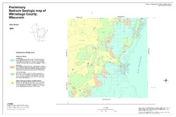
Preliminary Bedrock Geologic Map of Winnebago County, Wisconsin
Open-file report; contains unpublished data that has not yet been peer-reviewed.-
Preliminary Bedrock Geologic Map of Winnebago County, Wisconsin
2004
Map: 33.75 in x 22.5 in, scale 1:100,000
-
-
Preliminary Analysis of Aeromagnetic Data in Southern Wisconsin: The Role of Precambrian Basement in Paleozoic Evolution
Open-file report; contains unpublished data that has not yet been peer-reviewed.-
Preliminary Analysis of Aeromagnetic Data in Southern Wisconsin: The Role of Precambrian Basement in Paleozoic Evolution
2001
Data: Plain text files (.txt file format), documents (.pdf and .doc file formats), images (.jpg file format), spreadsheets (.xls file format)
-
-
Aggregate Resources of the Sinnipee Group in Eastern and Southern Wisconsin
Open-file report; contains unpublished data that has not yet been peer-reviewed. -
International Geological Correlation Project 426: Granite Systems and Proterozoic Lithospheric Processes: 1998 International Field Conference: Proterozoic Granite Systems of the Penokean Terrane in Wisconsin
Open-file report; contains unpublished data that has not yet been peer-reviewed. -
A Reconnaissance Survey of Wells in Eastern Wisconsin for Indications of Mississippi Valley Type Mineralization
Open-file report; contains unpublished data that has not yet been peer-reviewed. -
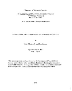
Summary of Field Mapping in the Superior Map Sheet, Wisconsin
Open-file report; contains unpublished data that has not yet been peer-reviewed. -
Geology of Wisconsin - Outcrop Descriptions
These descriptions illustrate various geologic formations, features, and characteristics. Individual descriptions are one to ten pages long, and include a map with specific location, a description of geologic features, and a discussion of the geologic significance.-
Adams County: Upper Wisconsin Dells (T14N R6E Sec28)
Report: 3 p.
-
Adams County: Friendship Mound (T17N R6E Sec5)
Report: 2 p.
-
Adams County: Hamilton Mound (T20N R6E Sec36)
Report: 4 p.
-
Ashland County: Mt. Whittelsey (T44N R2W Sec9A)
Report: 3 p.
-
Ashland County: Mellen Gabbro (T45N R2W Sec30)
Report: 3 p.
-
Ashland County: Mellen Granite (T45N R2W Sec31)
Report: 3 p.
-
Ashland County: White River (T46N R4W Sec6)
Report: 2 p.
-
Bayfield County: South Fish Creek (T47N R5W Sec20)
Report: 2 p.
- 123 more...
-
-
Lower Proterozoic Volcanic Rocks and Their Setting in the Southern Lake Superior District
Reprinted from Geological Society of America Memoir 160. -
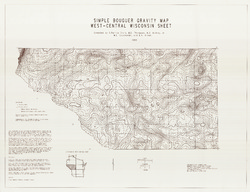
Simple Bouguer Anomaly Gravity Map, West Central Wisconsin Sheet
-
Simple Bouguer Gravity Map, West-Central Wisconsin Sheet
1993
Map: 43.3 in x 33.2 in, scale 1:250,000
-
-
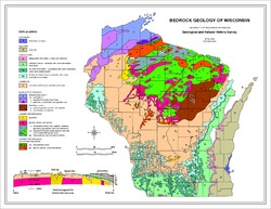
Bedrock Geology of Wisconsin, West-Central Sheet
Types of bedrock, formation names, major faults, and time period of formation.-
Bedrock Geology of Wisconsin, West-Central Sheet [GIS data]
1988
GIS Data: GeMS file geodatabase (.gdb file format)
-
Bedrock Geology of Wisconsin, Northeast Sheet
Types of bedrock, formation names, major faults, and time period of formation.-
Bedrock Geology of Wisconsin, Northeast Sheet [GIS data]
1984
GIS Data: GeMS file geodatabase (.gdb file format)
-
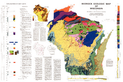
Bedrock Geologic Map of Wisconsin
Describes the types of rocks found throughout the state by age and explains how to interpret the accompanying cross section.-
Bedrock Geologic Map of Wisconsin [GIS data]
1982
GIS Data: MrSID files (.sid file format), coverage (.e00 file format)
-
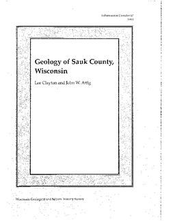
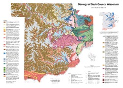
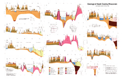
Geology of Sauk County, Wisconsin
Geologic history and description of Sauk County, the home of Devils Lake and Parfreys Glen. Includes four-color bedrock map and cross sections. Map and cross sections are folded.-
GIS Data for the Geology of Sauk County, Wisconsin (version 2) [dataset 1]
1990
GIS Data: GeMS Level 3 file geodatabase (.gdb file format), shapefiles (.shp file format)
-
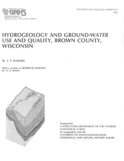
Hydrogeology and Ground-Water Use and Quality, Brown County, Wisconsin
-
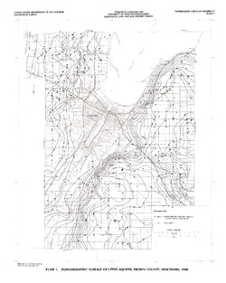
Potentiometric Surface of Upper Aquifer, Brown County, Wisconsin, 1980 [plate 1]
1986
Map: 20 in x 25 in, scale 1:100,000
-
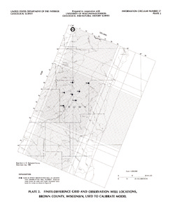
Finite-Difference Grid and Observation Well Locations, Brown County, Wisconsin, Used to Calibrate Model [plate 2]
1986
Map: 16 in x 19 in, scale 1:500,000
-
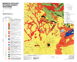
Bedrock Geology of Wood County, Wisconsin
-
Bedrock Geology of Wood County, Wisconsin [GIS data]
1986
GIS Data: Shapefiles (.shp file format), MrSID files (.sid file format)
-
-
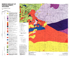
Bedrock Geology of Portage County, Wisconsin
-
GIS Data for Bedrock Geology of Portage County, Wisconsin (version 2) [dataset 1]
1986
GIS Data: GeMS Level 3 file geodatabase (.gdb file format)
-

Publications Catalog
Wisconsin Geological and Natural History Survey