-
Irrigable Lands Inventory--Phase I Groundwater and Related Information
This paper contains hydrogeologic information for the Golden Sands Resource Conservation and Development Area in central Wisconsin. The set of maps includes water-table elevation maps for the following counties: Adams, Jackson, Juneau, Marathon, Marquette, Monroe, Portage, Waupaca, Waushara, and Wood (scale 1:126,720). It also includes a regional aquifer...-
Irrigable Lands Inventory - Phase I Groundwater and Related Information
1981
Report: 13 p., 11 maps, scale 1:126,720 and 1:500,000
- 2 more...
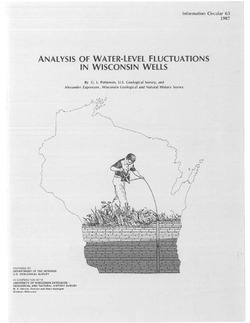
-
-
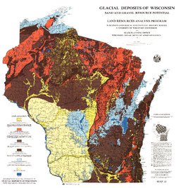
Glacial Deposits of Wisconsin: Sand and Gravel Resource Potential
Color map showing outwash, ground moraine, end moraine, and glacial deposits.-
Glacial Deposits of Wisconsin: Sand and Gravel Resource Potential
1976
Map: 45 in x 43.25 in, scale 1:500,000
-
-
Pleistocene Geology of Wood County, Wisconsin
-
Pleistocene Geology of Wood County, Wisconsin [GIS data]
1991
GIS Data: Shapefiles (.shp file format), MrSID files (.sid file format)
-
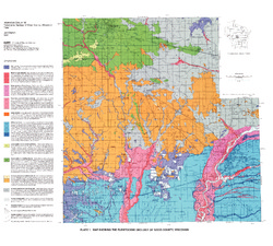
Map Showing the Pleistocene Geology of Wood County, Wisconsin [plate 1]
1991
Map: 25.5 in x 23 in, scale 1:100,000
-
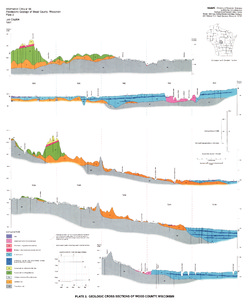
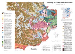
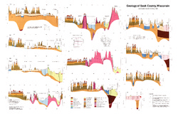
Geology of Sauk County, Wisconsin
Geologic history and description of Sauk County, the home of Devils Lake and Parfreys Glen. Includes four-color bedrock map and cross sections. Map and cross sections are folded.-
GIS Data for the Geology of Sauk County, Wisconsin (version 2) [dataset 1]
1990
GIS Data: GeMS Level 3 file geodatabase (.gdb file format), shapefiles (.shp file format)
-
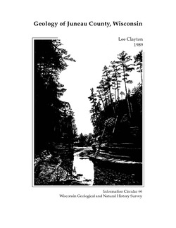
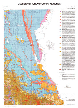
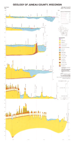
Geology of Juneau County, Wisconsin
-
GIS Data for the Geology of Juneau County, Wisconsin (version 2) [dataset 1]
1989
GIS Data: GeMS Level 3 file geodatabase (.gdb file format), shapefiles (.shp file format)
-
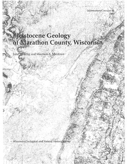
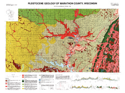
Pleistocene Geology of Marathon County, Wisconsin
-
Pleistocene Geology of Marathon County, Wisconsin (version 3) [GIS data]
1989
GIS Data: GeMS Level 3 file geodatabase (.gdb file format)
-
Pleistocene Geology of Marathon County, Wisconsin [plate 1]
1989
Map: 37.5 in x 28 in, scale 1:100,000
-
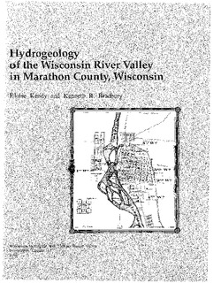
Hydrogeology of the Wisconsin River Valley in Marathon County, Wisconsin
-
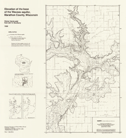
Elevation of the Base of the Wausau Aquifer, Marathon County, Wisconsin [plate 1]
1988
Map: 21.3 in x 23.3 in, scale 1:100,000
-
Elevation of the Water Table in the Wisconsin River Valley, Marathon County, Wisconsin [plate 2]
1988
Map: 21.3 in x 23.4 in, scale 1:100,000
-
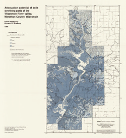
Attenuation Potential of Soils Overlying Parts of the Wisconsin River Valley, Marathon County, Wisconsin [plate 3]
1988
Map: 21.4 in x 23.3 in, scale 1:100,000

Publications Catalog
Wisconsin Geological and Natural History Survey