-
Atlas of the Geological Survey of Wisconsin
Collection of most of the plates accompanying Chamberlin's four-volume Geology of Wisconsin: Survey of 1873-1879.-
Atlas of the Geological Survey of Wisconsin: General Geological Map of Wisconsin [plate 1]
1882
Map: 25.5 in x 30.3 in, scale 1 in = 15 miles
-
Atlas of the Geological Survey of Wisconsin: General Map of Quaternary Formations [plate 2]
1882
Map: 28.2 in x 32.4 in
-
Atlas of the Geological Survey of Wisconsin: General Map of Native Vegetation [plate 2A]
1882
Map: 28.2 in x 32.4 in
-
Atlas of the Geological Survey of Wisconsin: General Map of Soils [plate 2B]
1882
Map: 28.2 in x 32.5 in
-
Atlas of the Geological Survey of Wisconsin: Map of Rainfall and Temperature [plate 2C]
1882
Map: 27.7 in x 32.5 in
-
Atlas of the Geological Survey of Wisconsin: Maps of Subsoils and Native Vegetation of Eastern Wisconsin [plate 3]
1877
Map: 27.82 in x 32.17 in, scale 1 in = 12 miles
-
Atlas of the Geological Survey of Wisconsin: Maps of Topography and Quaternary Formations of Eastern Wisconsin [plate 4]
1877
Map: 27.83 in x 32.06 in, scale 1 in = 12 miles
-
Atlas of the Geological Survey of Wisconsin: Geology and Topography of the Lead Region [plate 5]
1877
Map: 27.68 in x 32.18 in
-
Atlas of the Geological Survey of Wisconsin: Geology and Topography of the Lead Region [plate 6]
1877
Map: 23.98 in x 28.94 in
-
Atlas of the Geological Survey of Wisconsin: Geology and Topography of the Lead Region [plate 8]
1877
Map: 24.03 in x 28.38 in
- 32 more...
-
-
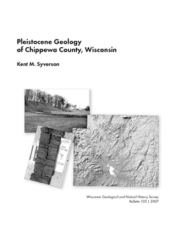
Pleistocene Geology of Chippewa County, Wisconsin
-
Pleistocene Geology of Chippewa County, Wisconsin (version 2) [GIS data]
2007
GIS Data: GeMS file geodatabase (.gdb file format)
-
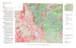
Pleistocene Geologic Map of Chippewa County, Wisconsin [plate 1]
2007
Plate: 36 in x 23 in, scale 1:100,000
-
Pleistocene Geologic Cross Sections of Chippewa County, Wisconsin [plate 2]
2007
Plate: 16.5 in x 9.4 in, scale 1:100,000
-
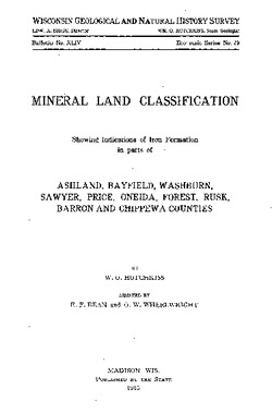
Mineral Land Classification, Showing Indications of Iron Formation in Parts of Ashland, Bayfield, Washburn, Sawyer, Price, Oneida, Forest, Rusk, Barron, and Chippewa Counties
-
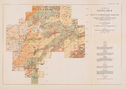
Map Showing Geology of Part of Northwestern Wisconsin Including Parts of Ashland, Bayfield, Washburn, Sawyer, Price, Oneida, Barron, Rusk, and Chippewa Counties [plate 1]
1915
Map: 20.7 in x 13.5 in, scale 1 in = 6 miles

Publications Catalog
Wisconsin Geological and Natural History Survey