-
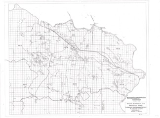
Florence Iron Mine: Historical Maps Showing Location of Surface Development, Regional Setting, and Underground Workings
From 1880 to 1931, an extensive iron mine operated near the city of Florence in northeast Wisconsin. These 21 maps from its middle years of operation are the only surviving records of what exists below the surface. These maps are of historical interest for their record of surface features that are no longer in existence. They may also have potential...-
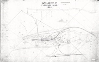
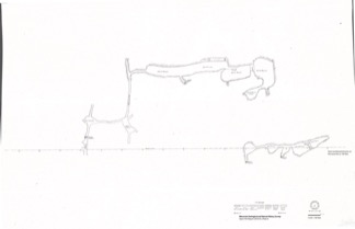
Extent of Florence Mine Surface Development in 1903 [plate 1]
2021
Map: 56 in x 35.1 in, scale 1 in = 100 ft
-
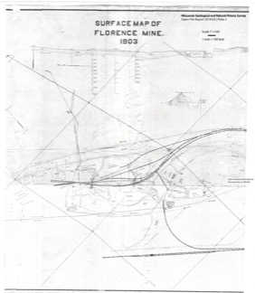
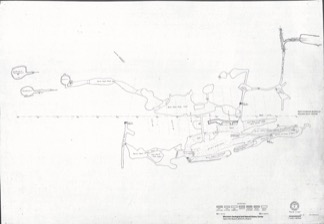
Florence Mine Surface Development in 1903 With Annotated Shaft Locations [plate 2]
2021
Map: 33.3 in x 38.2 in, scale 1 in = 100 ft
-
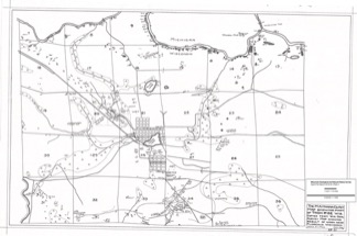
Mines in the Area Adjacent to the City of Florence in 1928 [plate 3]
2021
Map: 29.7 in x 19.7 in, scale 1 in = 1/4 mile
-
Florence Iron Mining District Covering Part of Florence County [plate 4]
2021
Map: 36.3 in x 26.8 in, scale 1 in = 1/2 mile
-
Florence Mine Level 1 With Annotated Shaft Locations and Surface Features [plate 5]
2021
Map: 52.8 in x 24.3 in, scale 1 in = 100 ft
-
Florence Mine Level 1 (1910), Northwest Ore Zone [plate 7]
2021
Map: 27 in x 19 in, scale 1 in = 60 ft
-
Florence Mine Level 2 (1907), Northwest Ore Zone [plate 9]
2021
Map: 27.1 in x 18.8 in, scale 1 in = 60 ft
- 12 more...
-
Characterization of Groundwater Resources in the Chequamegon-Nicolet National Forest, Wisconsin
Results of a comprehensive review and analysis of groundwater resources in the Chequamegon-Nicolet National Forest. The study was divided by location into four reports corresponding to the four main land units: Medford, Nicolet, Park Falls, and Washburn/Great Divide. Each report describes the results of the inventory, modeling, and analysis.-
Characterization of Groundwater Resources in the Chequamegon-Nicolet National Forest, Wisconsin: Medford Unit [GIS data]
2018
GIS Data: File geodatabase (.gdb file format)
-
Characterization of Groundwater Resources in the Chequamegon-Nicolet National Forest, Wisconsin: Medford Unit [plates]
2018
Map: 10 maps, 11 in x 17 in
-
Characterization of Groundwater Resources in the Chequamegon-Nicolet National Forest, Wisconsin: Nicolet Unit [GIS data]
2018
GIS Data: File geodatabase (.gdb file format)
-
Characterization of Groundwater Resources in the Chequamegon-Nicolet National Forest, Wisconsin: Nicolet Unit [plates]
2018
Map: 20 maps (10 each, northern and southern Nicolet Unit), 11 in x 17 in
-
Characterization of Groundwater Resources in the Chequamegon-Nicolet National Forest, Wisconsin: Park Falls Unit [GIS data]
2018
GIS Data: File geodatabase (.gdb file format)
-
Characterization of Groundwater Resources in the Chequamegon-Nicolet National Forest, Wisconsin: Park Falls Unit [plates]
2018
Map: 10 maps, 11 in x 17 in
- 2 more...
-
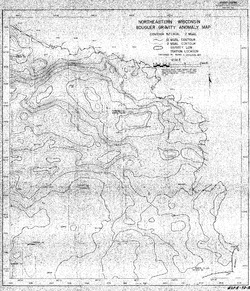
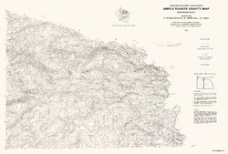
Bouguer Gravity Anomaly Map of Northeastern Wisconsin
Open-file report; contains unpublished data that has not yet been peer-reviewed. -
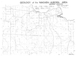
Geology of the Niagara-Aurora Area
Open-file report; contains unpublished data that has not yet been peer-reviewed. -
Bedrock Geology of Wisconsin, Northeast Sheet
Types of bedrock, formation names, major faults, and time period of formation.-
Bedrock Geology of Wisconsin, Northeast Sheet [GIS data]
1984
GIS Data: GeMS file geodatabase (.gdb file format)
-
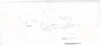
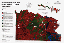
Pleistocene Geology of Florence County, Wisconsin
-
Pleistocene Geology of Florence County, Wisconsin (version 3) [GIS data]
1986
GIS Data: GeMS Level 3 file geodatabase (.gdb file format)
-
Pleistocene Geology of Florence County, Wisconsin [plate 1]
1986
Map: 26.8 in x 18.2 in, scale 1:100,000
-
Atlas of the Geological Survey of Wisconsin
Collection of most of the plates accompanying Chamberlin's four-volume Geology of Wisconsin: Survey of 1873-1879.-
Atlas of the Geological Survey of Wisconsin: General Geological Map of Wisconsin [plate 1]
1882
Map: 25.5 in x 30.3 in, scale 1 in = 15 miles
-
Atlas of the Geological Survey of Wisconsin: General Map of Quaternary Formations [plate 2]
1882
Map: 28.2 in x 32.4 in
-
Atlas of the Geological Survey of Wisconsin: General Map of Native Vegetation [plate 2A]
1882
Map: 28.2 in x 32.4 in
-
Atlas of the Geological Survey of Wisconsin: General Map of Soils [plate 2B]
1882
Map: 28.2 in x 32.5 in
-
Atlas of the Geological Survey of Wisconsin: Map of Rainfall and Temperature [plate 2C]
1882
Map: 27.7 in x 32.5 in
-
Atlas of the Geological Survey of Wisconsin: Maps of Subsoils and Native Vegetation of Eastern Wisconsin [plate 3]
1877
Map: 27.82 in x 32.17 in, scale 1 in = 12 miles
-
Atlas of the Geological Survey of Wisconsin: Maps of Topography and Quaternary Formations of Eastern Wisconsin [plate 4]
1877
Map: 27.83 in x 32.06 in, scale 1 in = 12 miles
-
Atlas of the Geological Survey of Wisconsin: Geology and Topography of the Lead Region [plate 5]
1877
Map: 27.68 in x 32.18 in
-
Atlas of the Geological Survey of Wisconsin: Geology and Topography of the Lead Region [plate 6]
1877
Map: 23.98 in x 28.94 in
-
Atlas of the Geological Survey of Wisconsin: Geology and Topography of the Lead Region [plate 8]
1877
Map: 24.03 in x 28.38 in
- 32 more...
-
-
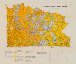
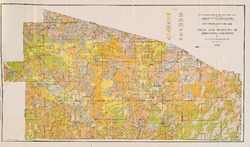
Reconnoissance [sic] Soil Survey of North Eastern Wisconsin
-
Soil Map: Wisconsin, Reconnoissance [sic] Survey - Northeastern Wisconsin Sheet
1916
Map: 23.6 in x 24.9 in, scale 1 in = 3 miles
-
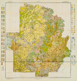
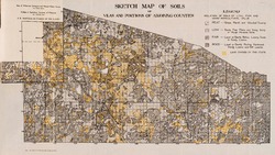
Special Report on the Reconnoissance [sic] Soil Survey of Vilas and Portions of Adjoining Counties, Wisconsin
-
Reconnoissance [sic] Soil Map of Vilas and Portions of Adjoining Counties
1915
Map: 24.6 in x 14.5 in, scale 1/2 in = 1 mile

Publications Catalog
Wisconsin Geological and Natural History Survey