-
The Driftless Area: The extent of unglaciated and similar terrains in Wisconsin, Illinois, Iowa, and Minnesota
The Driftless Area of southwestern Wisconsin and northwestern Illinois got its name from the lack of glacial sediment ("drift") covering the landscape. The surficial geology and topography of the Driftless Area are thus distinct from the surrounding region where multiple phases of glaciation left their mark. This pamphlet, a collaborative effort between...-
GIS data for the outline of the Driftless Area and similar terrains in Wisconsin, Illinois, Iowa, and Minnesota
2023
GIS Data: Shapefiles (.shp file format)
-
Page-sized and web-version maps of the Driftless Area and similar terrains in Wisconsin, Illinois, Iowa, and Minnesota
2023
Map: Documents (.pdf file format), images (.tif file format)
-
A Subsurface Study of the St. Peter Sandstone in Southern and Eastern Wisconsin
-
Structure Contour Map of the Pre-St. Peter Sandstone Erosion Surface in Southern and Eastern Wisconsin [plate 1]
1985
Map: 39.7 in x 23.5 in, scale 1:750,000
-
Paleogeologic Map of the Pre-St. Peter Sandstone Surface in Southern and Eastern Wisconsin & Thickness Map of the St. Peter Sandstone in Southern and Eastern Wisconsin [plate 2]
1985
Map: 39.4 in x 23.6 in, scale 1:750,000
-
Atlas of the Geological Survey of Wisconsin
Collection of most of the plates accompanying Chamberlin's four-volume Geology of Wisconsin: Survey of 1873-1879.-
Atlas of the Geological Survey of Wisconsin: General Geological Map of Wisconsin [plate 1]
1882
Map: 25.5 in x 30.3 in, scale 1 in = 15 miles
-
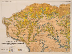
Atlas of the Geological Survey of Wisconsin: General Map of Quaternary Formations [plate 2]
1882
Map: 28.2 in x 32.4 in
-
Atlas of the Geological Survey of Wisconsin: General Map of Native Vegetation [plate 2A]
1882
Map: 28.2 in x 32.4 in
-
Atlas of the Geological Survey of Wisconsin: General Map of Soils [plate 2B]
1882
Map: 28.2 in x 32.5 in
-
Atlas of the Geological Survey of Wisconsin: Map of Rainfall and Temperature [plate 2C]
1882
Map: 27.7 in x 32.5 in
-
Atlas of the Geological Survey of Wisconsin: Maps of Subsoils and Native Vegetation of Eastern Wisconsin [plate 3]
1877
Map: 27.82 in x 32.17 in, scale 1 in = 12 miles
-
Atlas of the Geological Survey of Wisconsin: Maps of Topography and Quaternary Formations of Eastern Wisconsin [plate 4]
1877
Map: 27.83 in x 32.06 in, scale 1 in = 12 miles
-
Atlas of the Geological Survey of Wisconsin: Geology and Topography of the Lead Region [plate 5]
1877
Map: 27.68 in x 32.18 in
-
Atlas of the Geological Survey of Wisconsin: Geology and Topography of the Lead Region [plate 6]
1877
Map: 23.98 in x 28.94 in
-
Atlas of the Geological Survey of Wisconsin: Geology and Topography of the Lead Region [plate 8]
1877
Map: 24.03 in x 28.38 in
- 32 more...
-
-
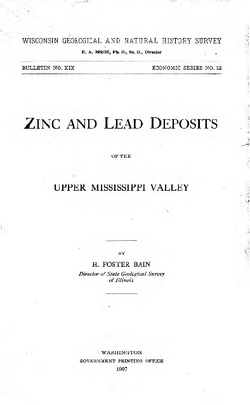
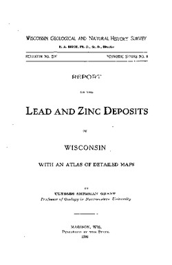
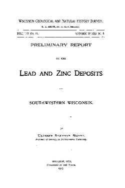
Report on Lead and Zinc Deposits of Wisconsin, with an Atlas of Detailed Geologic and Topographic Maps of Southwestern Wisconsin
-
Report on the Lead and Zinc Deposits of Wisconsin With an Atlas of Detailed Maps
1906
Report: 100 p.
-
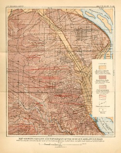
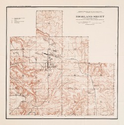
Highland Sheet of the Lead and Zinc District [topography] [plate 1]
1906
Map: 19.1 in x 19.2 in, scale 4 in = 1 mile
-
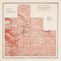
Highland Sheet of the Lead and Zinc District [geology] [plate 2]
1906
Map: 19.1 in x 19.1 in, scale 4 in = 1 mile
-
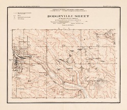
Dodgeville Sheet of the Lead and Zinc District [topography] [plate 3]
1906
Map: 14.8 in x 12.9 in, scale 4 in = 1 mile
-
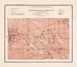
Dodgeville Sheet of the Lead and Zinc District [geology] [plate 4]
1906
Map: 15.0 in x 13.2 in, scale 4 in = 1 mile
-
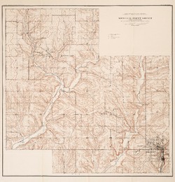
Mineral Point Sheet of the Lead and Zinc District [topography] [plate 5]
1906
Map: 19.9 in x 20.7 in, scale 4 in = 1 mile
-
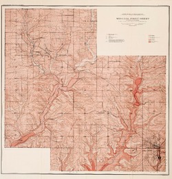
Mineral Point Sheet of the Lead and Zinc District [geology] [plate 6]
1906
Map: 19.9 in x 20.7 in, scale 4 in = 1 mile
-
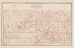
Mifflin Sheet of the Lead and Zinc District [topography] [plate 7]
1906
Map: 24.5 in x 17.3 in, scale 4 in = 1 mile
-
Mifflin Sheet of the Lead and Zinc District [geology] [plate 8]
1906
Map: 26.1 in x 16.8 in, scale 4 in = 1 mile
-
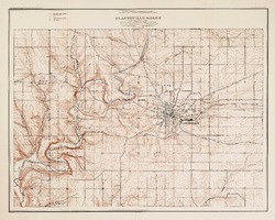
Platteville Sheet of the Lead and Zinc District [topography] [plate 9]
1906
Map: 20.6 in x 16.5 in, scale 4 in = 1 mile
- 16 more...
-

Publications Catalog
Wisconsin Geological and Natural History Survey