
Report on Lead and Zinc Deposits of Wisconsin, with an Atlas of Detailed Geologic and Topographic Maps of Southwestern Wisconsin
Data and Resources
-
Report on the Lead and Zinc Deposits of Wisconsin With an Atlas of Detailed Maps
1906
Report: 100 p.
-
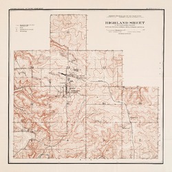
Highland Sheet of the Lead and Zinc District [topography] [plate 1]
1906
Map: 19.1 in x 19.2 in, scale 4 in = 1 mile
-
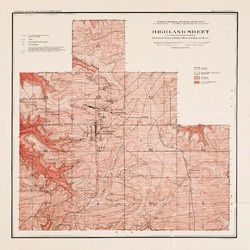
Highland Sheet of the Lead and Zinc District [geology] [plate 2]
1906
Map: 19.1 in x 19.1 in, scale 4 in = 1 mile
-
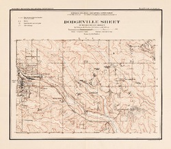
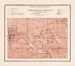
Dodgeville Sheet of the Lead and Zinc District [topography] [plate 3]
1906
Map: 14.8 in x 12.9 in, scale 4 in = 1 mile
-
Dodgeville Sheet of the Lead and Zinc District [geology] [plate 4]
1906
Map: 15.0 in x 13.2 in, scale 4 in = 1 mile
-
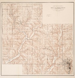
Mineral Point Sheet of the Lead and Zinc District [topography] [plate 5]
1906
Map: 19.9 in x 20.7 in, scale 4 in = 1 mile
-
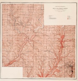
Mineral Point Sheet of the Lead and Zinc District [geology] [plate 6]
1906
Map: 19.9 in x 20.7 in, scale 4 in = 1 mile
-
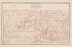
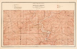
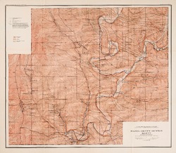
Mifflin Sheet of the Lead and Zinc District [topography] [plate 7]
1906
Map: 24.5 in x 17.3 in, scale 4 in = 1 mile
-
Mifflin Sheet of the Lead and Zinc District [geology] [plate 8]
1906
Map: 26.1 in x 16.8 in, scale 4 in = 1 mile
-
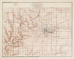
Platteville Sheet of the Lead and Zinc District [topography] [plate 9]
1906
Map: 20.6 in x 16.5 in, scale 4 in = 1 mile
-
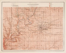
Platteville Sheet of the Lead and Zinc District [geology] [plate 10]
1906
Map: 20.5 in x 16.5 in, scale 4 in = 1 mile
-
Hazel Green-Benton Sheet of the Lead and Zinc District [topography] [plate 11]
1906
Map: 20.6 in x 17.9 in, scale 4 in = 1 mile
-
Hazel Green-Benton Sheet of the Lead and Zinc District [geology] [plate 12]
1906
Map: 20.6 in x 18.0 in, scale 4 in = 1 mile
-
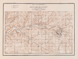
Shullsburg Sheet of the Lead and Zinc District [topography] [plate 13]
1906
Map: 22.9 in x 17.2 in, scale 4 in = 1 mile
-
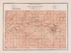
Shullsburg Sheet of the Lead and Zinc District [geology] [plate 14]
1906
Map: 23.0 in x 17.2 in, scale 4 in = 1 mile
-
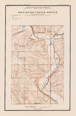
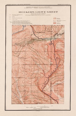
Meekers Grove Sheet of the Lead and Zinc District [topography] [plate 15]
1906
Map: 11.7 in x 17.8 in, scale 4 in = 1 mile
-
Meekers Grove Sheet of the Lead and Zinc District [geology] [plate 16]
1906
Map: 11.7 in x 17.8 in, scale 4 in = 1 mile
-
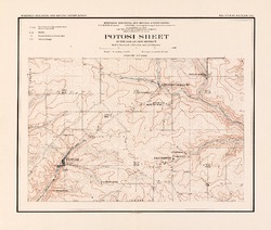
Potosi Sheet of the Lead and Zinc District [topography] [plate 17]
1906
Map: 15.1 in x 12.8 in, scale 4 in = 1 mile
-
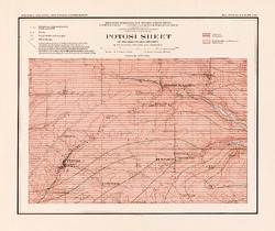
Potosi Sheet of the Lead and Zinc District [geology] [plate 18]
1906
Map: 15.1 in x 12.7 in, scale 4 in = 1 mile
-
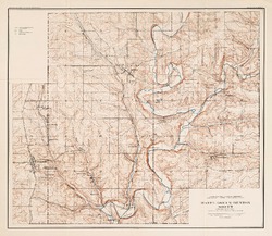
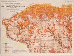
Geological Map of Grant, Iowa and Lafayette Counties, Wisconsin [plate 20]
1906
Map: 18.2 in x 13.9 in, scale 1 in = 4 miles
-
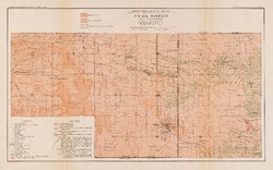
Cuba Sheet of the Lead and Zinc District [supplementary plate 1]
1906
Map: 26.1 in x 16.3 in, scale 4 in = 1 mile
-
Big Patch - Elk Grove Sheet of the Lead and Zinc District [supplementary plate 2]
1906
Map: 23.0 in x 15.0 in, scale 4 in = 1 mile
-
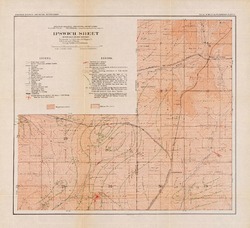
Ipswich Sheet of the Lead and Zinc District [supplementary plate 3]
1906
Map: 21.0 in x 19.1 in, scale 4 in = 1 mile
-
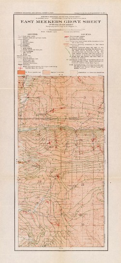
East Meekers Grove Sheet of the Lead and Zinc District [supplementary plate 4]
1906
Map: 11.3 in x 24.4 in, scale 4 in = 1 mile
-
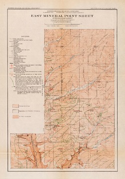
East Mineral Point Sheet of the Lead and Zinc District [supplementary plate 5]
1906
Map: 14.3 in x 20.4 in, scale 4 in = 1 mile
-
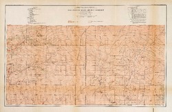
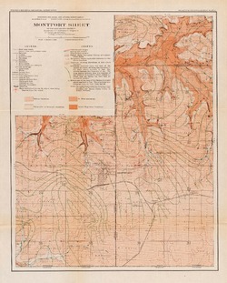
Montfort Sheet of the Lead and Zinc District [supplementary plate 6]
1906
Map: 18.0 in x 22.5 in, scale 4 in = 1 mile
Related Collections
-

Bulletin
View Bulletin