-
The Heavy, Non-Magnetic Residuals of Certain Samples Collected by the Wisconsin Geological Survey
Open-file report; contains unpublished data that has not yet been peer-reviewed. -
Limestones and Marls of Wisconsin
-
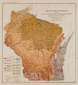
Geologic Map of Wisconsin Showing Locations From Which Samples of Limestone, Dolomite, Marl, Shale or Clay Were Analyzed [plate 6]
1924
Map: 15.5 in x 16.9 in, scale 1:1,000,000
-
Report on Lead and Zinc Deposits of Wisconsin, with an Atlas of Detailed Geologic and Topographic Maps of Southwestern Wisconsin
-
Report on the Lead and Zinc Deposits of Wisconsin With an Atlas of Detailed Maps
1906
Report: 100 p.
-
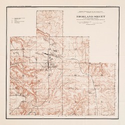
Highland Sheet of the Lead and Zinc District [topography] [plate 1]
1906
Map: 19.1 in x 19.2 in, scale 4 in = 1 mile
-
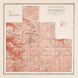
Highland Sheet of the Lead and Zinc District [geology] [plate 2]
1906
Map: 19.1 in x 19.1 in, scale 4 in = 1 mile
-
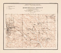
Dodgeville Sheet of the Lead and Zinc District [topography] [plate 3]
1906
Map: 14.8 in x 12.9 in, scale 4 in = 1 mile
-
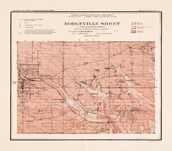
Dodgeville Sheet of the Lead and Zinc District [geology] [plate 4]
1906
Map: 15.0 in x 13.2 in, scale 4 in = 1 mile
-
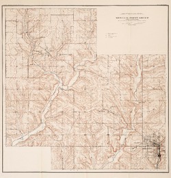
Mineral Point Sheet of the Lead and Zinc District [topography] [plate 5]
1906
Map: 19.9 in x 20.7 in, scale 4 in = 1 mile
-
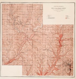
Mineral Point Sheet of the Lead and Zinc District [geology] [plate 6]
1906
Map: 19.9 in x 20.7 in, scale 4 in = 1 mile
-
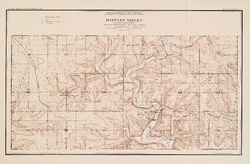
Mifflin Sheet of the Lead and Zinc District [topography] [plate 7]
1906
Map: 24.5 in x 17.3 in, scale 4 in = 1 mile
-
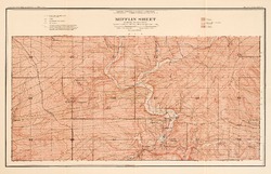
Mifflin Sheet of the Lead and Zinc District [geology] [plate 8]
1906
Map: 26.1 in x 16.8 in, scale 4 in = 1 mile
-
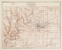
Platteville Sheet of the Lead and Zinc District [topography] [plate 9]
1906
Map: 20.6 in x 16.5 in, scale 4 in = 1 mile
- 16 more...
-

Publications Catalog
Wisconsin Geological and Natural History Survey