-
International Geological Correlation Project 426: Granite Systems and Proterozoic Lithospheric Processes: 1998 International Field Conference: Proterozoic Granite Systems of the Penokean Terrane in Wisconsin
Open-file report; contains unpublished data that has not yet been peer-reviewed. -
Volcanic Hosted Gold Occurrence in Marathon County, Wisconsin
Open-file report; contains unpublished data that has not yet been peer-reviewed. -
Uranium and Thorium Data for Selected Precambrian Rock Units in Northern Wisconsin
Open-file report; contains unpublished data that has not yet been peer-reviewed. -
A Structural Study of the Wausau Area
Open-file report; contains unpublished data that has not yet been peer-reviewed. -
Syenites and Nepheline Syenites of the Wausau Area
Open-file report; contains unpublished data that has not yet been peer-reviewed.-
Syenites and Nepheline Syenites of the Wausau Area
1945
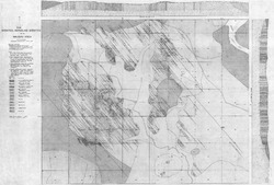
Map: 54 in x 36.4 in, scale 1 in = 1,000 feet
-
A Structural Study of the Wausau Area
Open-file report; contains unpublished data that has not yet been peer-reviewed. -
Report on the Nepheline Syenite of Marathon County, Wisconsin
Open-file report; contains unpublished data that has not yet been peer-reviewed. -
The Rib Mountain Red Granite
Open-file report; contains unpublished data that has not yet been peer-reviewed. -
Geology of Wisconsin - Outcrop Descriptions
These descriptions illustrate various geologic formations, features, and characteristics. Individual descriptions are one to ten pages long, and include a map with specific location, a description of geologic features, and a discussion of the geologic significance.-
Adams County: Upper Wisconsin Dells (T14N R6E Sec28)
Report: 3 p.
-
Adams County: Friendship Mound (T17N R6E Sec5)
Report: 2 p.
-
Adams County: Hamilton Mound (T20N R6E Sec36)
Report: 4 p.
-
Ashland County: Mt. Whittelsey (T44N R2W Sec9A)
Report: 3 p.
-
Ashland County: Mellen Gabbro (T45N R2W Sec30)
Report: 3 p.
-
Ashland County: Mellen Granite (T45N R2W Sec31)
Report: 3 p.
-
Ashland County: White River (T46N R4W Sec6)
Report: 2 p.
-
Bayfield County: South Fish Creek (T47N R5W Sec20)
Report: 2 p.
- 123 more...
-
-
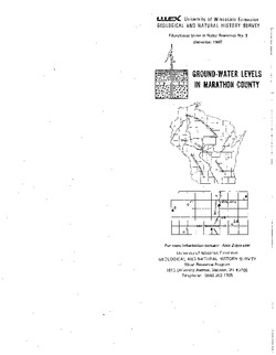
Irrigable Lands Inventory--Phase I Groundwater and Related Information
This paper contains hydrogeologic information for the Golden Sands Resource Conservation and Development Area in central Wisconsin. The set of maps includes water-table elevation maps for the following counties: Adams, Jackson, Juneau, Marathon, Marquette, Monroe, Portage, Waupaca, Waushara, and Wood (scale 1:126,720). It also includes a regional aquifer...-
Irrigable Lands Inventory - Phase I Groundwater and Related Information
1981
Report: 13 p., 11 maps, scale 1:126,720 and 1:500,000
- 2 more...
-
-
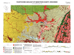
Pleistocene Geology of Marathon County, Wisconsin
-
Pleistocene Geology of Marathon County, Wisconsin (version 3) [GIS data]
1989
GIS Data: GeMS Level 3 file geodatabase (.gdb file format)
-
Pleistocene Geology of Marathon County, Wisconsin [plate 1]
1989
Map: 37.5 in x 28 in, scale 1:100,000
-
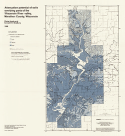
Hydrogeology of the Wisconsin River Valley in Marathon County, Wisconsin
-
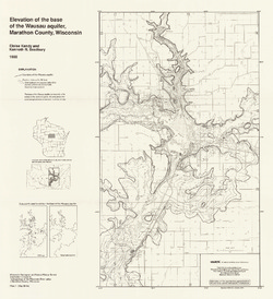
Elevation of the Base of the Wausau Aquifer, Marathon County, Wisconsin [plate 1]
1988
Map: 21.3 in x 23.3 in, scale 1:100,000
-
Elevation of the Water Table in the Wisconsin River Valley, Marathon County, Wisconsin [plate 2]
1988
Map: 21.3 in x 23.4 in, scale 1:100,000
-
Attenuation Potential of Soils Overlying Parts of the Wisconsin River Valley, Marathon County, Wisconsin [plate 3]
1988
Map: 21.4 in x 23.3 in, scale 1:100,000
-
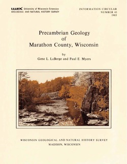
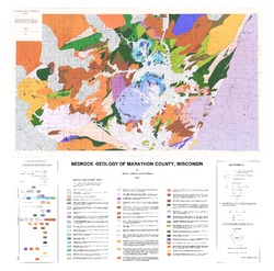
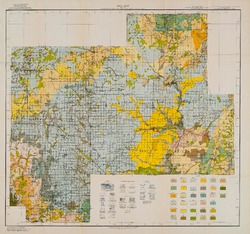
Precambrian Geology of Marathon County, Wisconsin
-
GIS Data for the Precambrian Geology of Marathon County, Wisconsin (version 2) [dataset 1]
1983
GIS Data: GeMS Level 3 file geodatabase (.gdb file format), shapefiles (.shp file format), GeoPackage (.gpkg file format)
-
Reconnoissance [sic] Soil Survey of South Part of North Central Wisconsin
-
Soil Map: Wisconsin, Reconnoissance [sic] Survey - South Part of the North-Central Wisconsin Sheet
1918
Map: 20.5 in x 19.2 in, scale 1 in = 3 miles
-
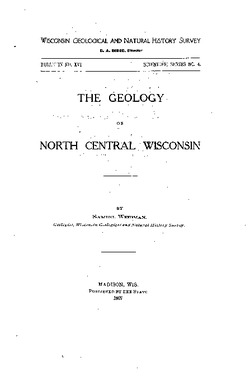
The Geology of North Central Wisconsin
-
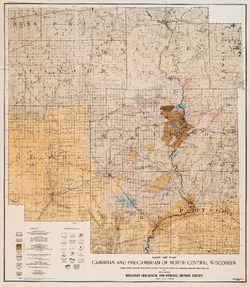
Map of the Cambrian and Pre-Cambrian of North Central Wisconsin: Clark, Wood, Portage, Marathon, Lincoln, Taylor and Parts of Langlade, Rusk and Price Counties [plate 1]
1907
Map: 20.0 in x 22.9 in, scale 1 in = 3 miles
-
Map of the Pleistocene of North Central Wisconsin: Clark, Wood, Portage, Marathon, Lincoln, Taylor and Parts of Langlade, Rusk and Price Counties [plate 2]
1907
Map: 20.1 in x 23.1 in, scale 1 in = 3 miles
-
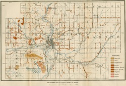
Map Showing Rock Outcrops in Vicinity of Athens and Upper Rib River [plate 8]
1907
Map: 13.6 in x 8.8 in
-
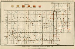
Map Showing Rock Outcrops in Vicinity of Arpin and Junction City [plate 12]
1907
Map: 15.1 in x 9.9 in
-
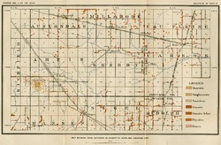
Map Showing Rock Outcrops in Vicinity of Hewitt and Rozellville [plate 15]
1907
Map: 10.9 in x 7.5 in

Publications Catalog
Wisconsin Geological and Natural History Survey