-
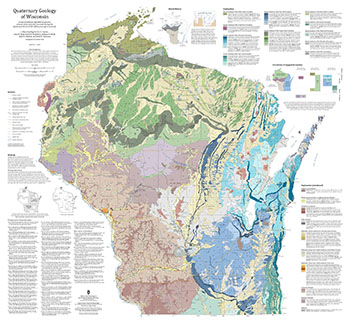
Quaternary Geology of Wisconsin
This 1:500,000 scale map of Wisconsin depicts sediment deposited by glaciers, streams, wind, and other processes during the Quaternary Period (2.58 million years ago to present). The map was made by compiling detailed Quaternary mapping and lithostratigraphic studies previously conducted by the WGNHS to generate consistent statewide Quaternary map units....-
GIS Data for the Quaternary Geology of Wisconsin (revised 2025) [dataset 1]
2025
GIS Data: GeMS file geodatabase, GeoPackage, shapefiles, metadata
-
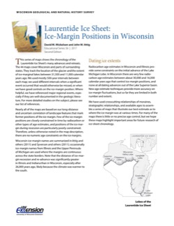
Laurentide Ice Sheet: Ice-Margin Positions in Wisconsin
Series of 43 page-size maps showing the chronology of the last glaciation's advances and retreats across Wisconsin. Includes a brief discussion about how the maps were made, how lake positions were determined, as well as a list of selected references. -
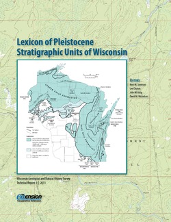
Lexicon of Pleistocene Stratigraphic Units of Wisconsin
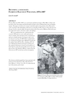
This 180-page book marks the first update in over 20 years to the collection of formal definitions of Wisconsin's Pleistocene units. Contains over 100 color maps, photographs, and figures as well as an extensive list of references. -
Geology of Wisconsin - Outcrop Descriptions
These descriptions illustrate various geologic formations, features, and characteristics. Individual descriptions are one to ten pages long, and include a map with specific location, a description of geologic features, and a discussion of the geologic significance.-
Adams County: Upper Wisconsin Dells (T14N R6E Sec28)
Report: 3 p.
-
Adams County: Friendship Mound (T17N R6E Sec5)
Report: 2 p.
-
Adams County: Hamilton Mound (T20N R6E Sec36)
Report: 4 p.
-
Ashland County: Mt. Whittelsey (T44N R2W Sec9A)
Report: 3 p.
-
Ashland County: Mellen Gabbro (T45N R2W Sec30)
Report: 3 p.
-
Ashland County: Mellen Granite (T45N R2W Sec31)
Report: 3 p.
-
Ashland County: White River (T46N R4W Sec6)
Report: 2 p.
-
Bayfield County: South Fish Creek (T47N R5W Sec20)
Report: 2 p.
- 123 more...
-
-
Geoscience Wisconsin Volume 18
History of Wisconsin Geologists-
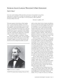
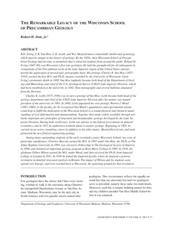
Chamberlin, Salisbury, and Collie: A Tale of Three Beloit College Geologists
2001
Journal Article: p. 9-20
-
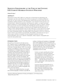
Sequence Stratigraphy at the Turn of the Century: E.O. Ulrich's Ozarkian System in Wisconsin
2001
Journal Article: p. 43-47
- 1 more...
-
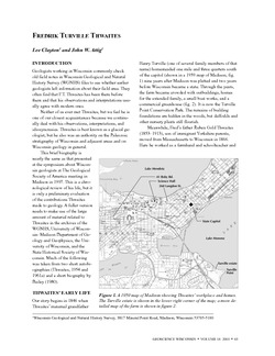
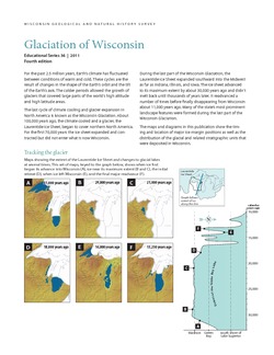
Glaciation of Wisconsin
Brief technical description of Wisconsin’s geologic history, glacial phases and lobes, and correlation and distribution of Pleistocene units. Heavily illustrated.

Publications Catalog
Wisconsin Geological and Natural History Survey