-
Depth to Silurian Bedrock in Eastern Wisconsin
Silurian-aged bedrock in eastern Wisconsin is shallow, fractured, and contains groundwater that is susceptible to surface water contamination. Revisions to Wisconsin state rules ATCP50 and NR151 to regulate manure spreading over this Silurian-aged bedrock create the need for a depth-to-bedrock map of eastern WI. The Wisconsin Geological and Natural...-
Depth to Silurian Bedrock in Eastern Wisconsin [dataset 1]
2025
GIS Data: File geodatabase (.gdb file format)
-
-
Water-Quality Indicators of Human Impacts to the Wetlands of Door County, Wisconsin
Door County, the narrow peninsula in eastern Wisconsin, is home to numerous wetlands, many of which are fed by groundwater. Poor-quality groundwater discharging to a wetland can alter the ecology of the wetland and harm native plant and animal communities. This report documents a one-year study of six wetlands. Researchers recorded water quality and... -
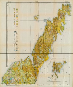
Quaternary Geology of Door County, Wisconsin
Traces the complex glacial history of Door County. Map shows glacial units with shaded relief.-
Quaternary Geology of Door County, Wisconsin [GIS data]
2016
GIS Data: Shapefiles (.shp file format)
-
Delineation of Areas Contributing Groundwater to Springs and Wetlands Supporting the Hine's Emerald Dragonfly, Door County, Wisconsin
Open-file report; contains unpublished data that has not yet been peer-reviewed. -
Field Verification of Capture Zones for Municipal Wells at Sturgeon Bay, Wisconsin: Final Report to the Wisconsin Department of Natural Resources
Open-file report; contains unpublished data that has not yet been peer-reviewed. -
Stratigraphic Controls on Distribution of Hydraulic Conductivity in Carbonate Aquifers
Open-file report; contains unpublished data that has not yet been peer-reviewed. -
Application of a Discrete Fracture Flow Model for Wellhead Protection at Sturgeon Bay, Wisconsin
Open-file report; contains unpublished data that has not yet been peer-reviewed. -
Correlation of High-Permeability Zones with Stratigraphic Features in the Silurian Dolomite, Sturgeon Bay, Wisconsin
Open-file report; contains unpublished data that has not yet been peer-reviewed. -
Hydrogeology and Groundwater Monitoring of Fractured Dolomite in the Upper Door Priority Watershed, Door County, Wisconsin
Open-file report; contains unpublished data that has not yet been peer-reviewed. -
Merging Pleistocene Lithostratigraphy with Geotechnical and Hydrogeologic Data--Examples from Eastern Wisconsin
Open-file report; contains unpublished data that has not yet been peer-reviewed. -
Cement Materials in Door County, Wisconsin
Open-file report; contains unpublished data that has not yet been peer-reviewed. -
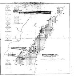
Structure and Oil Possibilities in Door County, Wisconsin
Open-file report; contains unpublished data that has not yet been peer-reviewed. -
A Subsurface Study of the St. Peter Sandstone in Southern and Eastern Wisconsin
-
Structure Contour Map of the Pre-St. Peter Sandstone Erosion Surface in Southern and Eastern Wisconsin [plate 1]
1985
Map: 39.7 in x 23.5 in, scale 1:750,000
-
Paleogeologic Map of the Pre-St. Peter Sandstone Surface in Southern and Eastern Wisconsin & Thickness Map of the St. Peter Sandstone in Southern and Eastern Wisconsin [plate 2]
1985
Map: 39.4 in x 23.6 in, scale 1:750,000
-
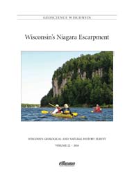
Geoscience Wisconsin Volume 22
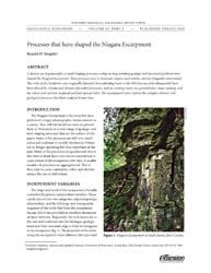
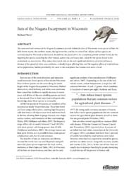
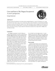
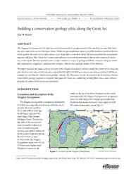
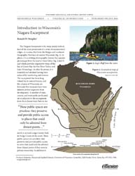
This special edition of Geoscience Wisconsin provides an overview of the Niagara Escarpment in Wisconsin. The papers cover the geology, processes that shaped the escarpment, biota, bats, caves and karst, and the concept of conservation geology.-
Geoscience Wisconsin, Volume 22: Wisconsin's Niagara Escarpment
2016
Journal: 86 p. (introduction, 6 articles)
-
-
Geoscience Wisconsin Volume 08
-
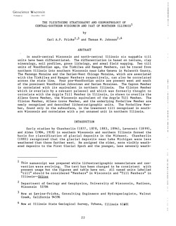
The Pleistocene Stratigraphy and Geomorphology of Central-Southern Wisconsin and Part of Northern Illinois
1983
Journal Article: p. 22-44
-
Geophysical Evidence That the Haeger Till Member Underlies Southern Western Lake Michigan
1983
Journal Article: p. 45-58
-
Atlas of the Geological Survey of Wisconsin
Collection of most of the plates accompanying Chamberlin's four-volume Geology of Wisconsin: Survey of 1873-1879.-
Atlas of the Geological Survey of Wisconsin: General Geological Map of Wisconsin [plate 1]
1882
Map: 25.5 in x 30.3 in, scale 1 in = 15 miles
-
Atlas of the Geological Survey of Wisconsin: General Map of Quaternary Formations [plate 2]
1882
Map: 28.2 in x 32.4 in
-
Atlas of the Geological Survey of Wisconsin: General Map of Native Vegetation [plate 2A]
1882
Map: 28.2 in x 32.4 in
-
Atlas of the Geological Survey of Wisconsin: General Map of Soils [plate 2B]
1882
Map: 28.2 in x 32.5 in
-
Atlas of the Geological Survey of Wisconsin: Map of Rainfall and Temperature [plate 2C]
1882
Map: 27.7 in x 32.5 in
-
Atlas of the Geological Survey of Wisconsin: Maps of Subsoils and Native Vegetation of Eastern Wisconsin [plate 3]
1877
Map: 27.82 in x 32.17 in, scale 1 in = 12 miles
-
Atlas of the Geological Survey of Wisconsin: Maps of Topography and Quaternary Formations of Eastern Wisconsin [plate 4]
1877
Map: 27.83 in x 32.06 in, scale 1 in = 12 miles
-
Atlas of the Geological Survey of Wisconsin: Geology and Topography of the Lead Region [plate 5]
1877
Map: 27.68 in x 32.18 in
-
Atlas of the Geological Survey of Wisconsin: Geology and Topography of the Lead Region [plate 6]
1877
Map: 23.98 in x 28.94 in
-
Atlas of the Geological Survey of Wisconsin: Geology and Topography of the Lead Region [plate 8]
1877
Map: 24.03 in x 28.38 in
- 32 more...
-

Publications Catalog
Wisconsin Geological and Natural History Survey