-
Elevation contours of the Precambrian surface of south-central Wisconsin
Elevation contour data and an accompanying report provide an updated interpretation of the elevation of the top of Precambrian bedrock in south-central Wisconsin. The elevation surface was developed from geologic and geophysical data, and provides new detail on the entrenched bedrock valleys that were incised into the north and south ranges of the Baraboo...-
Elevation contours of the Precambrian surface of south-central Wisconsin [dataset 1]
2022
GIS Data: File geodatabase (.gdb file format)
-
-
Groundwater Recharge in Calumet, Outagamie, and Winnebago Counties, Wisconsin, Estimated by a GIS-Based Water-Balance Model
Open-file report; contains unpublished data that has not yet been peer-reviewed. -
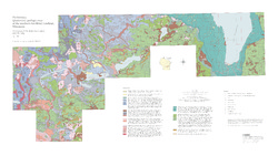
Preliminary Quaternary Geologic Map of the Southern Fox River Lowland, Wisconsin
Open-file report; contains unpublished data that has not yet been peer-reviewed.-
Preliminary Quaternary Geologic Map of the Southern Fox River Lowland, Wisconsin
2005
Map: 48 in x 27 in, scale 1:100,000
-
-
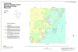
Preliminary Bedrock Geologic Map of Winnebago County, Wisconsin
Open-file report; contains unpublished data that has not yet been peer-reviewed.-
Preliminary Bedrock Geologic Map of Winnebago County, Wisconsin
2004
Map: 33.75 in x 22.5 in, scale 1:100,000
-
-
Preliminary Quaternary Geologic Map of the Central Fox River Lowland, Wisconsin
Open-file report; contains unpublished data that has not yet been peer-reviewed.-
Preliminary Quaternary Geologic Map of the Central Fox River Lowland, Wisconsin
2004
Map: 39 in x 32 in, scale 1:100,000
-
-
General Geology and Natural Resources of Winnebago County, Wisconsin: Field Trip Guide Book
Open-file report; contains unpublished data that has not yet been peer-reviewed. -
Aggregate Resources of the Sinnipee Group in Eastern and Southern Wisconsin
Open-file report; contains unpublished data that has not yet been peer-reviewed. -
Merging Pleistocene Lithostratigraphy with Geotechnical and Hydrogeologic Data--Examples from Eastern Wisconsin
Open-file report; contains unpublished data that has not yet been peer-reviewed. -
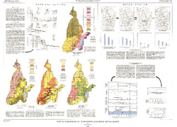
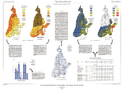
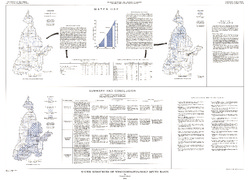
Water Resources of Wisconsin - Rock-Fox River Basin, Hydrologic Investigations Atlas HA-360
-
Water Resources of Wisconsin, Fox-Wolf River Basin: Plate 1, Physical Setting, Water System
1968
Plate: 38 in x 27.25 in
-
Water Resources of Wisconsin, Fox-Wolf River Basin: Plate 2, Ground Water
1968
Plate: 38 in x 27.25 in
-
-
A Subsurface Study of the St. Peter Sandstone in Southern and Eastern Wisconsin
-
Structure Contour Map of the Pre-St. Peter Sandstone Erosion Surface in Southern and Eastern Wisconsin [plate 1]
1985
Map: 39.7 in x 23.5 in, scale 1:750,000
-
Paleogeologic Map of the Pre-St. Peter Sandstone Surface in Southern and Eastern Wisconsin & Thickness Map of the St. Peter Sandstone in Southern and Eastern Wisconsin [plate 2]
1985
Map: 39.4 in x 23.6 in, scale 1:750,000
-
Geoscience Wisconsin Volume 17
-
Paleoecology and Sedimentology of the Prasopora Zonule in the Dunleith Formation (Ordovician), Upper Mississippi Valley
2007
Journal Article: p. 11-20
-
Trace-Element Signatures and Tectonic Affinities of Proterozoic A-Type Granites and Rhyolites in Central Wisconsin
2007
Journal Article: p. 35-51
-
Coupled Modeling of Gravity and Aeromagnetic Data to Estimate Subsurface Basement Topography in Southeastern Wisconsin
2007
Journal Article: p. 53-64
-
Geoscience Wisconsin Volume 08
-
The Pleistocene Stratigraphy and Geomorphology of Central-Southern Wisconsin and Part of Northern Illinois
1983
Journal Article: p. 22-44
-
Geophysical Evidence That the Haeger Till Member Underlies Southern Western Lake Michigan
1983
Journal Article: p. 45-58
-
Atlas of the Geological Survey of Wisconsin
Collection of most of the plates accompanying Chamberlin's four-volume Geology of Wisconsin: Survey of 1873-1879.-
Atlas of the Geological Survey of Wisconsin: General Geological Map of Wisconsin [plate 1]
1882
Map: 25.5 in x 30.3 in, scale 1 in = 15 miles
-
Atlas of the Geological Survey of Wisconsin: General Map of Quaternary Formations [plate 2]
1882
Map: 28.2 in x 32.4 in
-
Atlas of the Geological Survey of Wisconsin: General Map of Native Vegetation [plate 2A]
1882
Map: 28.2 in x 32.4 in
-
Atlas of the Geological Survey of Wisconsin: General Map of Soils [plate 2B]
1882
Map: 28.2 in x 32.5 in
-
Atlas of the Geological Survey of Wisconsin: Map of Rainfall and Temperature [plate 2C]
1882
Map: 27.7 in x 32.5 in
-
Atlas of the Geological Survey of Wisconsin: Maps of Subsoils and Native Vegetation of Eastern Wisconsin [plate 3]
1877
Map: 27.82 in x 32.17 in, scale 1 in = 12 miles
-
Atlas of the Geological Survey of Wisconsin: Maps of Topography and Quaternary Formations of Eastern Wisconsin [plate 4]
1877
Map: 27.83 in x 32.06 in, scale 1 in = 12 miles
-
Atlas of the Geological Survey of Wisconsin: Geology and Topography of the Lead Region [plate 5]
1877
Map: 27.68 in x 32.18 in
-
Atlas of the Geological Survey of Wisconsin: Geology and Topography of the Lead Region [plate 6]
1877
Map: 23.98 in x 28.94 in
-
Atlas of the Geological Survey of Wisconsin: Geology and Topography of the Lead Region [plate 8]
1877
Map: 24.03 in x 28.38 in
- 32 more...
-
-
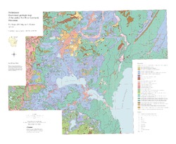
Quaternary Geology of Winnebago County, Wisconsin
-
Quaternary Geology of Winnebago County, Wisconsin (version 2) [GIS data]
2008
GIS Data: GeMS Level 3 file geodatabase (.gdb file format)
-
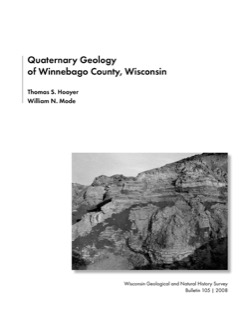
Quaternary Geologic Map of Winnebago County, Wisconsin [plate 1]
2008
Map: 25 in x 20 in, scale 1:100,000
-
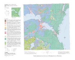
Geologic Cross Sections of Winnebago County, Wisconsin [plate 2]
2008
Plate: 25 in x 27 in, scale 1:100,000

Publications Catalog
Wisconsin Geological and Natural History Survey