-
Summary Sheets: Attributes of Wisconsin Lake Plants
Open-file report; contains unpublished data that has not yet been peer-reviewed. -
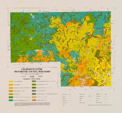
Original Vegetation Cover of Wisconsin
Based on the original land-survey records compiled between 1832 and 1866. Also available as set with Wisconsin Land Cover map. -
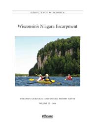
Geoscience Wisconsin Volume 22
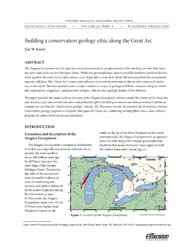
This special edition of Geoscience Wisconsin provides an overview of the Niagara Escarpment in Wisconsin. The papers cover the geology, processes that shaped the escarpment, biota, bats, caves and karst, and the concept of conservation geology.-
Geoscience Wisconsin, Volume 22: Wisconsin's Niagara Escarpment
2016
Journal: 86 p. (introduction, 6 articles)
-
-
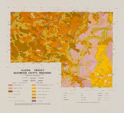
Atlas of the Geological Survey of Wisconsin
Collection of most of the plates accompanying Chamberlin's four-volume Geology of Wisconsin: Survey of 1873-1879.-
Atlas of the Geological Survey of Wisconsin: General Geological Map of Wisconsin [plate 1]
1882
Map: 25.5 in x 30.3 in, scale 1 in = 15 miles
-
Atlas of the Geological Survey of Wisconsin: General Map of Quaternary Formations [plate 2]
1882
Map: 28.2 in x 32.4 in
-
Atlas of the Geological Survey of Wisconsin: General Map of Native Vegetation [plate 2A]
1882
Map: 28.2 in x 32.4 in
-
Atlas of the Geological Survey of Wisconsin: General Map of Soils [plate 2B]
1882
Map: 28.2 in x 32.5 in
-
Atlas of the Geological Survey of Wisconsin: Map of Rainfall and Temperature [plate 2C]
1882
Map: 27.7 in x 32.5 in
-
Atlas of the Geological Survey of Wisconsin: Maps of Subsoils and Native Vegetation of Eastern Wisconsin [plate 3]
1877
Map: 27.82 in x 32.17 in, scale 1 in = 12 miles
-
Atlas of the Geological Survey of Wisconsin: Maps of Topography and Quaternary Formations of Eastern Wisconsin [plate 4]
1877
Map: 27.83 in x 32.06 in, scale 1 in = 12 miles
-
Atlas of the Geological Survey of Wisconsin: Geology and Topography of the Lead Region [plate 5]
1877
Map: 27.68 in x 32.18 in
-
Atlas of the Geological Survey of Wisconsin: Geology and Topography of the Lead Region [plate 6]
1877
Map: 23.98 in x 28.94 in
-
Atlas of the Geological Survey of Wisconsin: Geology and Topography of the Lead Region [plate 8]
1877
Map: 24.03 in x 28.38 in
- 32 more...
-
-
An Introduction to Wisconsin Wetlands
Description of the different types of wetlands in Wisconsin and their importance to the surrounding landscape. Illustrated with black and white photographs. -
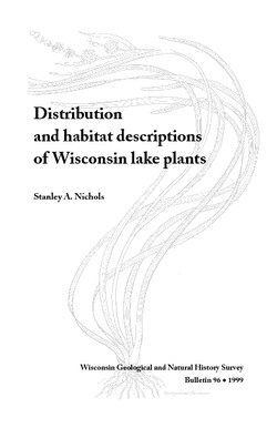
Distribution and Habitat Descriptions of Wisconsin Lake Plants
A catalog that features technical information and detailed drawings for more than 100 species of lake plants that range from the rare to the commonplace. Wire bound with plastic cover. -
On the Instincts and Habits of Solitary Wasps
An enchantingly written and beautifully illustrated treatise on solitary wasps. Written by a husband and wife team who devoted many hours of observation to the pursuit of solitary wasps.

Publications Catalog
Wisconsin Geological and Natural History Survey