Sandstones of the Wisconsin Coast of Lake Superior
Data and Resources
-
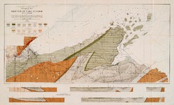
Geological Map of Part of West End of Lake Superior
1912
Map: 25.2 in x 15.2 in, scale 1 in = 3 miles
Related Collections
-

Bulletin
View Bulletin

1912
Map: 25.2 in x 15.2 in, scale 1 in = 3 miles