
Hydrographic Map of Lake Mendota, Dane County, Wisconsin, and of Its Adjacent Topography
Data and Resources
-
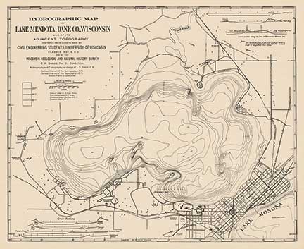
Hydrographic Map of Lake Mendota, Dane County, Wisconsin, and of Its Adjacent Topography
1900
Map: 24.9 in x 20.3 in, scale 1 in = 1/3 mile
-
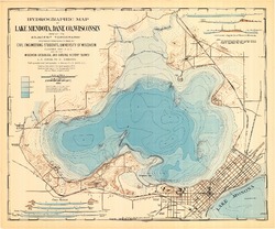
Hydrographic Map of Lake Mendota, Dane County, Wisconsin, and of Its Adjacent Topography
1900
Map: 24.9 in x 20.7 in, scale 1 in = 1/3 mile
Related Collections
-

Map
View Map