-
Water Resources of Wisconsin - Rock-Fox River Basin, Hydrologic Investigations Atlas HA-360
-
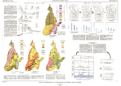
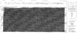
Water Resources of Wisconsin, Fox-Wolf River Basin: Plate 1, Physical Setting, Water System
1968
Plate: 38 in x 27.25 in
-
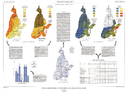
Water Resources of Wisconsin, Fox-Wolf River Basin: Plate 2, Ground Water
1968
Plate: 38 in x 27.25 in
-
-
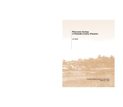
Pleistocene Geology of Wood County, Wisconsin
-
Pleistocene Geology of Wood County, Wisconsin [GIS data]
1991
GIS Data: Shapefiles (.shp file format), MrSID files (.sid file format)
-
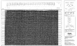
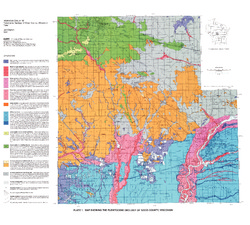
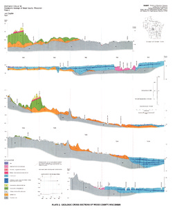
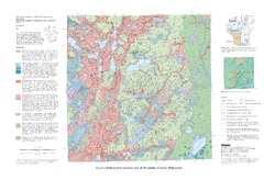
Map Showing the Pleistocene Geology of Wood County, Wisconsin [plate 1]
1991
Map: 25.5 in x 23 in, scale 1:100,000
-
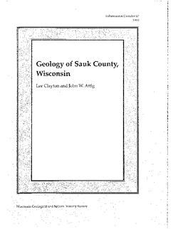
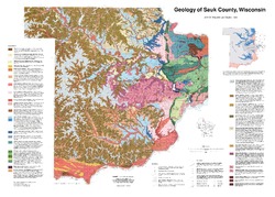
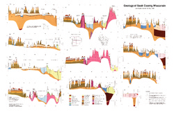
Geology of Sauk County, Wisconsin
Geologic history and description of Sauk County, the home of Devils Lake and Parfreys Glen. Includes four-color bedrock map and cross sections. Map and cross sections are folded.-
GIS Data for the Geology of Sauk County, Wisconsin (version 2) [dataset 1]
1990
GIS Data: GeMS Level 3 file geodatabase (.gdb file format), shapefiles (.shp file format)
-
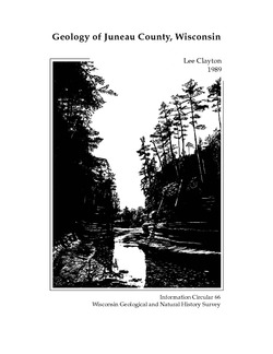
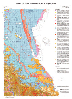
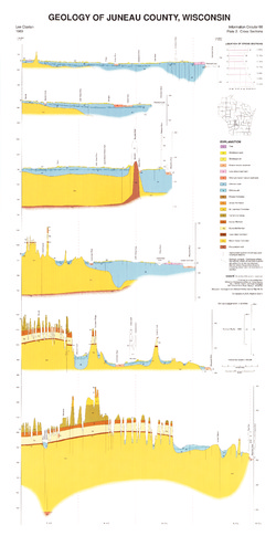
Geology of Juneau County, Wisconsin
-
GIS Data for the Geology of Juneau County, Wisconsin (version 2) [dataset 1]
1989
GIS Data: GeMS Level 3 file geodatabase (.gdb file format), shapefiles (.shp file format)
-
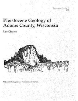
Pleistocene Geology of Adams County, Wisconsin
-
GIS Data for the Pleistocene Geology of Adams County, Wisconsin (version 2) [dataset 1]
1987
GIS Data: GeMS Level 3 file geodatabase (.gdb file format), shapefiles (.shp file format)
-
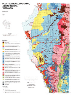
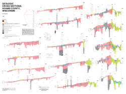
Pleistocene Geologic Map, Adams County, Wisconsin [plate 1]
1987
Map: 22 in x 28.5 in, scale 1:100,000
-
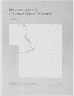
Pleistocene Geology of Portage County, Wisconsin
-
GIS Data for the Pleistocene Geology of Portage County, Wisconsin (version 2) [dataset 1]
1986
GIS Data: GeMS Level 3 file geodatabase (.gdb file format), shapefiles (.shp file format), GeoPackage (.gpkg file format)
-
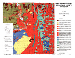
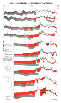
Pleistocene Geology of Portage County, Wisconsin [plate 1]
1986
Map: 28.5 in x 22 in, scale 1:100,000
-
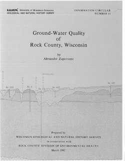
Ground-Water Quality of Rock County, Wisconsin
-
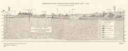
Generalized Geologic Cross Section of Rock County, West-East [plate 1]
1982
Plate: 23.9 in x 9.7 in, scale 1:100,000
-
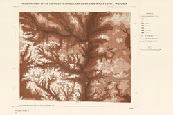
Preliminary Map of the Thickness of Unconsolidated Material in Rock County, Wisconsin [plate 2]
1982
Map: 29.7 in x 19.8 in, scale 1:100,000
-
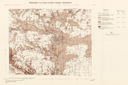
Permeability of Soils in Rock County, Wisconsin [plate 3]
1982
Map: 29.7 in x 19.7 in, scale 1:100,000
-
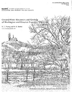
Ground-Water Resources and Geology of Washington and Ozaukee Counties, Wisconsin
-
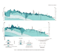
Geohydrologic Sections Through Washington and Ozaukee Counties, Wisconsin [plate 1]
1980
Plate: 19 in x 16 in
-
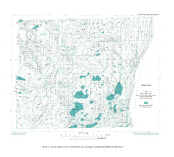
Water-Table Map of Washington and Ozaukee Counties, Wisconsin, Winter 1976-77
1980
Map: 20 in x 18 in, scale 1:125,000
-
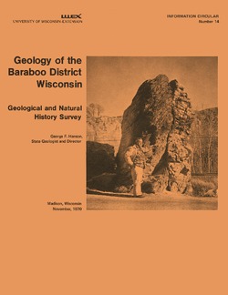
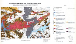
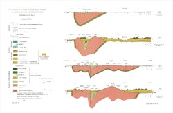
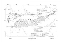
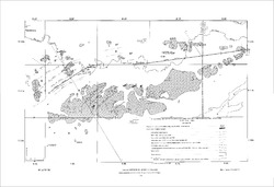
Geology of the Baraboo District, Wisconsin: A Description and Field Guide Incorporating Structural Analysis of the Precambrian Rocks and Sedimentologic Studies of the Paleozoic Strata
With summaries: Glacial Geology, R.F. Black; and Plant Ecology of the Baraboo Hills, J.H. Zimmerman.-
Geologic Map of the Baraboo District, Columbia and Sauk Counties, Wisconsin [plate 1]
1970
Map: 39.5 in x 22.7 in, scale 1:62,500
-
Geologic Cross Sections of the Baraboo District, Columbia and Sauk Counties, Wisconsin [plate 2]
1970
Plate: 32 in x 21 in
-
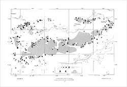
Map of Main Phase Minor Structures in the Baraboo Syncline, Columbia and Sauk Counties, Wisconsin [plate 3]
1970
Map: 31.5 in x 21.5 in
-
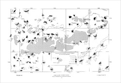
Structural Map of the Baraboo Syncline, Columbia and Sauk Counties, Wisconsin [plate 4]
1970
Map: 31.5 in x 21.5 in
-
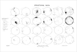
Structural Data: Lower Hemisphere Equal-Area Stereoplots of Structural Elements in the Baraboo Quartzite [plate 5]
1970
Plate: 31.5 in x 21.5 in
-
Orientations of Cross Stratification in Cambrian and Ordovician Sandstones [plate 7]
1970
Map: 31.5 in x 21.5 in
-
Quaternary Geology of Sheboygan County, Wisconsin
This report traces the advances and retreats of glaciers through Sheboygan County in eastern Wisconsin. Available as a bulletin, map, cross sections, and GIS data.-
Quaternary Geology of Sheboygan County, Wisconsin [GIS data]
2011
GIS Data: Shapefiles (.shp file format), MrSID files (.sid file format)
-
Quaternary Geology of Sheboygan County, Wisconsin [plate 1]
2011
Map: 32 in x 22 in, scale 1:100,000
-
Geologic Cross Sections of Sheboygan County, Wisconsin [plate 2]
2011
Plate: 33 in x 24 in, scale 1:100,000
-
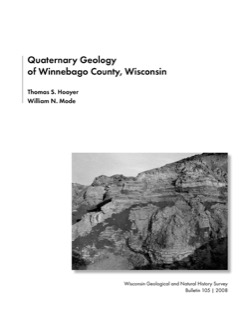
Quaternary Geology of Winnebago County, Wisconsin
-
Quaternary Geology of Winnebago County, Wisconsin (version 2) [GIS data]
2008
GIS Data: GeMS Level 3 file geodatabase (.gdb file format)
-
Quaternary Geologic Map of Winnebago County, Wisconsin [plate 1]
2008
Map: 25 in x 20 in, scale 1:100,000
-
Geologic Cross Sections of Winnebago County, Wisconsin [plate 2]
2008
Plate: 25 in x 27 in, scale 1:100,000
-
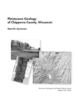
Pleistocene Geology of Chippewa County, Wisconsin
-
Pleistocene Geology of Chippewa County, Wisconsin (version 2) [GIS data]
2007
GIS Data: GeMS file geodatabase (.gdb file format)
-
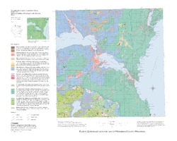
Pleistocene Geologic Map of Chippewa County, Wisconsin [plate 1]
2007
Plate: 36 in x 23 in, scale 1:100,000
-
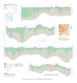
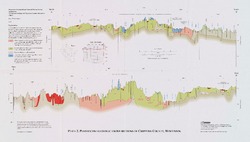
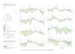
Pleistocene Geologic Cross Sections of Chippewa County, Wisconsin [plate 2]
2007
Plate: 16.5 in x 9.4 in, scale 1:100,000
-
Pleistocene Geology of Waukesha County, Wisconsin
-
Pleistocene Geology of Waukesha County, Wisconsin (version 2) [GIS data]
2001
GIS Data: GeMS file geodatabase (.gdb file format)
-
Pleistocene Geologic Map of Waukesha County, Wisconsin [plate 1]
2001
Map: 29 in x 19 in, scale 1:100,000
-
Pleistocene Geologic Cross Sections of Waukesha County, Wisconsin [plate 2]
2001
Plate: 25 in x 18 in, scale 1:200,000
-
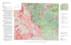
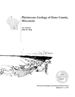
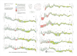
Pleistocene Geology of Dane County, Wisconsin
Description of the geologic history of Dane County. The preface points out the significance of glacial landscape research at WGNHS over the past century. Many pictures and diagrams and a four-color map and cross sections show the striking differences between glaciated and unglaciated regions of the county. Map and cross sections are folded.-
Pleistocene Geology of Dane County, Wisconsin (version 2) [GIS data]
1997
GIS Data: GeMS file geodatabase (.gdb file format)
-
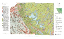
Pleistocene Geologic Map of Dane County, Wisconsin [plate 1]
1997
Map: 39 in x 23.5 in, scale 1:100,000
-
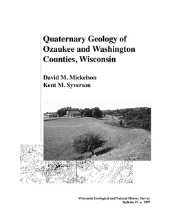
Quaternary Geology of Ozaukee and Washington Counties, Wisconsin
-
Quaternary Geology of Ozaukee and Washington Counties, Wisconsin (version 2) [GIS data]
1997
GIS Data: GeMS Level 3 file geodatabase (.gdb file format)
-
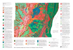
Quaternary Geologic Map of Ozaukee and Washington Counties, Wisconsin [plate 1]
1997
Map: 32.5 in x 22.5 in, scale 1:100,000
-
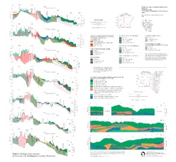
Geologic Cross Sections of Ozaukee and Washington Counties, Wisconsin [plate 2]
1997
Plate: 26 in x 24 in, scale 1:100,000

Publications Catalog
Wisconsin Geological and Natural History Survey